Photos • Location


No higher resolution available.
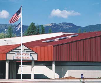
Sandpoint_High_Exterior.JPG (344 × 285 pixels, file size: 17 KB, MIME type: image/jpeg)
| This is a file from the
Wikimedia Commons. Information from its
description page there is shown below. Commons is a freely licensed media file repository. You can help. |
|
This is an image of a place or building that is listed on the
National Register of Historic Places in the
United States of America. Its reference number is
84001100. |
Summary
| Description |
English: Exterior of Sandpoint High School |
| Source | Own work |
| Author |
| Object location |
| View this and other nearby images on: OpenStreetMap |
|
|---|
Licensing
| I, the copyright holder of this work, release this work into the
public domain. This applies worldwide. In some countries this may not be legally possible; if so: I grant anyone the right to use this work for any purpose, without any conditions, unless such conditions are required by law. |
File history
Click on a date/time to view the file as it appeared at that time.
| Date/Time | Thumbnail | Dimensions | User | Comment | |
|---|---|---|---|---|---|
| current | 01:29, 29 December 2010 |
| 344 × 285 (17 KB) | M0JAV13 | {{Information |Description={{en|1=Exterior of Sandpoint High School}} |Source=Myself |Author= Jbaxter088 |Date= |Permission= |other_versions= }} |
File usage
The following pages on the English Wikipedia use this file (pages on other projects are not listed):
Global file usage
The following other wikis use this file:
- Usage on ru.wikipedia.org
- Usage on www.wikidata.org
Metadata
No higher resolution available.
Sandpoint_High_Exterior.JPG (344 × 285 pixels, file size: 17 KB, MIME type: image/jpeg)
| This is a file from the
Wikimedia Commons. Information from its
description page there is shown below. Commons is a freely licensed media file repository. You can help. |
|
This is an image of a place or building that is listed on the
National Register of Historic Places in the
United States of America. Its reference number is
84001100. |
Summary
| Description |
English: Exterior of Sandpoint High School |
| Source | Own work |
| Author |
| Object location |
| View this and other nearby images on: OpenStreetMap |
|
|---|
Licensing
| I, the copyright holder of this work, release this work into the
public domain. This applies worldwide. In some countries this may not be legally possible; if so: I grant anyone the right to use this work for any purpose, without any conditions, unless such conditions are required by law. |
File history
Click on a date/time to view the file as it appeared at that time.
| Date/Time | Thumbnail | Dimensions | User | Comment | |
|---|---|---|---|---|---|
| current | 01:29, 29 December 2010 |
| 344 × 285 (17 KB) | M0JAV13 | {{Information |Description={{en|1=Exterior of Sandpoint High School}} |Source=Myself |Author= Jbaxter088 |Date= |Permission= |other_versions= }} |
File usage
The following pages on the English Wikipedia use this file (pages on other projects are not listed):
Global file usage
The following other wikis use this file:
- Usage on ru.wikipedia.org
- Usage on www.wikidata.org