
Size of this preview:
800 × 354 pixels. Other resolutions:
320 × 141 pixels |
640 × 283 pixels |
1,024 × 452 pixels |
1,280 × 566 pixels |
3,123 × 1,380 pixels.
Original file (3,123 × 1,380 pixels, file size: 5.34 MB, MIME type: image/jpeg)
| This is a file from the
Wikimedia Commons. Information from its
description page there is shown below. Commons is a freely licensed media file repository. You can help. |
| Description |
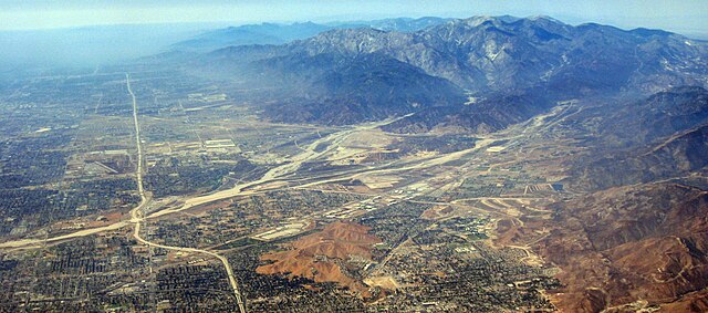
A burned section of the San Bernardino Mountains in the right foreground, and the Inland Empire and city of San Bernardino in the center foreground — within San Bernardino County, Southern California.
|
||
| Date | |||
| Source | originally posted to Flickr as 2008_09_08_bos-ord-sna_497 | ||
| Author | Doc Searls | ||
| Permission ( Reusing this file) |
This file is licensed under the
Creative Commons
Attribution-Share Alike 2.0 Generic license.
|
||
| Other versions |

.jpg)
File history
Click on a date/time to view the file as it appeared at that time.
| Date/Time | Thumbnail | Dimensions | User | Comment | |
|---|---|---|---|---|---|
| current | 21:05, 28 August 2023 |
| 3,123 × 1,380 (5.34 MB) | Cristiano Tomás | File:San Bernardino Valley, San Gabriel, SB Mountains, I-215.jpg cropped 13 % vertically using CropTool with precise mode. |
File usage
The following pages on the English Wikipedia use this file (pages on other projects are not listed):
Metadata
.jpg)
Size of this preview:
800 × 354 pixels. Other resolutions:
320 × 141 pixels |
640 × 283 pixels |
1,024 × 452 pixels |
1,280 × 566 pixels |
3,123 × 1,380 pixels.
Original file (3,123 × 1,380 pixels, file size: 5.34 MB, MIME type: image/jpeg)
| This is a file from the
Wikimedia Commons. Information from its
description page there is shown below. Commons is a freely licensed media file repository. You can help. |
| Description |
A burned section of the San Bernardino Mountains in the right foreground, and the Inland Empire and city of San Bernardino in the center foreground — within San Bernardino County, Southern California.
|
||
| Date | |||
| Source | originally posted to Flickr as 2008_09_08_bos-ord-sna_497 | ||
| Author | Doc Searls | ||
| Permission ( Reusing this file) |
This file is licensed under the
Creative Commons
Attribution-Share Alike 2.0 Generic license.
|
||
| Other versions |
File history
Click on a date/time to view the file as it appeared at that time.
| Date/Time | Thumbnail | Dimensions | User | Comment | |
|---|---|---|---|---|---|
| current | 21:05, 28 August 2023 |
| 3,123 × 1,380 (5.34 MB) | Cristiano Tomás | File:San Bernardino Valley, San Gabriel, SB Mountains, I-215.jpg cropped 13 % vertically using CropTool with precise mode. |
File usage
The following pages on the English Wikipedia use this file (pages on other projects are not listed):