Photos • Location


Size of this preview:
421 × 600 pixels. Other resolutions:
168 × 240 pixels |
337 × 480 pixels |
539 × 768 pixels |
719 × 1,024 pixels |
1,437 × 2,048 pixels |
3,393 × 4,834 pixels.
Original file (3,393 × 4,834 pixels, file size: 4.42 MB, MIME type: image/jpeg)
| This is a file from the
Wikimedia Commons. Information from its
description page there is shown below. Commons is a freely licensed media file repository. You can help. |
Summary
| Description |
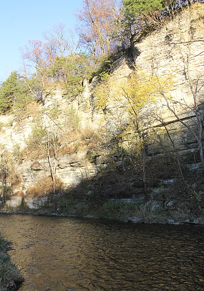
English: Bluff seen from the North Branch of the Root River in Root River Olmsted County Park south of Simpson, Minnesota, United States |
||
| Date | |||
| Source | Own work | ||
| Author | Jonathunder | ||
| Permission ( Reusing this file) |
|
| Camera location |
| View this and other nearby images on: OpenStreetMap |
|
|---|
Licensing

|
Permission is granted to copy, distribute and/or modify this document under the terms of the GNU Free Documentation License, Version 1.2 only as published by the Free Software Foundation; with no Invariant Sections, no Front-Cover Texts, and no Back-Cover Texts. A copy of the license is included in the section entitled GNU Free Documentation License. | 1.2 only |
File history
Click on a date/time to view the file as it appeared at that time.
| Date/Time | Thumbnail | Dimensions | User | Comment | |
|---|---|---|---|---|---|
| current | 14:43, 25 October 2017 |
| 3,393 × 4,834 (4.42 MB) | Jonathunder | == {{int:filedesc}} == {{Information |Description= {{en|1=The Root River and bluff in Root River Olmsted County Park south of Simpson, Minnesota, United States}} |Source ={{own}} |Author = Jonathunder |Date... |
File usage
The following pages on the English Wikipedia use this file (pages on other projects are not listed):
Global file usage
The following other wikis use this file:
- Usage on ceb.wikipedia.org
- Usage on de.wikipedia.org
- Usage on www.wikidata.org
Metadata
Size of this preview:
421 × 600 pixels. Other resolutions:
168 × 240 pixels |
337 × 480 pixels |
539 × 768 pixels |
719 × 1,024 pixels |
1,437 × 2,048 pixels |
3,393 × 4,834 pixels.
Original file (3,393 × 4,834 pixels, file size: 4.42 MB, MIME type: image/jpeg)
| This is a file from the
Wikimedia Commons. Information from its
description page there is shown below. Commons is a freely licensed media file repository. You can help. |
Summary
| Description |
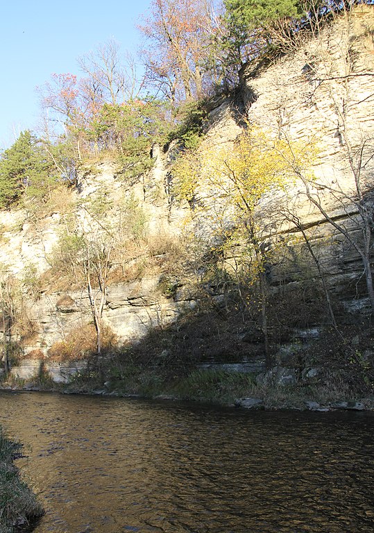
English: Bluff seen from the North Branch of the Root River in Root River Olmsted County Park south of Simpson, Minnesota, United States |
||
| Date | |||
| Source | Own work | ||
| Author | Jonathunder | ||
| Permission ( Reusing this file) |
|
| Camera location |
| View this and other nearby images on: OpenStreetMap |
|
|---|
Licensing
|
|
Permission is granted to copy, distribute and/or modify this document under the terms of the GNU Free Documentation License, Version 1.2 only as published by the Free Software Foundation; with no Invariant Sections, no Front-Cover Texts, and no Back-Cover Texts. A copy of the license is included in the section entitled GNU Free Documentation License. | 1.2 only |
File history
Click on a date/time to view the file as it appeared at that time.
| Date/Time | Thumbnail | Dimensions | User | Comment | |
|---|---|---|---|---|---|
| current | 14:43, 25 October 2017 |
| 3,393 × 4,834 (4.42 MB) | Jonathunder | == {{int:filedesc}} == {{Information |Description= {{en|1=The Root River and bluff in Root River Olmsted County Park south of Simpson, Minnesota, United States}} |Source ={{own}} |Author = Jonathunder |Date... |
File usage
The following pages on the English Wikipedia use this file (pages on other projects are not listed):
Global file usage
The following other wikis use this file:
- Usage on ceb.wikipedia.org
- Usage on de.wikipedia.org
- Usage on www.wikidata.org