
Original file (4,554 × 3,420 pixels, file size: 9.84 MB, MIME type: image/jpeg)
| This is a file from the
Wikimedia Commons. Information from its
description page there is shown below. Commons is a freely licensed media file repository. You can help. |
Summary
| Description |
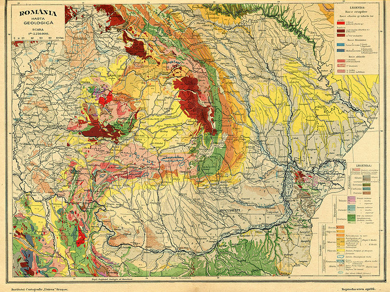
English: Geological map of Romania and neighboroughs. Frontières 2009.
Français : Carte géologique de la Roumanie et de son voisinage. Frontières 2009
Română: Harta geologică a României și a vecinilor cu frontiere actualizate în 2009 |
| Date | |
| Source | Atlas geografic Unirea, Brasov, 1928 |
| Author | Pr.N.A.Constantinescu |
Licensing
|
This work is in the public domain in its country of origin and other countries and areas where the copyright term is the author's life plus 70 years or fewer.
| |
| This file has been identified as being free of known restrictions under copyright law, including all related and neighboring rights. | |
File history
Click on a date/time to view the file as it appeared at that time.
| Date/Time | Thumbnail | Dimensions | User | Comment | |
|---|---|---|---|---|---|
| current | 18:33, 14 April 2009 |
| 4,554 × 3,420 (9.84 MB) | Spiridon Ion Cepleanu | {{Information |Description={{en|1=Geological map of Romania and neighboroughs. Frontières 2009.}} {{fr|1=Carte géologique de la Roumanie et de son voisinage. Frontières 2009}} |Source=Atlas geografic Unirea, Brasov, 1928 |Author=Pr.N.A.Constantinescu | |
File usage
Global file usage
The following other wikis use this file:
- Usage on de.wikipedia.org
- Usage on fr.wikipedia.org
- Usage on hr.wiktionary.org
- Usage on it.wikipedia.org
- Usage on ja.wikipedia.org
- Usage on ro.wikipedia.org
- Usage on ru.wikipedia.org
- Usage on sk.wikipedia.org
- Usage on sl.wikipedia.org
- Usage on uk.wikipedia.org
- Usage on zh.wikipedia.org
Metadata
Original file (4,554 × 3,420 pixels, file size: 9.84 MB, MIME type: image/jpeg)
| This is a file from the
Wikimedia Commons. Information from its
description page there is shown below. Commons is a freely licensed media file repository. You can help. |
Summary
| Description |
English: Geological map of Romania and neighboroughs. Frontières 2009.
Français : Carte géologique de la Roumanie et de son voisinage. Frontières 2009
Română: Harta geologică a României și a vecinilor cu frontiere actualizate în 2009 |
| Date | |
| Source | Atlas geografic Unirea, Brasov, 1928 |
| Author | Pr.N.A.Constantinescu |
Licensing
|
This work is in the public domain in its country of origin and other countries and areas where the copyright term is the author's life plus 70 years or fewer.
| |
| This file has been identified as being free of known restrictions under copyright law, including all related and neighboring rights. | |
File history
Click on a date/time to view the file as it appeared at that time.
| Date/Time | Thumbnail | Dimensions | User | Comment | |
|---|---|---|---|---|---|
| current | 18:33, 14 April 2009 |
| 4,554 × 3,420 (9.84 MB) | Spiridon Ion Cepleanu | {{Information |Description={{en|1=Geological map of Romania and neighboroughs. Frontières 2009.}} {{fr|1=Carte géologique de la Roumanie et de son voisinage. Frontières 2009}} |Source=Atlas geografic Unirea, Brasov, 1928 |Author=Pr.N.A.Constantinescu | |
File usage
Global file usage
The following other wikis use this file:
- Usage on de.wikipedia.org
- Usage on fr.wikipedia.org
- Usage on hr.wiktionary.org
- Usage on it.wikipedia.org
- Usage on ja.wikipedia.org
- Usage on ro.wikipedia.org
- Usage on ru.wikipedia.org
- Usage on sk.wikipedia.org
- Usage on sl.wikipedia.org
- Usage on uk.wikipedia.org
- Usage on zh.wikipedia.org