
Size of this PNG preview of this SVG file:
800 × 495 pixels. Other resolutions:
320 × 198 pixels |
640 × 396 pixels |
1,024 × 634 pixels |
1,280 × 792 pixels |
2,560 × 1,585 pixels |
1,181 × 731 pixels.
Original file (SVG file, nominally 1,181 × 731 pixels, file size: 2.21 MB)
| This is a file from the
Wikimedia Commons. Information from its
description page there is shown below. Commons is a freely licensed media file repository. You can help. |
Summary
.svg)
.svg)
.svg)
.svg)
.svg)
.svg)
.svg)

-en.svg)

.svg)
.svg)
.svg)

_(US48).svg)
_(small_islands_magnified)_(-mini_map_-rivers).svg)
.svg)
_(extra_close)_(US48).svg)
.svg)
_(zoom).svg)

.svg)


_(UNMIK).svg)
.svg)
_(disputed_hatched).svg)
_(claimed_and_disputed_hatched).svg)
.svg)
.svg)
_(%2Ball_claims_hatched).svg)

.svg)
_(shade).svg)
_(shade)_(special_marker).svg)
_(-mini_map).svg)
_(-mini_map).svg)
_(-mini_map).svg)


.svg)

.svg)
_(extra_close).svg)
Licensing
I, the copyright holder of this work, hereby publish it under the following license:
This file is licensed under the
Creative Commons
Attribution-Share Alike 3.0 Unported license.
- You are free:
- to share – to copy, distribute and transmit the work
- to remix – to adapt the work
- Under the following conditions:
- attribution – You must give appropriate credit, provide a link to the license, and indicate if changes were made. You may do so in any reasonable manner, but not in any way that suggests the licensor endorses you or your use.
- share alike – If you remix, transform, or build upon the material, you must distribute your contributions under the same or compatible license as the original.

|
I'd greatly appreciate, that you attribute this media file to Wikimedia Commons, if used outside Wikipedia or Commons. For use in publications such as books, newspapers, blogs, websites, please insert
here the following line:
|
_(extra_close).svg&action=edit&redlink=1)
File history
Click on a date/time to view the file as it appeared at that time.
| Date/Time | Thumbnail | Dimensions | User | Comment | |
|---|---|---|---|---|---|
| current | 20:50, 2 April 2024 |
| 1,181 × 731 (2.21 MB) | Spesh531 | correction to Rhode Island border. Little Compton and Tiverton was previously shown to be in Massachusetts |
| 22:01, 30 July 2011 |
 | 1,181 × 731 (3.53 MB) | TUBS | corr | |
| 18:12, 30 July 2011 |
 | 1,181 × 731 (3.53 MB) | TUBS |
File usage
The following pages on the English Wikipedia use this file (pages on other projects are not listed):
Global file usage
The following other wikis use this file:
- Usage on de.wikipedia.org
- Usage on es.wikipedia.org
- Usage on et.wikipedia.org
- Usage on hsb.wikipedia.org
- Usage on incubator.wikimedia.org
- Usage on kk.wikipedia.org
- Usage on mhr.wikipedia.org
- Usage on mi.wikipedia.org
- Usage on my.wikipedia.org
- Usage on ru.wikipedia.org
- Usage on sh.wikipedia.org
- Usage on simple.wikipedia.org
Metadata
_(extra_close).svg)
Size of this PNG preview of this SVG file:
800 × 495 pixels. Other resolutions:
320 × 198 pixels |
640 × 396 pixels |
1,024 × 634 pixels |
1,280 × 792 pixels |
2,560 × 1,585 pixels |
1,181 × 731 pixels.
Original file (SVG file, nominally 1,181 × 731 pixels, file size: 2.21 MB)
| This is a file from the
Wikimedia Commons. Information from its
description page there is shown below. Commons is a freely licensed media file repository. You can help. |
Summary
| Description |
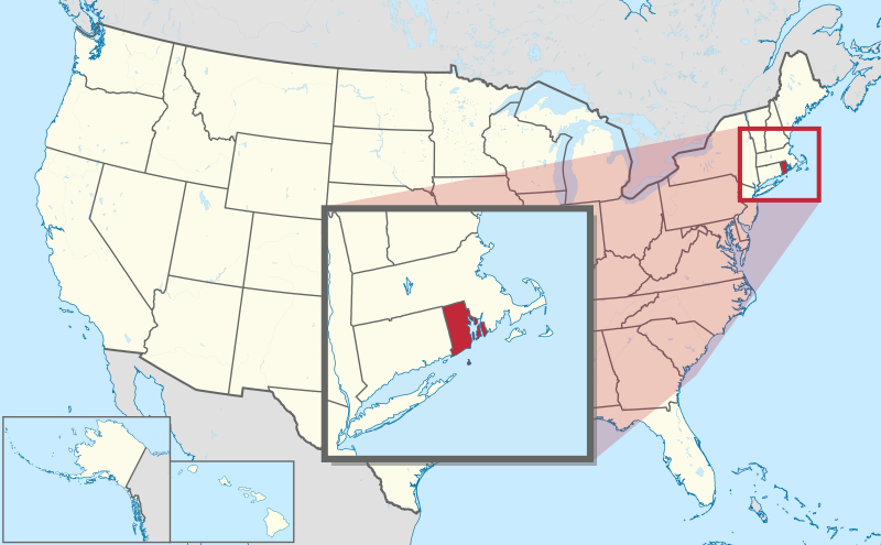
Deutsch: Lage von Rhode Island in United States (zoom) (extra close) in den
Vereinigten Staaten.
English: Location of state of Rhode Island in United States (zoom) (extra close) in the
United States |
||||||||||||||||||||||||||||||||||||
| Date | |||||||||||||||||||||||||||||||||||||
| Source |
Own work This SVG
locator map includes elements from this
locator map:
This SVG
locator map includes elements from this
locator map:
|
||||||||||||||||||||||||||||||||||||
| Author |
TUBS
|
||||||||||||||||||||||||||||||||||||
| Other versions |
|
||||||||||||||||||||||||||||||||||||
| SVG development | This oversized W3C-invalid
locator map was created with
Adobe Illustrator by TUBS, and with Inkscape. This large W3C-invalid SVG
locator map was uploaded with
Commonist. This
Adobe
SVG
locator map is very large because TUBS kept the superfluous Adobe PGF or other CDATA garbage . |
||||||||||||||||||||||||||||||||||||
Licensing
I, the copyright holder of this work, hereby publish it under the following license:
This file is licensed under the
Creative Commons
Attribution-Share Alike 3.0 Unported license.
- You are free:
- to share – to copy, distribute and transmit the work
- to remix – to adapt the work
- Under the following conditions:
- attribution – You must give appropriate credit, provide a link to the license, and indicate if changes were made. You may do so in any reasonable manner, but not in any way that suggests the licensor endorses you or your use.
- share alike – If you remix, transform, or build upon the material, you must distribute your contributions under the same or compatible license as the original.
|
|
I'd greatly appreciate, that you attribute this media file to Wikimedia Commons, if used outside Wikipedia or Commons. For use in publications such as books, newspapers, blogs, websites, please insert
here the following line:
|
File history
Click on a date/time to view the file as it appeared at that time.
| Date/Time | Thumbnail | Dimensions | User | Comment | |
|---|---|---|---|---|---|
| current | 20:50, 2 April 2024 |
| 1,181 × 731 (2.21 MB) | Spesh531 | correction to Rhode Island border. Little Compton and Tiverton was previously shown to be in Massachusetts |
| 22:01, 30 July 2011 |
| 1,181 × 731 (3.53 MB) | TUBS | corr | |
| 18:12, 30 July 2011 |
| 1,181 × 731 (3.53 MB) | TUBS |
File usage
The following pages on the English Wikipedia use this file (pages on other projects are not listed):
Global file usage
The following other wikis use this file:
- Usage on de.wikipedia.org
- Usage on es.wikipedia.org
- Usage on et.wikipedia.org
- Usage on hsb.wikipedia.org
- Usage on incubator.wikimedia.org
- Usage on kk.wikipedia.org
- Usage on mhr.wikipedia.org
- Usage on mi.wikipedia.org
- Usage on my.wikipedia.org
- Usage on ru.wikipedia.org
- Usage on sh.wikipedia.org
- Usage on simple.wikipedia.org