
Original file (1,810 × 1,854 pixels, file size: 2.37 MB, MIME type: image/png)
| This is a file from the
Wikimedia Commons. Information from its
description page there is shown below. Commons is a freely licensed media file repository. You can help. |
| Description |
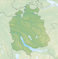
Deutsch: Reliefkarte des Kantons Zürich
Topographischer Hintergrund:
NASA Shuttle Radar Topography Mission (public domain). SRTM3 v.2. |
||||||||
| Date | |||||||||
| Source | Own work | ||||||||
| Author | Tschubby | ||||||||
| Permission ( Reusing this file) |
I, the copyright holder of this work, hereby publish it under the following licenses:
This file is licensed under the
Creative Commons Attribution-Share Alike
2.5 Generic,
2.0 Generic and
1.0 Generic license.
You may select the license of your choice. |
||||||||
| Other versions |
 |

File history
Click on a date/time to view the file as it appeared at that time.
| Date/Time | Thumbnail | Dimensions | User | Comment | |
|---|---|---|---|---|---|
| current | 09:36, 13 June 2014 |
| 1,810 × 1,854 (2.37 MB) | Tschubby | {{Information |Description= |Source= |Date= |Author= |Permission= |other_versions= }} |
| 12:54, 6 December 2013 |
 | 1,813 × 1,855 (3.35 MB) | Tschubby | {{Information |Description= {{de| Reliefkarte des Kantons Zürich}} Topographischer Hintergrund: [http://www2.jpl.nasa.gov/srtm NASA Shuttle Radar Topography Mission] (public domain). SRTM3 v.2. |Source={{own}} |Date= 2013-12-06 |Author= [[:de:User:Tsc... |
File usage
More than 100 pages use this file. The following list shows the first 100 pages that use this file only. A full list is available.
- Adliswil
- Aeugst am Albis
- Affoltern am Albis
- Altikon
- Bachenbülach
- Bachs
- Bassersdorf
- Bauma
- Bertschikon bei Attikon
- Bonstetten, Switzerland
- Boppelsen
- Brütten
- Buchs, Zürich
- Bülach
- Dielsdorf
- Dietikon
- Dietlikon
- Dinhard
- Dorf, Switzerland
- Dägerlen
- Dällikon
- Dänikon
- Dättlikon
- Dübendorf
- Egg, Switzerland
- Eglisau
- Elgg
- Ellikon an der Thur
- Elsau
- Embrach
- Erlenbach, Switzerland
- Feuerthalen
- Freienstein-Teufen
- Glattfelden
- Greifensee, Zürich
- Greifensee (lake)
- Hagenbuch
- Hausen am Albis
- Hedingen
- Herrliberg
- Hochfelden, Switzerland
- Horgen
- Höri
- Hüntwangen
- Hüttikon
- Illnau-Effretikon
- Kappel am Albis
- Kilchberg, Zürich
- Kloten
- Knonau
- Kyburg, Zürich
- Kyburg (castle)
- Küsnacht
- Lake Zurich
- Langnau am Albis
- Lufingen
- Maschwanden
- Meilen
- Mettmenstetten
- Männedorf
- Mönchaltorf
- Neerach
- Niederglatt
- Niederhasli
- Niederweningen
- Nürensdorf
- Oberembrach
- Oberglatt
- Oberrieden
- Oberweningen
- Obfelden
- Opfikon
- Otelfingen
- Ottenbach, Switzerland
- Pfäffikon, Zürich
- Rafz
- Regensberg
- Regensdorf
- Rifferswil
- Rorbas
- Rümlang
- Rüschlikon
- Schleinikon
- Schlieren, Switzerland
- Schöfflisdorf
- Stadel bei Niederglatt
- Stallikon
- Steinmaur
- Stäfa
- Thalheim an der Thur
- Thalwil
- Uetikon am See
- Uster
- Wallisellen
- Wasterkingen
- Weiach
- Wettswil am Albis
- Wetzikon
- Winkel, Switzerland
- Winterthur
View more links to this file.
Global file usage
The following other wikis use this file:
- Usage on als.wikipedia.org
- Usage on bg.wikipedia.org
- Usage on de.wikipedia.org
- Lägern
- Uetliberg
- Forch
- Pfannenstiel (Zürich)
- Bahnhof Langholz
- Wildpark Langenberg
- Albispass
- Albis
- Zimmerberg
- Bachtel
- Ruine Alt-Landenberg
- Ruine Tössegg
- Ruine Alt-Wildberg
- Schnabelburg (Albis)
- Ruine Glanzenberg
- Ruine Liebenberg (Tösstal)
- Ruine Alt-Lägern
- Ruine Breitenlandenberg
- Ruine Freienstein
- Ruine Hohenlandenberg
- Ruine Schauenberg
- Ruine Sünikon
- Fernsehturm Uetliberg
- Türlersee
- Park im Grüene
- Hörnli (Berg)
- Zürichberg
- Irchel
- Zimmerberg-Basistunnel
- Buchenegg
- Hirzel (Pass)
- Islisbergtunnel
- Kirche Enge
- Burg Sellenbüren
- Burg Baldern
- Sternenweiher
- Burg Uetliburg
- Tössstock
View more global usage of this file.
Metadata
Original file (1,810 × 1,854 pixels, file size: 2.37 MB, MIME type: image/png)
| This is a file from the
Wikimedia Commons. Information from its
description page there is shown below. Commons is a freely licensed media file repository. You can help. |
| Description |
Deutsch: Reliefkarte des Kantons Zürich
Topographischer Hintergrund:
NASA Shuttle Radar Topography Mission (public domain). SRTM3 v.2. |
||||||||
| Date | |||||||||
| Source | Own work | ||||||||
| Author | Tschubby | ||||||||
| Permission ( Reusing this file) |
I, the copyright holder of this work, hereby publish it under the following licenses:
This file is licensed under the
Creative Commons Attribution-Share Alike
2.5 Generic,
2.0 Generic and
1.0 Generic license.
You may select the license of your choice. |
||||||||
| Other versions |
|
File history
Click on a date/time to view the file as it appeared at that time.
| Date/Time | Thumbnail | Dimensions | User | Comment | |
|---|---|---|---|---|---|
| current | 09:36, 13 June 2014 |
| 1,810 × 1,854 (2.37 MB) | Tschubby | {{Information |Description= |Source= |Date= |Author= |Permission= |other_versions= }} |
| 12:54, 6 December 2013 |
| 1,813 × 1,855 (3.35 MB) | Tschubby | {{Information |Description= {{de| Reliefkarte des Kantons Zürich}} Topographischer Hintergrund: [http://www2.jpl.nasa.gov/srtm NASA Shuttle Radar Topography Mission] (public domain). SRTM3 v.2. |Source={{own}} |Date= 2013-12-06 |Author= [[:de:User:Tsc... |
File usage
More than 100 pages use this file. The following list shows the first 100 pages that use this file only. A full list is available.
- Adliswil
- Aeugst am Albis
- Affoltern am Albis
- Altikon
- Bachenbülach
- Bachs
- Bassersdorf
- Bauma
- Bertschikon bei Attikon
- Bonstetten, Switzerland
- Boppelsen
- Brütten
- Buchs, Zürich
- Bülach
- Dielsdorf
- Dietikon
- Dietlikon
- Dinhard
- Dorf, Switzerland
- Dägerlen
- Dällikon
- Dänikon
- Dättlikon
- Dübendorf
- Egg, Switzerland
- Eglisau
- Elgg
- Ellikon an der Thur
- Elsau
- Embrach
- Erlenbach, Switzerland
- Feuerthalen
- Freienstein-Teufen
- Glattfelden
- Greifensee, Zürich
- Greifensee (lake)
- Hagenbuch
- Hausen am Albis
- Hedingen
- Herrliberg
- Hochfelden, Switzerland
- Horgen
- Höri
- Hüntwangen
- Hüttikon
- Illnau-Effretikon
- Kappel am Albis
- Kilchberg, Zürich
- Kloten
- Knonau
- Kyburg, Zürich
- Kyburg (castle)
- Küsnacht
- Lake Zurich
- Langnau am Albis
- Lufingen
- Maschwanden
- Meilen
- Mettmenstetten
- Männedorf
- Mönchaltorf
- Neerach
- Niederglatt
- Niederhasli
- Niederweningen
- Nürensdorf
- Oberembrach
- Oberglatt
- Oberrieden
- Oberweningen
- Obfelden
- Opfikon
- Otelfingen
- Ottenbach, Switzerland
- Pfäffikon, Zürich
- Rafz
- Regensberg
- Regensdorf
- Rifferswil
- Rorbas
- Rümlang
- Rüschlikon
- Schleinikon
- Schlieren, Switzerland
- Schöfflisdorf
- Stadel bei Niederglatt
- Stallikon
- Steinmaur
- Stäfa
- Thalheim an der Thur
- Thalwil
- Uetikon am See
- Uster
- Wallisellen
- Wasterkingen
- Weiach
- Wettswil am Albis
- Wetzikon
- Winkel, Switzerland
- Winterthur
View more links to this file.
Global file usage
The following other wikis use this file:
- Usage on als.wikipedia.org
- Usage on bg.wikipedia.org
- Usage on de.wikipedia.org
- Lägern
- Uetliberg
- Forch
- Pfannenstiel (Zürich)
- Bahnhof Langholz
- Wildpark Langenberg
- Albispass
- Albis
- Zimmerberg
- Bachtel
- Ruine Alt-Landenberg
- Ruine Tössegg
- Ruine Alt-Wildberg
- Schnabelburg (Albis)
- Ruine Glanzenberg
- Ruine Liebenberg (Tösstal)
- Ruine Alt-Lägern
- Ruine Breitenlandenberg
- Ruine Freienstein
- Ruine Hohenlandenberg
- Ruine Schauenberg
- Ruine Sünikon
- Fernsehturm Uetliberg
- Türlersee
- Park im Grüene
- Hörnli (Berg)
- Zürichberg
- Irchel
- Zimmerberg-Basistunnel
- Buchenegg
- Hirzel (Pass)
- Islisbergtunnel
- Kirche Enge
- Burg Sellenbüren
- Burg Baldern
- Sternenweiher
- Burg Uetliburg
- Tössstock
View more global usage of this file.