Original file (4,069 × 3,143 pixels, file size: 12.26 MB, MIME type: image/png)
| This is a file from the
Wikimedia Commons. Information from its
description page there is shown below. Commons is a freely licensed media file repository. You can help. |
| Description |
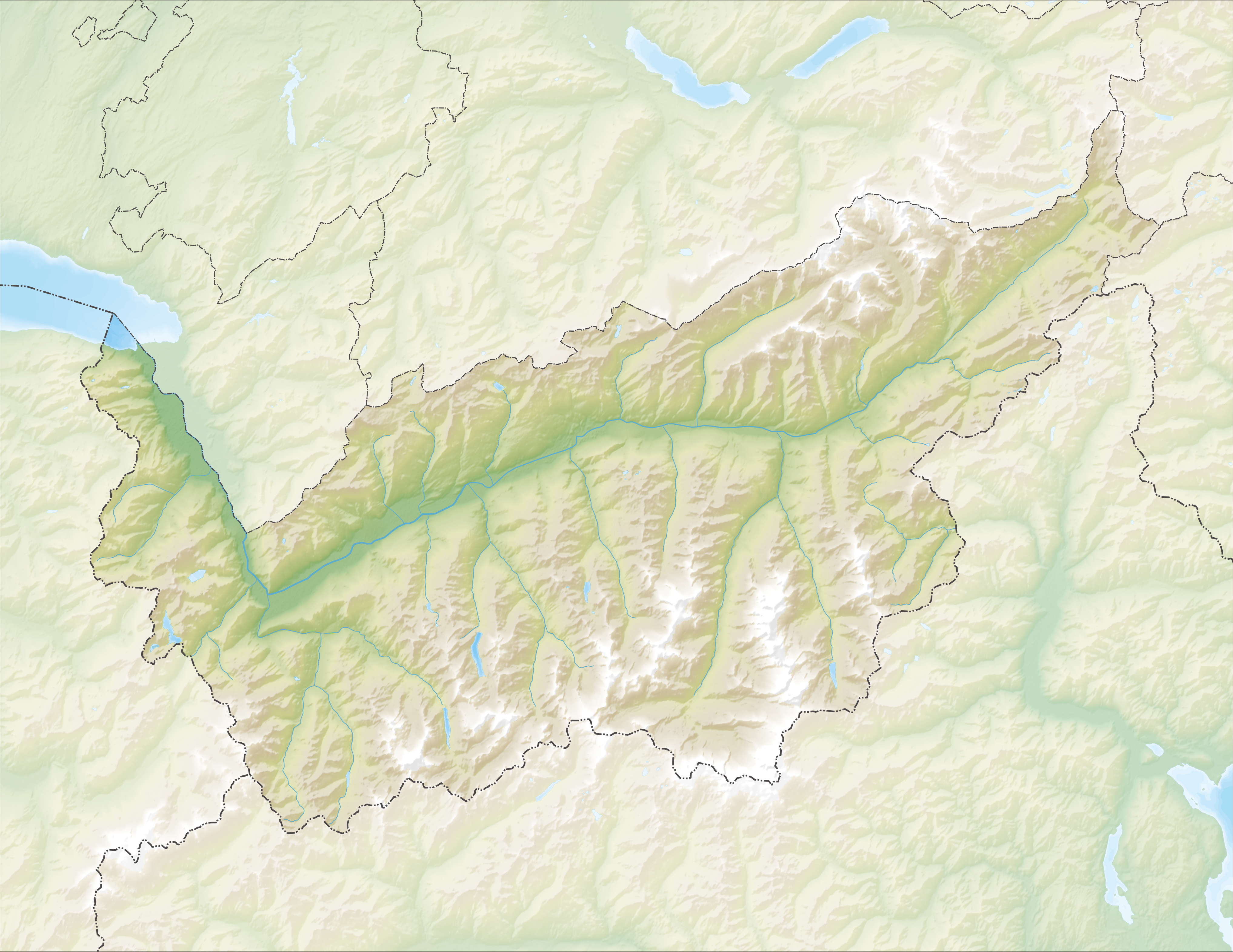
Deutsch: Reliefkarte des Kantons Wallis
Topographischer Hintergrund:
NASA Shuttle Radar Topography Mission (public domain). SRTM3 v.2. |
||||||||
| Date | |||||||||
| Source | Own work | ||||||||
| Author | Tschubby | ||||||||
| Permission ( Reusing this file) |
I, the copyright holder of this work, hereby publish it under the following licenses:
This file is licensed under the
Creative Commons Attribution-Share Alike
2.5 Generic,
2.0 Generic and
1.0 Generic license.
You may select the license of your choice. |
||||||||
| Other versions |
 |

File history
Click on a date/time to view the file as it appeared at that time.
| Date/Time | Thumbnail | Dimensions | User | Comment | |
|---|---|---|---|---|---|
| current | 12:18, 6 December 2013 |
| 4,069 × 3,143 (12.26 MB) | Tschubby | {{Information |Description= {{de| Reliefkarte des Kantons Wallis}} Topographischer Hintergrund: [http://www2.jpl.nasa.gov/srtm NASA Shuttle Radar Topography Mission] (public domain). SRTM3 v.2. |Source={{own}} |Date= 2013-12-06 |Author= [[:de:User:Tsch... |
File usage
More than 100 pages use this file. The following list shows the first 100 pages that use this file only. A full list is available.
- Agarn
- Albinen
- Arbaz
- Ardon, Switzerland
- Ausserbinn
- Ayent
- Bagnes
- Battle on the Planta
- Bellwald
- Binn
- Blitzingen
- Bourg-Saint-Pierre
- Bovernier
- Bratsch
- Chamoson
- Champéry
- Charrat
- Collombey-Muraz
- Collonges, Switzerland
- Conthey
- Crans-Montana
- Dufourspitze
- Eischoll
- Ergisch
- Ernen
- Erschmatt
- Evolène
- Fiesch
- Fieschertal
- Fully
- Gampel
- Gorner Glacier
- Grafschaft, Switzerland
- Grande Dixence Dam
- Grimisuat
- Grächen
- Guttet-Feschel
- Hérémence
- Inden, Switzerland
- Isérables
- Jungfrau
- Lake Geneva
- Lax, Switzerland
- Lens, Switzerland
- Les Agettes
- Leuk
- Leukerbad
- Leytron
- Liddes
- Martigny
- Martigny-Combe
- Mase, Switzerland
- Monthey
- Mund
- Münster-Geschinen
- Nax
- Nendaz
- Niederwald, Switzerland
- Nufenen Pass
- Oberems
- Obergesteln
- Oberwald
- Orsières
- Port-Valais
- Randa, Switzerland
- Reckingen-Gluringen
- Rhône Glacier
- Riddes
- Riederalp
- Saas-Fee
- Saas-Grund
- Saillon
- Saint-Gingolph, Switzerland
- Saint-Martin, Valais
- Saint-Maurice, Switzerland
- Salgesch
- Salins, Switzerland
- Savièse
- Saxon, Switzerland
- Sembrancher
- Sierre
- Simplon, Valais
- Sion, Switzerland
- Trient, Switzerland
- Troistorrents
- Turtmann
- Täsch
- Ulrichen
- Unterems
- Val-d'Illiez
- Varen, Switzerland
- Vernamiège
- Vernayaz
- Vex, Switzerland
- Veysonnaz
- Vionnaz
- Visp
- Vollèges
- Vouvry
- Vétroz
View more links to this file.
Global file usage
The following other wikis use this file:
- Usage on als.wikipedia.org
- Usage on arz.wikipedia.org
- Usage on da.wikipedia.org
- Usage on de.wikipedia.org
- Dom (Berg)
- Bietschhorn
- Simplontunnel
- Pollux (Berg)
- Castor (Berg)
- Lötschbergtunnel
- Lac de Cleuson
- Lac des Dix
- Dent de Morcles
- Dents du Midi
- Zinalrothorn
- Grand Combin
- Alphubel
- Rhonegletscher
- Täschhorn
- Weisshorn (Wallis)
- Stausee Mattmark
- Dent Blanche
- Otemmagletscher
- Corbassièregletscher
- Giétrozgletscher
- Lac d’Emosson
- Gornergletscher
- Fieschergletscher
- Tsanfleurongletscher
- Findelgletscher
- Ferpècle-Gletscher
- Mont-Miné-Gletscher
- Feegletscher
- Allalingletscher
- Hohlaubgletscher
- Trientgletscher
- Moirygletscher
- Oberaletschgletscher
- Mittelaletschgletscher
- Saleinagletscher
- Brenaygletscher
- Tsijiore-Nouve-Gletscher
- Cheilongletscher
- Mont-Durand-Gletscher
View more global usage of this file.
Metadata
Original file (4,069 × 3,143 pixels, file size: 12.26 MB, MIME type: image/png)
| This is a file from the
Wikimedia Commons. Information from its
description page there is shown below. Commons is a freely licensed media file repository. You can help. |
| Description |
Deutsch: Reliefkarte des Kantons Wallis
Topographischer Hintergrund:
NASA Shuttle Radar Topography Mission (public domain). SRTM3 v.2. |
||||||||
| Date | |||||||||
| Source | Own work | ||||||||
| Author | Tschubby | ||||||||
| Permission ( Reusing this file) |
I, the copyright holder of this work, hereby publish it under the following licenses:
This file is licensed under the
Creative Commons Attribution-Share Alike
2.5 Generic,
2.0 Generic and
1.0 Generic license.
You may select the license of your choice. |
||||||||
| Other versions |
|
File history
Click on a date/time to view the file as it appeared at that time.
| Date/Time | Thumbnail | Dimensions | User | Comment | |
|---|---|---|---|---|---|
| current | 12:18, 6 December 2013 |
| 4,069 × 3,143 (12.26 MB) | Tschubby | {{Information |Description= {{de| Reliefkarte des Kantons Wallis}} Topographischer Hintergrund: [http://www2.jpl.nasa.gov/srtm NASA Shuttle Radar Topography Mission] (public domain). SRTM3 v.2. |Source={{own}} |Date= 2013-12-06 |Author= [[:de:User:Tsch... |
File usage
More than 100 pages use this file. The following list shows the first 100 pages that use this file only. A full list is available.
- Agarn
- Albinen
- Arbaz
- Ardon, Switzerland
- Ausserbinn
- Ayent
- Bagnes
- Battle on the Planta
- Bellwald
- Binn
- Blitzingen
- Bourg-Saint-Pierre
- Bovernier
- Bratsch
- Chamoson
- Champéry
- Charrat
- Collombey-Muraz
- Collonges, Switzerland
- Conthey
- Crans-Montana
- Dufourspitze
- Eischoll
- Ergisch
- Ernen
- Erschmatt
- Evolène
- Fiesch
- Fieschertal
- Fully
- Gampel
- Gorner Glacier
- Grafschaft, Switzerland
- Grande Dixence Dam
- Grimisuat
- Grächen
- Guttet-Feschel
- Hérémence
- Inden, Switzerland
- Isérables
- Jungfrau
- Lake Geneva
- Lax, Switzerland
- Lens, Switzerland
- Les Agettes
- Leuk
- Leukerbad
- Leytron
- Liddes
- Martigny
- Martigny-Combe
- Mase, Switzerland
- Monthey
- Mund
- Münster-Geschinen
- Nax
- Nendaz
- Niederwald, Switzerland
- Nufenen Pass
- Oberems
- Obergesteln
- Oberwald
- Orsières
- Port-Valais
- Randa, Switzerland
- Reckingen-Gluringen
- Rhône Glacier
- Riddes
- Riederalp
- Saas-Fee
- Saas-Grund
- Saillon
- Saint-Gingolph, Switzerland
- Saint-Martin, Valais
- Saint-Maurice, Switzerland
- Salgesch
- Salins, Switzerland
- Savièse
- Saxon, Switzerland
- Sembrancher
- Sierre
- Simplon, Valais
- Sion, Switzerland
- Trient, Switzerland
- Troistorrents
- Turtmann
- Täsch
- Ulrichen
- Unterems
- Val-d'Illiez
- Varen, Switzerland
- Vernamiège
- Vernayaz
- Vex, Switzerland
- Veysonnaz
- Vionnaz
- Visp
- Vollèges
- Vouvry
- Vétroz
View more links to this file.
Global file usage
The following other wikis use this file:
- Usage on als.wikipedia.org
- Usage on arz.wikipedia.org
- Usage on da.wikipedia.org
- Usage on de.wikipedia.org
- Dom (Berg)
- Bietschhorn
- Simplontunnel
- Pollux (Berg)
- Castor (Berg)
- Lötschbergtunnel
- Lac de Cleuson
- Lac des Dix
- Dent de Morcles
- Dents du Midi
- Zinalrothorn
- Grand Combin
- Alphubel
- Rhonegletscher
- Täschhorn
- Weisshorn (Wallis)
- Stausee Mattmark
- Dent Blanche
- Otemmagletscher
- Corbassièregletscher
- Giétrozgletscher
- Lac d’Emosson
- Gornergletscher
- Fieschergletscher
- Tsanfleurongletscher
- Findelgletscher
- Ferpècle-Gletscher
- Mont-Miné-Gletscher
- Feegletscher
- Allalingletscher
- Hohlaubgletscher
- Trientgletscher
- Moirygletscher
- Oberaletschgletscher
- Mittelaletschgletscher
- Saleinagletscher
- Brenaygletscher
- Tsijiore-Nouve-Gletscher
- Cheilongletscher
- Mont-Durand-Gletscher
View more global usage of this file.