
Original file (2,428 × 2,536 pixels, file size: 5.81 MB, MIME type: image/png)
| This is a file from the
Wikimedia Commons. Information from its
description page there is shown below. Commons is a freely licensed media file repository. You can help. |
| Description |
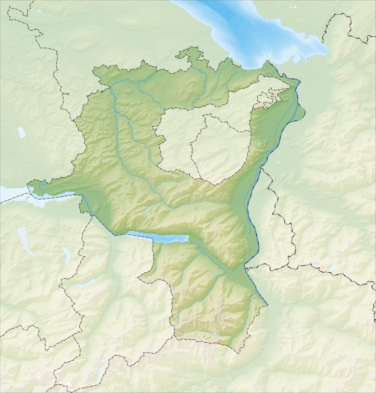
Deutsch: Reliefkarte des Kantons St. Gallen
Topographischer Hintergrund:
NASA Shuttle Radar Topography Mission (public domain). SRTM3 v.2. |
||||||||
| Date | |||||||||
| Source | Own work | ||||||||
| Author | Tschubby | ||||||||
| Permission ( Reusing this file) |
I, the copyright holder of this work, hereby publish it under the following licenses:
This file is licensed under the
Creative Commons Attribution-Share Alike
2.5 Generic,
2.0 Generic and
1.0 Generic license.
You may select the license of your choice. |
||||||||
| Other versions |
 |

File history
Click on a date/time to view the file as it appeared at that time.
| Date/Time | Thumbnail | Dimensions | User | Comment | |
|---|---|---|---|---|---|
| current | 07:11, 5 December 2013 |
| 2,428 × 2,536 (5.81 MB) | Tschubby | {{Information |Description= {{de| Reliefkarte des Kantons St. Gallen}} Topographischer Hintergrund: [http://www2.jpl.nasa.gov/srtm NASA Shuttle Radar Topography Mission] (public domain). SRTM3 v.2. |Source={{own}} |Date= 2013-12-05 |Author= [[:de:User:... |
File usage
More than 100 pages use this file. The following list shows the first 100 pages that use this file only. A full list is available.
- Alt St. Johann
- Altstätten
- Amden
- Andwil
- Au, St. Gallen
- Bad Ragaz
- Balgach
- Benken, St. Gallen
- Berg, St. Gallen
- Berneck, St. Gallen
- Bettenauer Weiher
- Bronschhofen
- Brunnadern
- Buchs, St. Gallen
- Bütschwil
- Chapfensee
- Degersheim
- Diepoldsau
- Ebnat-Kappel
- Egelsee (Bubikon)
- Eggersriet
- Eichberg, Switzerland
- Ernetschwil
- Eschenbach, St. Gallen
- Flawil
- Flums
- Gaiserwald
- Gams
- Ganterschwil
- Gigerwaldsee
- Goldach
- Goldingen
- Gommiswald
- Gossau, St. Gallen
- Grabs, Switzerland
- Gübsensee
- Hemberg, St. Gallen
- Häggenschwil
- Jonschwil
- Kaltbrunn
- Kirchberg, St. Gallen
- Krinau
- Lake Constance
- Lake Zurich
- Lichtensteig
- List of castles and fortresses in Switzerland
- Lütisburg
- Marbach, St. Gallen
- Mels
- Mogelsberg
- Mosnang
- Muolen
- Mörschwil
- Nesslau
- Niederbüren
- Niederhelfenschwil
- Oberbüren
- Oberer Murgsee
- Oberhelfenschwil
- Oberriet
- Oberuzwil
- Pfäfers
- Quarten
- Rapperswil-Jona
- Rebstein
- Rheineck
- Rieden, Switzerland
- Rorschach, Switzerland
- Rorschacherberg
- Rüthi
- Sargans
- Schmerikon
- Schänis
- Sennwald
- Sevelen
- St. Gallen
- St. Gallenkappel
- St. Gallen–Altenrhein Airport
- St. Margrethen
- St. Peterzell
- Stausee Mapragg
- Stein, St. Gallen
- Steinach, St. Gallen
- Thal, St. Gallen
- Tübach
- Untereggen
- Uznach
- Uzwil
- Vilters-Wangs
- Voralpsee
- Waldkirch, Switzerland
- Walensee
- Walenstadt
- Wartau
- Wattwil
- Weesen, Switzerland
- Werdenbergersee
- Widnau
- Wil
- Wildhaus
View more links to this file.
Global file usage
The following other wikis use this file:
- Usage on af.wikipedia.org
- Usage on arz.wikipedia.org
- Usage on de.wikipedia.org
- Gonzen
- Taminatal
- Rickenpass
- Schnebelhorn
- Hulftegg
- Burg Freudenberg (Bad Ragaz)
- Gigerwaldsee
- Wildhaus (Pass)
- Piz Sardona
- Schloss Sulzberg
- Wasserfluh
- Steinerburg
- Rickentunnel
- Tweralpspitz
- Mattstogg
- Margelchopf
- Wildhauser Schafberg
- Liste von Burgen und Schlössern in der Schweiz
- Wissthur
- Gamsberg (Ostschweiz)
- Wiler Turm
- Federispitz
- Chüemettler
- Kamor
- Raischibe
- Gulmen (SG)
- Leistchamm
- Flügespitz
- Saar (Rhein)
- Vilterser-Wangser-Kanal
- Vorder Höhi
- Biberlichopf
- Schloss Sargans
- Burg Gräpplang
- Burg Wartau
- Burg Alt-Toggenburg
- Burg Bibiton
- Burg Niederwindegg
- Mutschen
- Gätterifirst
- Chrüzberg
- Calfeisental
- Alvier (Berg)
- Ruine Uznaberg
- Simmi
- Wikipedia:Kartenwerkstatt/Positionskarten/Europa
- Benutzer:DiPix/Gauschla
- Bettenauer Weiher
View more global usage of this file.
Metadata
Original file (2,428 × 2,536 pixels, file size: 5.81 MB, MIME type: image/png)
| This is a file from the
Wikimedia Commons. Information from its
description page there is shown below. Commons is a freely licensed media file repository. You can help. |
| Description |
Deutsch: Reliefkarte des Kantons St. Gallen
Topographischer Hintergrund:
NASA Shuttle Radar Topography Mission (public domain). SRTM3 v.2. |
||||||||
| Date | |||||||||
| Source | Own work | ||||||||
| Author | Tschubby | ||||||||
| Permission ( Reusing this file) |
I, the copyright holder of this work, hereby publish it under the following licenses:
This file is licensed under the
Creative Commons Attribution-Share Alike
2.5 Generic,
2.0 Generic and
1.0 Generic license.
You may select the license of your choice. |
||||||||
| Other versions |
|
File history
Click on a date/time to view the file as it appeared at that time.
| Date/Time | Thumbnail | Dimensions | User | Comment | |
|---|---|---|---|---|---|
| current | 07:11, 5 December 2013 |
| 2,428 × 2,536 (5.81 MB) | Tschubby | {{Information |Description= {{de| Reliefkarte des Kantons St. Gallen}} Topographischer Hintergrund: [http://www2.jpl.nasa.gov/srtm NASA Shuttle Radar Topography Mission] (public domain). SRTM3 v.2. |Source={{own}} |Date= 2013-12-05 |Author= [[:de:User:... |
File usage
More than 100 pages use this file. The following list shows the first 100 pages that use this file only. A full list is available.
- Alt St. Johann
- Altstätten
- Amden
- Andwil
- Au, St. Gallen
- Bad Ragaz
- Balgach
- Benken, St. Gallen
- Berg, St. Gallen
- Berneck, St. Gallen
- Bettenauer Weiher
- Bronschhofen
- Brunnadern
- Buchs, St. Gallen
- Bütschwil
- Chapfensee
- Degersheim
- Diepoldsau
- Ebnat-Kappel
- Egelsee (Bubikon)
- Eggersriet
- Eichberg, Switzerland
- Ernetschwil
- Eschenbach, St. Gallen
- Flawil
- Flums
- Gaiserwald
- Gams
- Ganterschwil
- Gigerwaldsee
- Goldach
- Goldingen
- Gommiswald
- Gossau, St. Gallen
- Grabs, Switzerland
- Gübsensee
- Hemberg, St. Gallen
- Häggenschwil
- Jonschwil
- Kaltbrunn
- Kirchberg, St. Gallen
- Krinau
- Lake Constance
- Lake Zurich
- Lichtensteig
- List of castles and fortresses in Switzerland
- Lütisburg
- Marbach, St. Gallen
- Mels
- Mogelsberg
- Mosnang
- Muolen
- Mörschwil
- Nesslau
- Niederbüren
- Niederhelfenschwil
- Oberbüren
- Oberer Murgsee
- Oberhelfenschwil
- Oberriet
- Oberuzwil
- Pfäfers
- Quarten
- Rapperswil-Jona
- Rebstein
- Rheineck
- Rieden, Switzerland
- Rorschach, Switzerland
- Rorschacherberg
- Rüthi
- Sargans
- Schmerikon
- Schänis
- Sennwald
- Sevelen
- St. Gallen
- St. Gallenkappel
- St. Gallen–Altenrhein Airport
- St. Margrethen
- St. Peterzell
- Stausee Mapragg
- Stein, St. Gallen
- Steinach, St. Gallen
- Thal, St. Gallen
- Tübach
- Untereggen
- Uznach
- Uzwil
- Vilters-Wangs
- Voralpsee
- Waldkirch, Switzerland
- Walensee
- Walenstadt
- Wartau
- Wattwil
- Weesen, Switzerland
- Werdenbergersee
- Widnau
- Wil
- Wildhaus
View more links to this file.
Global file usage
The following other wikis use this file:
- Usage on af.wikipedia.org
- Usage on arz.wikipedia.org
- Usage on de.wikipedia.org
- Gonzen
- Taminatal
- Rickenpass
- Schnebelhorn
- Hulftegg
- Burg Freudenberg (Bad Ragaz)
- Gigerwaldsee
- Wildhaus (Pass)
- Piz Sardona
- Schloss Sulzberg
- Wasserfluh
- Steinerburg
- Rickentunnel
- Tweralpspitz
- Mattstogg
- Margelchopf
- Wildhauser Schafberg
- Liste von Burgen und Schlössern in der Schweiz
- Wissthur
- Gamsberg (Ostschweiz)
- Wiler Turm
- Federispitz
- Chüemettler
- Kamor
- Raischibe
- Gulmen (SG)
- Leistchamm
- Flügespitz
- Saar (Rhein)
- Vilterser-Wangser-Kanal
- Vorder Höhi
- Biberlichopf
- Schloss Sargans
- Burg Gräpplang
- Burg Wartau
- Burg Alt-Toggenburg
- Burg Bibiton
- Burg Niederwindegg
- Mutschen
- Gätterifirst
- Chrüzberg
- Calfeisental
- Alvier (Berg)
- Ruine Uznaberg
- Simmi
- Wikipedia:Kartenwerkstatt/Positionskarten/Europa
- Benutzer:DiPix/Gauschla
- Bettenauer Weiher
View more global usage of this file.