Original file (1,840 × 2,034 pixels, file size: 3.52 MB, MIME type: image/png)
| This is a file from the
Wikimedia Commons. Information from its
description page there is shown below. Commons is a freely licensed media file repository. You can help. |
| Description |
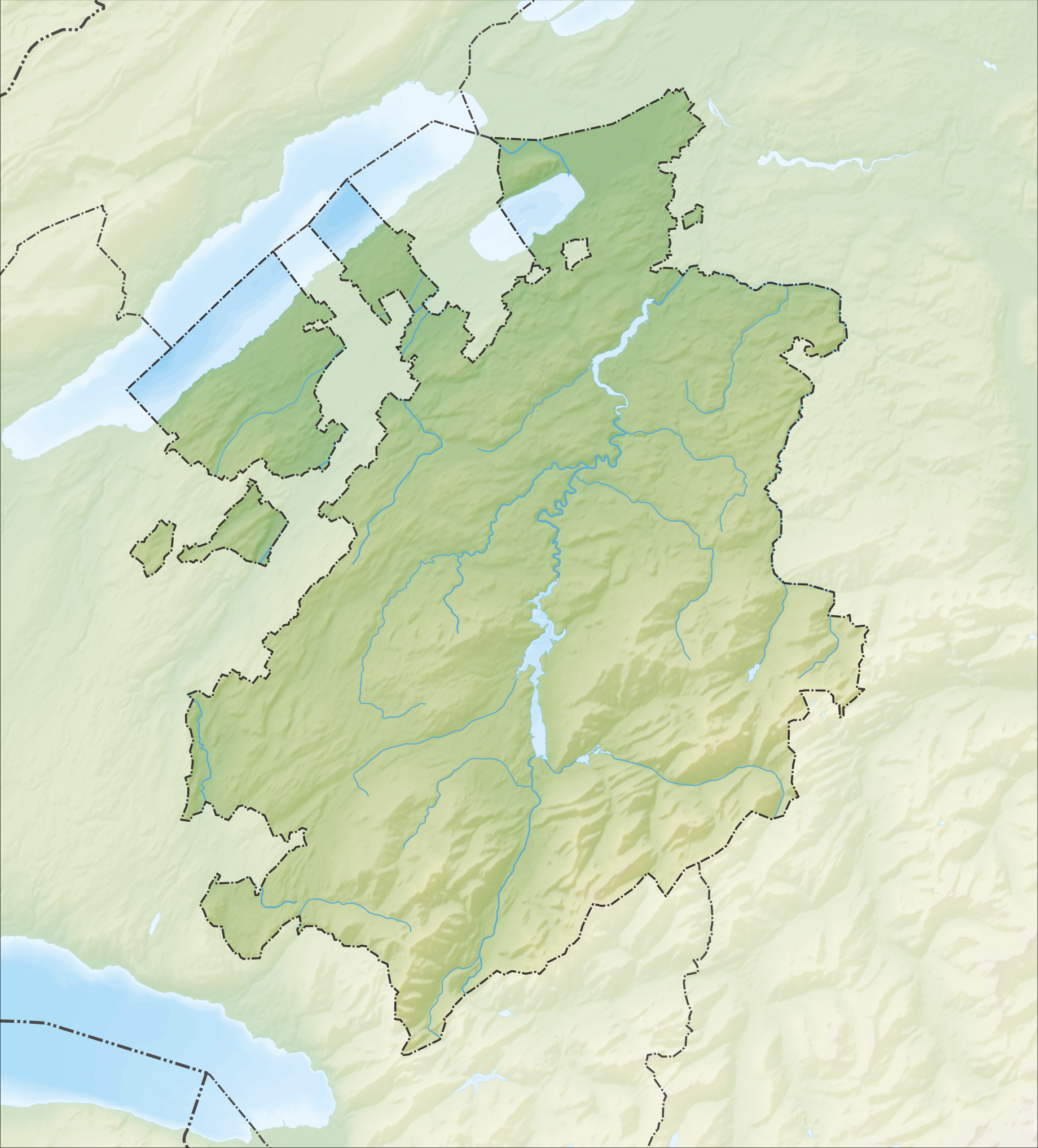
Deutsch: Reliefkarte des Kantons Freiburg
Topographischer Hintergrund:
NASA Shuttle Radar Topography Mission (public domain). SRTM3 v.2. |
||||||||
| Date | |||||||||
| Source | Own work | ||||||||
| Author | Tschubby | ||||||||
| Permission ( Reusing this file) |
I, the copyright holder of this work, hereby publish it under the following licenses:
This file is licensed under the
Creative Commons Attribution-Share Alike
2.5 Generic,
2.0 Generic and
1.0 Generic license.
You may select the license of your choice. |
||||||||
| Other versions |
 |

File history
Click on a date/time to view the file as it appeared at that time.
| Date/Time | Thumbnail | Dimensions | User | Comment | |
|---|---|---|---|---|---|
| current | 15:34, 5 December 2013 |
| 1,840 × 2,034 (3.52 MB) | Tschubby | {{Information |Description= {{de| Reliefkarte des Kantons Freiburg}} Topographischer Hintergrund: [http://www2.jpl.nasa.gov/srtm NASA Shuttle Radar Topography Mission] (public domain). SRTM3 v.2. |Source={{own}} |Date= 2013-12-05 |Author= [[:de:User:Ts... |
File usage
More than 100 pages use this file. The following list shows the first 100 pages that use this file only. A full list is available.
- Alterswil
- Arconciel
- Attalens
- Auboranges
- Barberêche
- Bas-Intyamon
- Billens-Hennens
- Bossonnens
- Botterens
- Broc
- Brünisried
- Bulle
- Bussy, Fribourg
- Bösingen, Fribourg
- Cerniat
- Chapelle, Glâne
- Charmey
- Cheiry
- Cheyres
- Châbles
- Châtel-Saint-Denis
- Châtel-sur-Montsalvens
- Châtillon, Fribourg
- Châtonnaye
- Clavaleyres
- Corbières, Gruyère
- Crésuz
- Cugy, Fribourg
- Delley-Portalban
- Domdidier
- Dompierre, Fribourg
- Düdingen
- Echarlens
- Estavayer-le-Lac
- Font, Switzerland
- Fribourg
- Fétigny, Switzerland
- Giffers
- Gletterens
- Grandvillard
- Granges, Switzerland
- Grangettes
- Gruyères
- Haut-Intyamon
- Hauteville, Switzerland
- Heitenried
- Jaun
- La Roche, Fribourg
- La Verrerie
- Lake Morat
- Lake Neuchâtel
- Lake of Gruyère
- Le Flon
- Le Pâquier, Fribourg
- Les Montets
- List of castles and fortresses in Switzerland
- Lully, Fribourg
- Léchelles
- Marsens
- Massonnens
- Montagny, Fribourg
- Morens
- Morlon
- Murist
- Murten
- Ménières
- Nuvilly
- Oberschrot
- Plaffeien
- Plasselb
- Pont-en-Ogoz
- Pont-la-Ville, Switzerland
- Prévondavaux
- Rechthalten
- Remaufens
- Rossens, Fribourg
- Rueyres-les-Prés
- Russy, Switzerland
- Saint-Aubin, Fribourg
- Saint-Martin, Fribourg
- Schmitten, Fribourg
- Semsales
- Sorens
- St. Antoni
- St. Silvester
- St. Ursen
- Surpierre
- Sâles, Fribourg
- Sévaz
- Tafers
- Tentlingen
- Ueberstorf
- Vallon
- Vaulruz
- Vernay, Switzerland
- Villarvolard
- Villeneuve, Fribourg
- Vuadens
- Vuissens
- Wünnewil-Flamatt
View more links to this file.
Global file usage
The following other wikis use this file:
- Usage on de.wikipedia.org
- Moléson
- Schwarzsee (See im Kanton Freiburg)
- Greyerzersee
- Mont Vully
- Schiffenensee
- Vanil d’Arpille
- Lac de Montsalvens
- Pérolles-See
- Cousimbert
- Glâne (Fluss)
- Gibloux (Berg)
- Papiliorama
- Jaunbach
- Arbogne
- Vanil Noir
- Liste von Burgen und Schlössern in der Schweiz
- Berra (Berg)
- Gastlosen
- Kaiseregg
- Vauderens-Tunnel
- Île d’Ogoz
- Schloss Greyerz
- Wikipedia:Kartenwerkstatt/Positionskarten/Europa
- Flugplatz Gruyères
- Sendeturm Mont-Gibloux
- Dent de Brenleire
- Vanil Carré
- Schwyberg
- Vorlage:Positionskarte Schweiz Freiburg
- Ölbergwerk
- Flugplatz Ecuvillens
- Schloss Löwenberg (Murten)
- Möösliturm
- Dent de Lys
- Breccaschlund
- Javro
- Schopfenspitz
- Benutzer:Tschubby/Reliefkarten
- Vanil des Artses
- Col de Lys
- Schloss Murten
- Schloss Pont
- Schloss Attalens
- Burgruine Illens
- Burgruine Arconciel
- Schloss Romont
- Schloss Vaulruz
- Schloss Chenaux
- Schloss Surpierre
- Burgruine Montagny-les-Monts
View more global usage of this file.
Metadata
Original file (1,840 × 2,034 pixels, file size: 3.52 MB, MIME type: image/png)
| This is a file from the
Wikimedia Commons. Information from its
description page there is shown below. Commons is a freely licensed media file repository. You can help. |
| Description |
Deutsch: Reliefkarte des Kantons Freiburg
Topographischer Hintergrund:
NASA Shuttle Radar Topography Mission (public domain). SRTM3 v.2. |
||||||||
| Date | |||||||||
| Source | Own work | ||||||||
| Author | Tschubby | ||||||||
| Permission ( Reusing this file) |
I, the copyright holder of this work, hereby publish it under the following licenses:
This file is licensed under the
Creative Commons Attribution-Share Alike
2.5 Generic,
2.0 Generic and
1.0 Generic license.
You may select the license of your choice. |
||||||||
| Other versions |
|
File history
Click on a date/time to view the file as it appeared at that time.
| Date/Time | Thumbnail | Dimensions | User | Comment | |
|---|---|---|---|---|---|
| current | 15:34, 5 December 2013 |
| 1,840 × 2,034 (3.52 MB) | Tschubby | {{Information |Description= {{de| Reliefkarte des Kantons Freiburg}} Topographischer Hintergrund: [http://www2.jpl.nasa.gov/srtm NASA Shuttle Radar Topography Mission] (public domain). SRTM3 v.2. |Source={{own}} |Date= 2013-12-05 |Author= [[:de:User:Ts... |
File usage
More than 100 pages use this file. The following list shows the first 100 pages that use this file only. A full list is available.
- Alterswil
- Arconciel
- Attalens
- Auboranges
- Barberêche
- Bas-Intyamon
- Billens-Hennens
- Bossonnens
- Botterens
- Broc
- Brünisried
- Bulle
- Bussy, Fribourg
- Bösingen, Fribourg
- Cerniat
- Chapelle, Glâne
- Charmey
- Cheiry
- Cheyres
- Châbles
- Châtel-Saint-Denis
- Châtel-sur-Montsalvens
- Châtillon, Fribourg
- Châtonnaye
- Clavaleyres
- Corbières, Gruyère
- Crésuz
- Cugy, Fribourg
- Delley-Portalban
- Domdidier
- Dompierre, Fribourg
- Düdingen
- Echarlens
- Estavayer-le-Lac
- Font, Switzerland
- Fribourg
- Fétigny, Switzerland
- Giffers
- Gletterens
- Grandvillard
- Granges, Switzerland
- Grangettes
- Gruyères
- Haut-Intyamon
- Hauteville, Switzerland
- Heitenried
- Jaun
- La Roche, Fribourg
- La Verrerie
- Lake Morat
- Lake Neuchâtel
- Lake of Gruyère
- Le Flon
- Le Pâquier, Fribourg
- Les Montets
- List of castles and fortresses in Switzerland
- Lully, Fribourg
- Léchelles
- Marsens
- Massonnens
- Montagny, Fribourg
- Morens
- Morlon
- Murist
- Murten
- Ménières
- Nuvilly
- Oberschrot
- Plaffeien
- Plasselb
- Pont-en-Ogoz
- Pont-la-Ville, Switzerland
- Prévondavaux
- Rechthalten
- Remaufens
- Rossens, Fribourg
- Rueyres-les-Prés
- Russy, Switzerland
- Saint-Aubin, Fribourg
- Saint-Martin, Fribourg
- Schmitten, Fribourg
- Semsales
- Sorens
- St. Antoni
- St. Silvester
- St. Ursen
- Surpierre
- Sâles, Fribourg
- Sévaz
- Tafers
- Tentlingen
- Ueberstorf
- Vallon
- Vaulruz
- Vernay, Switzerland
- Villarvolard
- Villeneuve, Fribourg
- Vuadens
- Vuissens
- Wünnewil-Flamatt
View more links to this file.
Global file usage
The following other wikis use this file:
- Usage on de.wikipedia.org
- Moléson
- Schwarzsee (See im Kanton Freiburg)
- Greyerzersee
- Mont Vully
- Schiffenensee
- Vanil d’Arpille
- Lac de Montsalvens
- Pérolles-See
- Cousimbert
- Glâne (Fluss)
- Gibloux (Berg)
- Papiliorama
- Jaunbach
- Arbogne
- Vanil Noir
- Liste von Burgen und Schlössern in der Schweiz
- Berra (Berg)
- Gastlosen
- Kaiseregg
- Vauderens-Tunnel
- Île d’Ogoz
- Schloss Greyerz
- Wikipedia:Kartenwerkstatt/Positionskarten/Europa
- Flugplatz Gruyères
- Sendeturm Mont-Gibloux
- Dent de Brenleire
- Vanil Carré
- Schwyberg
- Vorlage:Positionskarte Schweiz Freiburg
- Ölbergwerk
- Flugplatz Ecuvillens
- Schloss Löwenberg (Murten)
- Möösliturm
- Dent de Lys
- Breccaschlund
- Javro
- Schopfenspitz
- Benutzer:Tschubby/Reliefkarten
- Vanil des Artses
- Col de Lys
- Schloss Murten
- Schloss Pont
- Schloss Attalens
- Burgruine Illens
- Burgruine Arconciel
- Schloss Romont
- Schloss Vaulruz
- Schloss Chenaux
- Schloss Surpierre
- Burgruine Montagny-les-Monts
View more global usage of this file.