
Size of this preview:
672 × 600 pixels. Other resolutions:
269 × 240 pixels |
538 × 480 pixels |
861 × 768 pixels |
1,197 × 1,068 pixels.
Original file (1,197 × 1,068 pixels, file size: 2.39 MB, MIME type: image/png)
| This is a file from the
Wikimedia Commons. Information from its
description page there is shown below. Commons is a freely licensed media file repository. You can help. |
Summary
| Description |
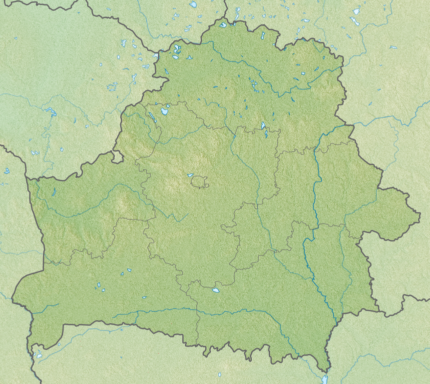
English: Relief map of
Belarus
Equirectangular projection, N/S stretching 170 %. Geographic limits of the map:
|
| Date | |
| Source | |
| Author |
|
Licensing
This file is licensed under the
Creative Commons
Attribution-Share Alike 3.0 Unported license.
- You are free:
- to share – to copy, distribute and transmit the work
- to remix – to adapt the work
- Under the following conditions:
- attribution – You must give appropriate credit, provide a link to the license, and indicate if changes were made. You may do so in any reasonable manner, but not in any way that suggests the licensor endorses you or your use.
- share alike – If you remix, transform, or build upon the material, you must distribute your contributions under the same or compatible license as the original.
File history
Click on a date/time to view the file as it appeared at that time.
| Date/Time | Thumbnail | Dimensions | User | Comment | |
|---|---|---|---|---|---|
| current | 02:00, 23 April 2013 |
| 1,197 × 1,068 (2.39 MB) | Ras67 | cropped |
| 16:37, 27 November 2010 |
 | 1,200 × 1,072 (2.78 MB) | Виктор В | SRTM3 | |
| 18:28, 30 August 2010 |
 | 1,200 × 1,072 (1.87 MB) | Виктор В | +реки | |
| 19:47, 26 August 2010 |
 | 1,000 × 893 (1.48 MB) | Виктор В | == {{int:filedesc}} == {{Information |Description={{en|Relief map of Belarus}} Equirectangular projection, N/S stretching 170 %. Geographic limits of the map: * N: 56.4° N * S: 51.1° N * W: 22.9° E * E: 33.0° E |Source=*[[:File:Belarus |
File usage
The following pages on the English Wikipedia use this file (pages on other projects are not listed):
- Aleh Byabenin
- Ashmyany
- Asipovichy Reservoir
- Battle of Lesnaya
- Battle of Ula
- Battle of the Niemen River
- Belovezhskaya Pushcha National Park
- Braslaw Lakes
- Brest, Belarus
- Choral Synagogue (Brest)
- Choral synagogue (Vitebsk)
- Cold Synagogue, Minsk
- Cold Synagogue, Mogilev
- Dryvyaty
- Drūkšiai
- Dzyarzhynsk
- Dzyarzhynskaya Hara
- Gomel
- Great Synagogue (Grodno)
- Grodno
- Grodno Hydroelectric Power Station
- Kletsk
- Lake Abakrytseli
- Lake Babyna
- Lake Beloye (Beshankovichy Raion)
- Lake Chervonoye
- Lake Ezerische
- Lake Ikazn
- Lake Ilmenak
- Lake Lukomlskoye
- Lake Neshcharda
- Lake Osveya
- Lake Rychy
- Lake Strusta
- Lake Yedigei
- List of fossiliferous stratigraphic units in Belarus
- Lyady, Vitebsk Region
- Minsk
- Minsk Cathedral Mosque
- Mir Castle Complex
- Narach (lake)
- Narachanski National Park
- Navahrudak Mosque
- Nesvizh Castle
- Old Belarusian History Museum
- Pinsk Marshes
- Pripyatsky National Park
- Ruzhany
- Slawharad
- Slonim Synagogue
- Snudy Lake
- Syaliba
- Syalyava
- Ubort
- Vilyeyka reservoir
- Vitebsk
- Vyhanaščanskaje Lake
- Wołpa Synagogue
- Zaniomanskaja Synagogue
- Zaslawskaye reservoir
- Wikipedia:Graphics Lab/Map workshop/Archive/Jun 2023
- Module:Location map/data/Belarus
- Module:Location map/data/Belarus/doc
Global file usage
The following other wikis use this file:
- Usage on als.wikipedia.org
- Usage on ar.wikipedia.org
- Usage on ast.wikipedia.org
- Usage on av.wikipedia.org
- Usage on azb.wikipedia.org
- Usage on az.wikipedia.org
- Usage on ba.wikipedia.org
- Usage on bcl.wikipedia.org
- Usage on be-tarask.wikipedia.org
- Лукомскае возера
- Балдук
- Глубля
- Глубелька
- Нарач
- Сялява (возера)
- Выганашчанскае возера
- Белае возера (Бешанковіцкі раён)
- Белае возера (Полацкі раён)
- Белае возера (Мёрскі раён)
- Белае возера (Чашніцкі раён)
- Белае возера (Дрысенскі раён)
- Белае возера (Берасьцейскі раён)
- Белае возера (Гарадоцкі раён)
- Белае возера (Расонскі раён)
- Белае возера (Гарадзенскі раён)
- Белае возера (Жыткавіцкі раён)
- Белае возера (Глыбоцкі раён)
- Белае возера (Бярозаўскі раён)
- Князь-возера
- Рычы (возера)
- Струста
- Мядзел (возера)
View more global usage of this file.
Size of this preview:
672 × 600 pixels. Other resolutions:
269 × 240 pixels |
538 × 480 pixels |
861 × 768 pixels |
1,197 × 1,068 pixels.
Original file (1,197 × 1,068 pixels, file size: 2.39 MB, MIME type: image/png)
| This is a file from the
Wikimedia Commons. Information from its
description page there is shown below. Commons is a freely licensed media file repository. You can help. |
Summary
| Description |
English: Relief map of
Belarus
Equirectangular projection, N/S stretching 170 %. Geographic limits of the map:
|
| Date | |
| Source | |
| Author |
|
Licensing
This file is licensed under the
Creative Commons
Attribution-Share Alike 3.0 Unported license.
- You are free:
- to share – to copy, distribute and transmit the work
- to remix – to adapt the work
- Under the following conditions:
- attribution – You must give appropriate credit, provide a link to the license, and indicate if changes were made. You may do so in any reasonable manner, but not in any way that suggests the licensor endorses you or your use.
- share alike – If you remix, transform, or build upon the material, you must distribute your contributions under the same or compatible license as the original.
File history
Click on a date/time to view the file as it appeared at that time.
| Date/Time | Thumbnail | Dimensions | User | Comment | |
|---|---|---|---|---|---|
| current | 02:00, 23 April 2013 |
| 1,197 × 1,068 (2.39 MB) | Ras67 | cropped |
| 16:37, 27 November 2010 |
| 1,200 × 1,072 (2.78 MB) | Виктор В | SRTM3 | |
| 18:28, 30 August 2010 |
| 1,200 × 1,072 (1.87 MB) | Виктор В | +реки | |
| 19:47, 26 August 2010 |
| 1,000 × 893 (1.48 MB) | Виктор В | == {{int:filedesc}} == {{Information |Description={{en|Relief map of Belarus}} Equirectangular projection, N/S stretching 170 %. Geographic limits of the map: * N: 56.4° N * S: 51.1° N * W: 22.9° E * E: 33.0° E |Source=*[[:File:Belarus |
File usage
The following pages on the English Wikipedia use this file (pages on other projects are not listed):
- Aleh Byabenin
- Ashmyany
- Asipovichy Reservoir
- Battle of Lesnaya
- Battle of Ula
- Battle of the Niemen River
- Belovezhskaya Pushcha National Park
- Braslaw Lakes
- Brest, Belarus
- Choral Synagogue (Brest)
- Choral synagogue (Vitebsk)
- Cold Synagogue, Minsk
- Cold Synagogue, Mogilev
- Dryvyaty
- Drūkšiai
- Dzyarzhynsk
- Dzyarzhynskaya Hara
- Gomel
- Great Synagogue (Grodno)
- Grodno
- Grodno Hydroelectric Power Station
- Kletsk
- Lake Abakrytseli
- Lake Babyna
- Lake Beloye (Beshankovichy Raion)
- Lake Chervonoye
- Lake Ezerische
- Lake Ikazn
- Lake Ilmenak
- Lake Lukomlskoye
- Lake Neshcharda
- Lake Osveya
- Lake Rychy
- Lake Strusta
- Lake Yedigei
- List of fossiliferous stratigraphic units in Belarus
- Lyady, Vitebsk Region
- Minsk
- Minsk Cathedral Mosque
- Mir Castle Complex
- Narach (lake)
- Narachanski National Park
- Navahrudak Mosque
- Nesvizh Castle
- Old Belarusian History Museum
- Pinsk Marshes
- Pripyatsky National Park
- Ruzhany
- Slawharad
- Slonim Synagogue
- Snudy Lake
- Syaliba
- Syalyava
- Ubort
- Vilyeyka reservoir
- Vitebsk
- Vyhanaščanskaje Lake
- Wołpa Synagogue
- Zaniomanskaja Synagogue
- Zaslawskaye reservoir
- Wikipedia:Graphics Lab/Map workshop/Archive/Jun 2023
- Module:Location map/data/Belarus
- Module:Location map/data/Belarus/doc
Global file usage
The following other wikis use this file:
- Usage on als.wikipedia.org
- Usage on ar.wikipedia.org
- Usage on ast.wikipedia.org
- Usage on av.wikipedia.org
- Usage on azb.wikipedia.org
- Usage on az.wikipedia.org
- Usage on ba.wikipedia.org
- Usage on bcl.wikipedia.org
- Usage on be-tarask.wikipedia.org
- Лукомскае возера
- Балдук
- Глубля
- Глубелька
- Нарач
- Сялява (возера)
- Выганашчанскае возера
- Белае возера (Бешанковіцкі раён)
- Белае возера (Полацкі раён)
- Белае возера (Мёрскі раён)
- Белае возера (Чашніцкі раён)
- Белае возера (Дрысенскі раён)
- Белае возера (Берасьцейскі раён)
- Белае возера (Гарадоцкі раён)
- Белае возера (Расонскі раён)
- Белае возера (Гарадзенскі раён)
- Белае возера (Жыткавіцкі раён)
- Белае возера (Глыбоцкі раён)
- Белае возера (Бярозаўскі раён)
- Князь-возера
- Рычы (возера)
- Струста
- Мядзел (возера)
View more global usage of this file.