
Size of this preview:
800 × 600 pixels. Other resolutions:
320 × 240 pixels |
640 × 480 pixels |
1,024 × 768 pixels |
1,280 × 960 pixels |
2,560 × 1,920 pixels |
4,000 × 3,000 pixels.
Original file (4,000 × 3,000 pixels, file size: 4.01 MB, MIME type: image/jpeg)
| This is a file from the
Wikimedia Commons. Information from its
description page there is shown below. Commons is a freely licensed media file repository. You can help. |
|
This is an image of a place or building that is listed on the
National Register of Historic Places in the
United States of America. Its reference number is
4000181. |
Summary
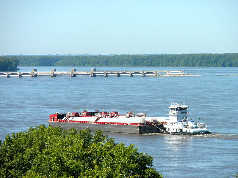
| Description | Lock and Dam No. 21 Historic District on the NRHP since March 10, 2004. Located on the Mississippi River about 0.5 mi. W of IL 57, near Quincy, Illinois. This photo was taken from the bluff by Villa Kathrine in Quincy which is also on the NRHP. |
| Date | Taken on 1 July 2010 |
| Source | Own work |
| Author | Smallbones |
Licensing
| I, the copyright holder of this work, release this work into the
public domain. This applies worldwide. In some countries this may not be legally possible; if so: I grant anyone the right to use this work for any purpose, without any conditions, unless such conditions are required by law. |
File history
Click on a date/time to view the file as it appeared at that time.
| Date/Time | Thumbnail | Dimensions | User | Comment | |
|---|---|---|---|---|---|
| current | 18:44, 22 July 2010 |
| 4,000 × 3,000 (4.01 MB) | Smallbones | {{Information |Description=Lock and Dam No. 21 Historic District on the NRHP since March 10, 2004. Located on the Mississippi River about 0.5 mi. W of IL 57, near Quincy, Illinois. This photo was taken from the bluff by Villa Kathrine in Quincy which is |
File usage
The following pages on the English Wikipedia use this file (pages on other projects are not listed):
Global file usage
The following other wikis use this file:
- Usage on de.wikipedia.org
Metadata
Size of this preview:
800 × 600 pixels. Other resolutions:
320 × 240 pixels |
640 × 480 pixels |
1,024 × 768 pixels |
1,280 × 960 pixels |
2,560 × 1,920 pixels |
4,000 × 3,000 pixels.
Original file (4,000 × 3,000 pixels, file size: 4.01 MB, MIME type: image/jpeg)
| This is a file from the
Wikimedia Commons. Information from its
description page there is shown below. Commons is a freely licensed media file repository. You can help. |
|
This is an image of a place or building that is listed on the
National Register of Historic Places in the
United States of America. Its reference number is
4000181. |
Summary
| Description | Lock and Dam No. 21 Historic District on the NRHP since March 10, 2004. Located on the Mississippi River about 0.5 mi. W of IL 57, near Quincy, Illinois. This photo was taken from the bluff by Villa Kathrine in Quincy which is also on the NRHP. |
| Date | Taken on 1 July 2010 |
| Source | Own work |
| Author | Smallbones |
Licensing
| I, the copyright holder of this work, release this work into the
public domain. This applies worldwide. In some countries this may not be legally possible; if so: I grant anyone the right to use this work for any purpose, without any conditions, unless such conditions are required by law. |
File history
Click on a date/time to view the file as it appeared at that time.
| Date/Time | Thumbnail | Dimensions | User | Comment | |
|---|---|---|---|---|---|
| current | 18:44, 22 July 2010 |
| 4,000 × 3,000 (4.01 MB) | Smallbones | {{Information |Description=Lock and Dam No. 21 Historic District on the NRHP since March 10, 2004. Located on the Mississippi River about 0.5 mi. W of IL 57, near Quincy, Illinois. This photo was taken from the bluff by Villa Kathrine in Quincy which is |
File usage
The following pages on the English Wikipedia use this file (pages on other projects are not listed):
Global file usage
The following other wikis use this file:
- Usage on de.wikipedia.org