Size of this preview:
800 × 459 pixels. Other resolutions:
320 × 183 pixels |
640 × 367 pixels |
1,024 × 587 pixels |
1,280 × 734 pixels |
1,917 × 1,099 pixels.
Original file (1,917 × 1,099 pixels, file size: 775 KB, MIME type: image/png)
| This is a file from the
Wikimedia Commons. Information from its
description page there is shown below. Commons is a freely licensed media file repository. You can help. |
Summary
| Description |
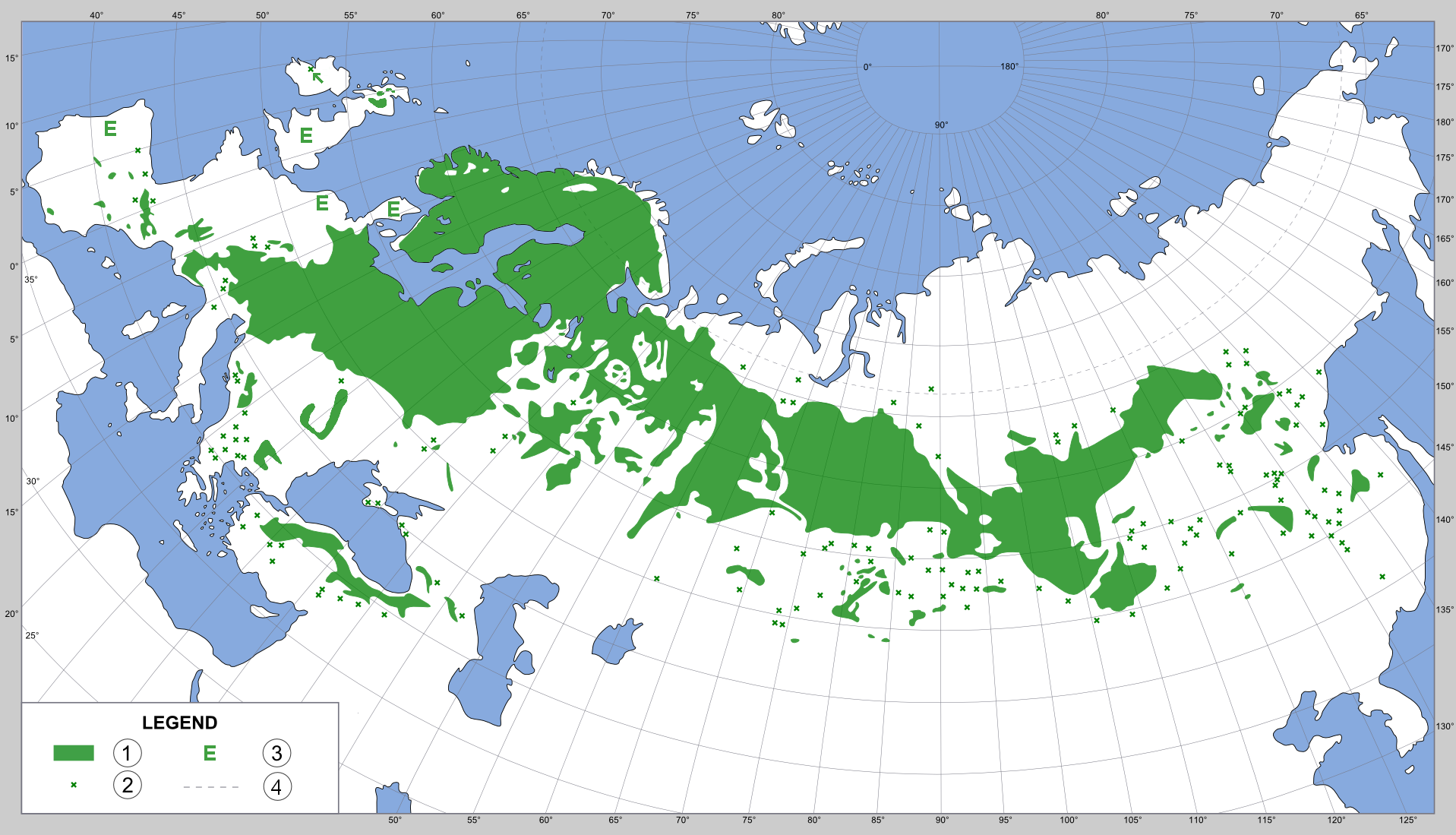
Polski: Zasięg sosny zwyczajnej —
Pinus sylvestris.
English:
Distribution map of the native ranges of
Pinus sylvestris (Scots pine) — in Asia and Europe.
Suomi:
Levinneisyyskartta
Pinus sylvestris (Mänty) — euroopan ja aasian alueella.
|
| Date | 07.01.2007 |
| Source |
Polski: Narysowane na podstawie
ScotsPine_map.jpg przesłanej na Commons przez
B.navez na licencji PD-USGov-USDA-FS.
|
| Author | Agnieszka Kwiecień ( Nova) |
| Permission ( Reusing this file) |
GFDL, CC-BY 2.5 |
Licensing
I, the copyright holder of this work, hereby publish it under the following licenses:

|
Permission is granted to copy, distribute and/or modify this document under the terms of the GNU Free Documentation License, Version 1.2 or any later version published by the Free Software Foundation; with no Invariant Sections, no Front-Cover Texts, and no Back-Cover Texts. A copy of the license is included in the section entitled GNU Free Documentation License. |
| This file is licensed under the Creative Commons Attribution-Share Alike 3.0 Unported license. | ||
| ||
| This licensing tag was added to this file as part of the GFDL licensing update. |
This file is licensed under the
Creative Commons
Attribution 2.5 Generic license.
- You are free:
- to share – to copy, distribute and transmit the work
- to remix – to adapt the work
- Under the following conditions:
- attribution – You must give appropriate credit, provide a link to the license, and indicate if changes were made. You may do so in any reasonable manner, but not in any way that suggests the licensor endorses you or your use.
You may select the license of your choice.
File history
Click on a date/time to view the file as it appeared at that time.
| Date/Time | Thumbnail | Dimensions | User | Comment | |
|---|---|---|---|---|---|
| current | 18:11, 10 December 2017 |
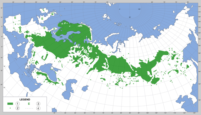
| 1,917 × 1,099 (775 KB) | MPF | Update: add Ireland population; ref ''J. Biogeogr.'' 43 (11): 2199–2208 (2016). |
| 20:49, 27 July 2007 |
 | 1,917 × 1,099 (615 KB) | MPF | Additional detail from Atlas Flora Europaea & Mirov, Genus Pinus | |
| 16:50, 13 January 2007 |
 | 1,917 × 1,099 (787 KB) | Nova | ||
| 22:42, 7 January 2007 |
 | 1,917 × 1,099 (840 KB) | Nova | {{Information |Description={{pl|Zasięg sosny zwyczajnej ('' Pinus sylvestris'').}}{{en|Scots Pine ('' Pinus sylvestris'') range.}} |Source={{pl|Narysowane na podstawie ScotsPine_map.jpg przesłanej na Commons prz |
File usage
The following pages on the English Wikipedia use this file (pages on other projects are not listed):
Global file usage
The following other wikis use this file:
- Usage on an.wikipedia.org
- Usage on ar.wikipedia.org
- Usage on ast.wikipedia.org
- Usage on ba.wikipedia.org
- Usage on be.wikipedia.org
- Usage on ceb.wikipedia.org
- Usage on cy.wikipedia.org
- Usage on da.wikipedia.org
- Usage on de.wikipedia.org
- Usage on de.wikibooks.org
- Usage on el.wikipedia.org
- Usage on eo.wikipedia.org
- Usage on et.wikipedia.org
- Usage on eu.wikipedia.org
- Usage on fa.wikipedia.org
- Usage on fiu-vro.wikipedia.org
- Usage on fi.wikipedia.org
- Usage on fr.wikipedia.org
- Usage on gl.wikipedia.org
- Usage on hr.wikipedia.org
- Usage on hsb.wikipedia.org
- Usage on hu.wikipedia.org
- Usage on hy.wikipedia.org
- Usage on id.wikipedia.org
- Usage on incubator.wikimedia.org
- Usage on inh.wikipedia.org
- Usage on is.wikipedia.org
- Usage on ja.wikipedia.org
- Usage on koi.wikipedia.org
- Usage on lt.wikipedia.org
- Usage on nl.wikipedia.org
- Usage on no.wikipedia.org
- Usage on os.wikipedia.org
- Usage on pl.wikipedia.org
- Usage on pt.wikipedia.org
- Usage on rm.wikipedia.org
- Usage on ru.wikipedia.org
- Usage on ru.wiktionary.org
- Usage on sco.wikipedia.org
- Usage on simple.wikipedia.org
- Usage on sl.wikipedia.org
- Usage on sr.wikipedia.org
- Usage on sv.wikipedia.org
View more global usage of this file.
Metadata
Size of this preview:
800 × 459 pixels. Other resolutions:
320 × 183 pixels |
640 × 367 pixels |
1,024 × 587 pixels |
1,280 × 734 pixels |
1,917 × 1,099 pixels.
Original file (1,917 × 1,099 pixels, file size: 775 KB, MIME type: image/png)
| This is a file from the
Wikimedia Commons. Information from its
description page there is shown below. Commons is a freely licensed media file repository. You can help. |
Summary
| Description |
Polski: Zasięg sosny zwyczajnej —
Pinus sylvestris.
English:
Distribution map of the native ranges of
Pinus sylvestris (Scots pine) — in Asia and Europe.
Suomi:
Levinneisyyskartta
Pinus sylvestris (Mänty) — euroopan ja aasian alueella.
|
| Date | 07.01.2007 |
| Source |
Polski: Narysowane na podstawie
ScotsPine_map.jpg przesłanej na Commons przez
B.navez na licencji PD-USGov-USDA-FS.
|
| Author | Agnieszka Kwiecień ( Nova) |
| Permission ( Reusing this file) |
GFDL, CC-BY 2.5 |
Licensing
I, the copyright holder of this work, hereby publish it under the following licenses:
|
|
Permission is granted to copy, distribute and/or modify this document under the terms of the GNU Free Documentation License, Version 1.2 or any later version published by the Free Software Foundation; with no Invariant Sections, no Front-Cover Texts, and no Back-Cover Texts. A copy of the license is included in the section entitled GNU Free Documentation License. |
| This file is licensed under the Creative Commons Attribution-Share Alike 3.0 Unported license. | ||
| ||
| This licensing tag was added to this file as part of the GFDL licensing update. |
This file is licensed under the
Creative Commons
Attribution 2.5 Generic license.
- You are free:
- to share – to copy, distribute and transmit the work
- to remix – to adapt the work
- Under the following conditions:
- attribution – You must give appropriate credit, provide a link to the license, and indicate if changes were made. You may do so in any reasonable manner, but not in any way that suggests the licensor endorses you or your use.
You may select the license of your choice.
File history
Click on a date/time to view the file as it appeared at that time.
| Date/Time | Thumbnail | Dimensions | User | Comment | |
|---|---|---|---|---|---|
| current | 18:11, 10 December 2017 |
| 1,917 × 1,099 (775 KB) | MPF | Update: add Ireland population; ref ''J. Biogeogr.'' 43 (11): 2199–2208 (2016). |
| 20:49, 27 July 2007 |
| 1,917 × 1,099 (615 KB) | MPF | Additional detail from Atlas Flora Europaea & Mirov, Genus Pinus | |
| 16:50, 13 January 2007 |
| 1,917 × 1,099 (787 KB) | Nova | ||
| 22:42, 7 January 2007 |
| 1,917 × 1,099 (840 KB) | Nova | {{Information |Description={{pl|Zasięg sosny zwyczajnej ('' Pinus sylvestris'').}}{{en|Scots Pine ('' Pinus sylvestris'') range.}} |Source={{pl|Narysowane na podstawie ScotsPine_map.jpg przesłanej na Commons prz |
File usage
The following pages on the English Wikipedia use this file (pages on other projects are not listed):
Global file usage
The following other wikis use this file:
- Usage on an.wikipedia.org
- Usage on ar.wikipedia.org
- Usage on ast.wikipedia.org
- Usage on ba.wikipedia.org
- Usage on be.wikipedia.org
- Usage on ceb.wikipedia.org
- Usage on cy.wikipedia.org
- Usage on da.wikipedia.org
- Usage on de.wikipedia.org
- Usage on de.wikibooks.org
- Usage on el.wikipedia.org
- Usage on eo.wikipedia.org
- Usage on et.wikipedia.org
- Usage on eu.wikipedia.org
- Usage on fa.wikipedia.org
- Usage on fiu-vro.wikipedia.org
- Usage on fi.wikipedia.org
- Usage on fr.wikipedia.org
- Usage on gl.wikipedia.org
- Usage on hr.wikipedia.org
- Usage on hsb.wikipedia.org
- Usage on hu.wikipedia.org
- Usage on hy.wikipedia.org
- Usage on id.wikipedia.org
- Usage on incubator.wikimedia.org
- Usage on inh.wikipedia.org
- Usage on is.wikipedia.org
- Usage on ja.wikipedia.org
- Usage on koi.wikipedia.org
- Usage on lt.wikipedia.org
- Usage on nl.wikipedia.org
- Usage on no.wikipedia.org
- Usage on os.wikipedia.org
- Usage on pl.wikipedia.org
- Usage on pt.wikipedia.org
- Usage on rm.wikipedia.org
- Usage on ru.wikipedia.org
- Usage on ru.wiktionary.org
- Usage on sco.wikipedia.org
- Usage on simple.wikipedia.org
- Usage on sl.wikipedia.org
- Usage on sr.wikipedia.org
- Usage on sv.wikipedia.org
View more global usage of this file.