Original file (2,000 × 1,333 pixels, file size: 1.61 MB, MIME type: image/jpeg)
| This is a file from the
Wikimedia Commons. Information from its
description page there is shown below. Commons is a freely licensed media file repository. You can help. |
Summary
| Description |
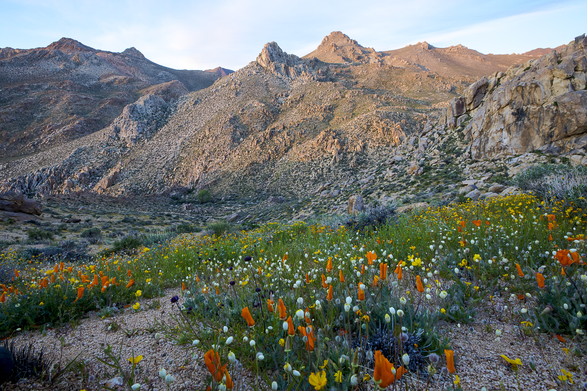
The majority of this Wilderness is comprised of the rugged eastern face of the Sierra Nevada Mountains. Owens Peak, the high point of the southern Sierra Nevada's, rises more than 8,400 feet. The mountainous terrain has deep, winding, open and expansive canyons, many which contain springs with extensive riparian vegetation. This area is a transition zone between the Great Basin, Mojave Desert and Sierra Nevada ecoregions. Vegetation varies considerably with a creosote desert scrub community on the bajadas, scattered yuccas, cacti, annuals, cottonwood and oak trees in the canyons and valleys and a juniper-pinyon woodland with sagebrush and digger/ grey pine on the upper elevations. Wildlife includes mule deer, golden eagle and prairie falcon. Evidence of occupation by prehistoric peoples has been found throughout the wilderness. The Pacific Crest Trail passes through the Wilderness along the crest and western side. |
| Date | Taken on 22 March 2017, 06:01 |
| Source | Owens Peak Wilderness |
| Author | Bob Wick, Bureau of Land Management |
| Camera location |
| View this and other nearby images on: OpenStreetMap |
|
|---|
Licensing
| This image is a work of a
Bureau of Land Management* employee, taken or made as part of that person's official duties. As a
work of the
U.S. federal government, the image is in the
public domain in the United States. *or predecessor organization |
| This image, originally posted to Flickr, was reviewed on 8 April 2017 by the administrator or reviewer Leoboudv, who confirmed that it was available on Flickr under the stated license on that date. |
File history
Click on a date/time to view the file as it appeared at that time.
| Date/Time | Thumbnail | Dimensions | User | Comment | |
|---|---|---|---|---|---|
| current | 04:50, 8 April 2017 |
| 2,000 × 1,333 (1.61 MB) | Tillman | Transferred from Flickr via Flickr2Commons |
File usage
Metadata
Original file (2,000 × 1,333 pixels, file size: 1.61 MB, MIME type: image/jpeg)
| This is a file from the
Wikimedia Commons. Information from its
description page there is shown below. Commons is a freely licensed media file repository. You can help. |
Summary
| Description |
The majority of this Wilderness is comprised of the rugged eastern face of the Sierra Nevada Mountains. Owens Peak, the high point of the southern Sierra Nevada's, rises more than 8,400 feet. The mountainous terrain has deep, winding, open and expansive canyons, many which contain springs with extensive riparian vegetation. This area is a transition zone between the Great Basin, Mojave Desert and Sierra Nevada ecoregions. Vegetation varies considerably with a creosote desert scrub community on the bajadas, scattered yuccas, cacti, annuals, cottonwood and oak trees in the canyons and valleys and a juniper-pinyon woodland with sagebrush and digger/ grey pine on the upper elevations. Wildlife includes mule deer, golden eagle and prairie falcon. Evidence of occupation by prehistoric peoples has been found throughout the wilderness. The Pacific Crest Trail passes through the Wilderness along the crest and western side. |
| Date | Taken on 22 March 2017, 06:01 |
| Source | Owens Peak Wilderness |
| Author | Bob Wick, Bureau of Land Management |
| Camera location |
| View this and other nearby images on: OpenStreetMap |
|
|---|
Licensing
| This image is a work of a
Bureau of Land Management* employee, taken or made as part of that person's official duties. As a
work of the
U.S. federal government, the image is in the
public domain in the United States. *or predecessor organization |
| This image, originally posted to Flickr, was reviewed on 8 April 2017 by the administrator or reviewer Leoboudv, who confirmed that it was available on Flickr under the stated license on that date. |
File history
Click on a date/time to view the file as it appeared at that time.
| Date/Time | Thumbnail | Dimensions | User | Comment | |
|---|---|---|---|---|---|
| current | 04:50, 8 April 2017 |
| 2,000 × 1,333 (1.61 MB) | Tillman | Transferred from Flickr via Flickr2Commons |