
Original file (2,001 × 2,632 pixels, file size: 481 KB, MIME type: image/jpeg)
| This is a file from the
Wikimedia Commons. Information from its
description page there is shown below. Commons is a freely licensed media file repository. You can help. |
| Description |
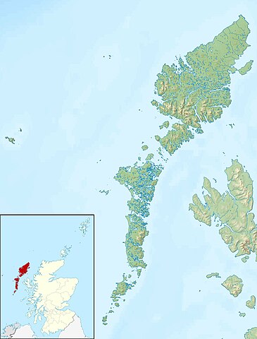
Relief map of the Outer Hebrides (excluding Sula Sgeir), UK. Equirectangular map projection on WGS 84 datum, with N/S stretched 180% Geographic limits:
|
| Date | |
| Source |
|
| Author | Nilfanion, created using Ordnance Survey data |
| Permission ( Reusing this file) |
This file is licensed under the
Creative Commons
Attribution-Share Alike 3.0 Unported license. Attribution: Contains Ordnance Survey data © Crown copyright and database right
|
| Other versions | File:Outer Hebrides UK blank map.svg - Blank map |
File history
Click on a date/time to view the file as it appeared at that time.
| Date/Time | Thumbnail | Dimensions | User | Comment | |
|---|---|---|---|---|---|
| current | 12:26, 30 November 2011 |
| 2,001 × 2,632 (481 KB) | Nilfanion | {{Information |Description=Relief map of the Outer Hebrides (excluding Sula Sgeir), UK. Equirectangular map projection on WGS 84 datum, with N/S stretched 180% Geographic limits: *West: 8.70W *East: 6.10W *North: 58 |
File usage
More than 100 pages use this file. The following list shows the first 100 pages that use this file only. A full list is available.
- Arnamul
- Baleshare
- Barra
- Barra Head
- Bearasaigh
- Beinn Mhòr (South Uist)
- Benbecula
- Berneray (North Uist)
- Boreray, North Uist
- Boreray, St Kilda
- Bun Sruth
- Campaigh
- Ceabhaigh
- Cealasaigh
- Ceallasaigh Beag
- Ceallasaigh Mòr
- Ceann Ear
- Ceann Iar
- Easaval
- Eilean Chaluim Chille
- Eilean Chearstaidh
- Eilean Liubhaird
- Eilean Mhealasta
- Eilean Mhuire
- Eilean Mòr, Loch Langavat
- Eilean na Cille
- Eileanan Chearabhaigh
- Eileanan Iasgaich
- Ensay (Outer Hebrides)
- Eriskay
- Fiaraidh
- Flannan Isles
- Flodaigh
- Flodaigh, Lewis
- Flodaigh (Outer Loch Ròg)
- Flodaigh Mòr
- Flodday, Loch Maddy
- Flodday (Sound of Barra)
- Flodday near Vatersay
- Fraoch-Eilean
- Fuaigh Mòr
- Fuday
- Fuiay
- Garbh Eilean, Shiant Islands
- Gighay
- Great Bernera
- Grimsay
- Grimsay (South East Benbecula)
- Haskeir
- Hecla (South Uist)
- Hellisay
- Hermetray
- Hirta
- Killegray
- Kirkibost
- Lewis and Harris
- Lingay, Fiaray
- Lingeigh
- Lingeigh, North Uist
- List of islands of the United Kingdom
- Little Bernera
- Loch Sgadabhagh
- Mingulay
- Muldoanich
- North Uist
- Oronsay, Outer Hebrides
- Orosay
- Outer Hebrides
- Pabaigh Mòr
- Pabbay, Barra Isles
- Pabbay, Harris
- Port Stoth
- Rainish Eilean Mòr
- Ronay
- Sandray
- Scalpay, Outer Hebrides
- Scarp, Scotland
- Seaforth Island
- Seanna Chnoc
- Sgeotasaigh
- Shillay
- Shillay, Monach Islands
- Soay, St Kilda
- Soay Mòr
- South Uist
- St Kilda, Scotland
- Stac Biorach
- Stac Lee
- Stac Levenish
- Stac an Armin
- Stocaigh
- Stockinish Island
- Stromay
- Stuley
- Tahay
- Taransay
- Vacsay
- Vallay
- Vatersay
- Wiay, Outer Hebrides
View more links to this file.
Global file usage
The following other wikis use this file:
- Usage on ar.wikipedia.org
- Usage on bg.wikipedia.org
- Usage on ceb.wikipedia.org
- Usage on da.wikipedia.org
- Usage on de.wikipedia.org
- Soay (St. Kilda)
- Hirta
- Uist
- Boreray (St. Kilda)
- Uig (Lewis)
- Dùn
- North Rona
- Sula Sgeir
- Stac Lee
- Stac an Armin
- Barra Head (Schottland)
- Loch Druidibeag
- Lewis and Harris
- Seaforth Island
- Haskeir
- Vorlage:Positionskarte Schottland Outer Hebrides
- Stiaraval
- Ruaval
- Heaval
- Ben Tangaval
- Beinn Sciathan
- Eriskay-Sund
- Acairseid Mhor
- Berneray-Sund
- Loch Borve
- Loch Beag Bhuirgh
- Loch Bhrusda
- Borve Hill
- Beinn Shleibhe
- Loch Seaforth
- Loch Odhairn
- Scarp
- Fladday
- Sound of Scarp
- Loch Langavat
- Mealasta
- Little Bernera
- Flodaigh
- Flodaigh (Bernera)
- Bearasay
- Seanna Chnoc
- Kealasay
- Campay
- Craigeam
View more global usage of this file.
Original file (2,001 × 2,632 pixels, file size: 481 KB, MIME type: image/jpeg)
| This is a file from the
Wikimedia Commons. Information from its
description page there is shown below. Commons is a freely licensed media file repository. You can help. |
| Description |
Relief map of the Outer Hebrides (excluding Sula Sgeir), UK. Equirectangular map projection on WGS 84 datum, with N/S stretched 180% Geographic limits:
|
| Date | |
| Source |
|
| Author | Nilfanion, created using Ordnance Survey data |
| Permission ( Reusing this file) |
This file is licensed under the
Creative Commons
Attribution-Share Alike 3.0 Unported license. Attribution: Contains Ordnance Survey data © Crown copyright and database right
|
| Other versions | File:Outer Hebrides UK blank map.svg - Blank map |
File history
Click on a date/time to view the file as it appeared at that time.
| Date/Time | Thumbnail | Dimensions | User | Comment | |
|---|---|---|---|---|---|
| current | 12:26, 30 November 2011 |
| 2,001 × 2,632 (481 KB) | Nilfanion | {{Information |Description=Relief map of the Outer Hebrides (excluding Sula Sgeir), UK. Equirectangular map projection on WGS 84 datum, with N/S stretched 180% Geographic limits: *West: 8.70W *East: 6.10W *North: 58 |
File usage
More than 100 pages use this file. The following list shows the first 100 pages that use this file only. A full list is available.
- Arnamul
- Baleshare
- Barra
- Barra Head
- Bearasaigh
- Beinn Mhòr (South Uist)
- Benbecula
- Berneray (North Uist)
- Boreray, North Uist
- Boreray, St Kilda
- Bun Sruth
- Campaigh
- Ceabhaigh
- Cealasaigh
- Ceallasaigh Beag
- Ceallasaigh Mòr
- Ceann Ear
- Ceann Iar
- Easaval
- Eilean Chaluim Chille
- Eilean Chearstaidh
- Eilean Liubhaird
- Eilean Mhealasta
- Eilean Mhuire
- Eilean Mòr, Loch Langavat
- Eilean na Cille
- Eileanan Chearabhaigh
- Eileanan Iasgaich
- Ensay (Outer Hebrides)
- Eriskay
- Fiaraidh
- Flannan Isles
- Flodaigh
- Flodaigh, Lewis
- Flodaigh (Outer Loch Ròg)
- Flodaigh Mòr
- Flodday, Loch Maddy
- Flodday (Sound of Barra)
- Flodday near Vatersay
- Fraoch-Eilean
- Fuaigh Mòr
- Fuday
- Fuiay
- Garbh Eilean, Shiant Islands
- Gighay
- Great Bernera
- Grimsay
- Grimsay (South East Benbecula)
- Haskeir
- Hecla (South Uist)
- Hellisay
- Hermetray
- Hirta
- Killegray
- Kirkibost
- Lewis and Harris
- Lingay, Fiaray
- Lingeigh
- Lingeigh, North Uist
- List of islands of the United Kingdom
- Little Bernera
- Loch Sgadabhagh
- Mingulay
- Muldoanich
- North Uist
- Oronsay, Outer Hebrides
- Orosay
- Outer Hebrides
- Pabaigh Mòr
- Pabbay, Barra Isles
- Pabbay, Harris
- Port Stoth
- Rainish Eilean Mòr
- Ronay
- Sandray
- Scalpay, Outer Hebrides
- Scarp, Scotland
- Seaforth Island
- Seanna Chnoc
- Sgeotasaigh
- Shillay
- Shillay, Monach Islands
- Soay, St Kilda
- Soay Mòr
- South Uist
- St Kilda, Scotland
- Stac Biorach
- Stac Lee
- Stac Levenish
- Stac an Armin
- Stocaigh
- Stockinish Island
- Stromay
- Stuley
- Tahay
- Taransay
- Vacsay
- Vallay
- Vatersay
- Wiay, Outer Hebrides
View more links to this file.
Global file usage
The following other wikis use this file:
- Usage on ar.wikipedia.org
- Usage on bg.wikipedia.org
- Usage on ceb.wikipedia.org
- Usage on da.wikipedia.org
- Usage on de.wikipedia.org
- Soay (St. Kilda)
- Hirta
- Uist
- Boreray (St. Kilda)
- Uig (Lewis)
- Dùn
- North Rona
- Sula Sgeir
- Stac Lee
- Stac an Armin
- Barra Head (Schottland)
- Loch Druidibeag
- Lewis and Harris
- Seaforth Island
- Haskeir
- Vorlage:Positionskarte Schottland Outer Hebrides
- Stiaraval
- Ruaval
- Heaval
- Ben Tangaval
- Beinn Sciathan
- Eriskay-Sund
- Acairseid Mhor
- Berneray-Sund
- Loch Borve
- Loch Beag Bhuirgh
- Loch Bhrusda
- Borve Hill
- Beinn Shleibhe
- Loch Seaforth
- Loch Odhairn
- Scarp
- Fladday
- Sound of Scarp
- Loch Langavat
- Mealasta
- Little Bernera
- Flodaigh
- Flodaigh (Bernera)
- Bearasay
- Seanna Chnoc
- Kealasay
- Campay
- Craigeam
View more global usage of this file.