
Original file (SVG file, nominally 1,083 × 1,424 pixels, file size: 3.25 MB)
| This is a file from the
Wikimedia Commons. Information from its
description page there is shown below. Commons is a freely licensed media file repository. You can help. |
| Description |
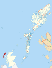
Blank map of the Outer Hebrides (excluding Sula Sgeir), UK with the following information shown:
Equirectangular map projection on WGS 84 datum, with N/S stretched 180% Geographic limits:
|
| Date | |
| Source |
|
| Author | Nilfanion, created using Ordnance Survey data |
| Permission ( Reusing this file) |
This file is licensed under the
Creative Commons
Attribution-Share Alike 3.0 Unported license. Attribution: Contains Ordnance Survey data © Crown copyright and database right
|
| Other versions | File:Outer Hebrides UK blank map.svg - Blank map |
File history
Click on a date/time to view the file as it appeared at that time.
| Date/Time | Thumbnail | Dimensions | User | Comment | |
|---|---|---|---|---|---|
| current | 20:23, 26 September 2010 |
| 1,083 × 1,424 (3.25 MB) | Nilfanion | {{Information |Description=Blank map of the Outer Hebrides (excluding Sula Sgeir), UK with the following information shown: *Administrative borders *Coastline, lakes and rivers *Roads and railways *Urban areas Equire |
File usage
More than 100 pages use this file. The following list shows the first 100 pages that use this file only. A full list is available.
- Achmore, Lewis
- Adabroc
- Aignish
- Aird, Lewis
- Allasdale
- Amhuinnsuidhe
- Amhuinnsuidhe Castle
- Ardhasaig
- Ardheisker
- Ardmore, Barra
- Ardroil
- Ardveenish
- Arnol
- Askernish
- Auratote
- Back, Lewis
- Bail' Iochdrach
- Baile Glas
- Baile an Truiseil
- Balallan
- Balgarva
- Balivanich
- Barra Airport
- Barvas
- Bayble
- Benbecula Airport
- Bogach
- Bornish
- Borrowston, Lewis
- Borsham
- Borve, Harris
- Bragar
- Branahuie
- Breaclete
- Breasclete
- Breivig
- Brenish
- Brevig, Barra
- Broker, Lewis
- Cabharstadh
- Calbost
- Callanish
- Callanish II
- Callanish III
- Callanish IV
- Callanish Stones
- Carinish
- Carloway
- Castlebay
- Cladh Hallan
- Daliburgh
- Dun Carloway
- Flesherin
- Garenin
- Garrabost
- Garynahine
- Gravir
- Gress
- Holm, Lewis
- Howmore
- Hushinish
- Kilaulay
- Kisimul Castle
- Knock, Isle of Lewis
- Laxdale
- Leurbost
- Leverburgh
- Lews Castle
- Lochboisdale
- Lochmaddy
- Mealista
- Melbost
- Ness, Lewis
- New Tolsta
- North Tolsta
- Northbay
- Nunton, Benbecula
- Outer Hebrides
- Parkend, Lewis
- Plasterfield
- Portnaguran
- Portvoller
- RAF Stornoway
- RRH Benbecula
- Rodel
- Sandwick, Lewis
- Shawbost
- Shulishader
- Skigersta
- Sollas
- St Clement's Church, Rodel
- Stoneybridge
- Stornoway
- Stornoway Airport
- Stornoway Town Hall
- Tarbert, Harris
- Tigharry
- Tong, Lewis
- Uig, Lewis
- Uist and Barra Hospital
View more links to this file.
Global file usage
The following other wikis use this file:
- Usage on ar.wikipedia.org
- Usage on bg.wikipedia.org
- Usage on ceb.wikipedia.org
- Usage on de.wikipedia.org
- Usage on eo.wikipedia.org
- Usage on es.wikipedia.org
- Usage on fa.wikipedia.org
- Usage on fi.wikipedia.org
- Usage on fr.wikipedia.org
View more global usage of this file.
Original file (SVG file, nominally 1,083 × 1,424 pixels, file size: 3.25 MB)
| This is a file from the
Wikimedia Commons. Information from its
description page there is shown below. Commons is a freely licensed media file repository. You can help. |
| Description |
Blank map of the Outer Hebrides (excluding Sula Sgeir), UK with the following information shown:
Equirectangular map projection on WGS 84 datum, with N/S stretched 180% Geographic limits:
|
| Date | |
| Source |
|
| Author | Nilfanion, created using Ordnance Survey data |
| Permission ( Reusing this file) |
This file is licensed under the
Creative Commons
Attribution-Share Alike 3.0 Unported license. Attribution: Contains Ordnance Survey data © Crown copyright and database right
|
| Other versions | File:Outer Hebrides UK blank map.svg - Blank map |
File history
Click on a date/time to view the file as it appeared at that time.
| Date/Time | Thumbnail | Dimensions | User | Comment | |
|---|---|---|---|---|---|
| current | 20:23, 26 September 2010 |
| 1,083 × 1,424 (3.25 MB) | Nilfanion | {{Information |Description=Blank map of the Outer Hebrides (excluding Sula Sgeir), UK with the following information shown: *Administrative borders *Coastline, lakes and rivers *Roads and railways *Urban areas Equire |
File usage
More than 100 pages use this file. The following list shows the first 100 pages that use this file only. A full list is available.
- Achmore, Lewis
- Adabroc
- Aignish
- Aird, Lewis
- Allasdale
- Amhuinnsuidhe
- Amhuinnsuidhe Castle
- Ardhasaig
- Ardheisker
- Ardmore, Barra
- Ardroil
- Ardveenish
- Arnol
- Askernish
- Auratote
- Back, Lewis
- Bail' Iochdrach
- Baile Glas
- Baile an Truiseil
- Balallan
- Balgarva
- Balivanich
- Barra Airport
- Barvas
- Bayble
- Benbecula Airport
- Bogach
- Bornish
- Borrowston, Lewis
- Borsham
- Borve, Harris
- Bragar
- Branahuie
- Breaclete
- Breasclete
- Breivig
- Brenish
- Brevig, Barra
- Broker, Lewis
- Cabharstadh
- Calbost
- Callanish
- Callanish II
- Callanish III
- Callanish IV
- Callanish Stones
- Carinish
- Carloway
- Castlebay
- Cladh Hallan
- Daliburgh
- Dun Carloway
- Flesherin
- Garenin
- Garrabost
- Garynahine
- Gravir
- Gress
- Holm, Lewis
- Howmore
- Hushinish
- Kilaulay
- Kisimul Castle
- Knock, Isle of Lewis
- Laxdale
- Leurbost
- Leverburgh
- Lews Castle
- Lochboisdale
- Lochmaddy
- Mealista
- Melbost
- Ness, Lewis
- New Tolsta
- North Tolsta
- Northbay
- Nunton, Benbecula
- Outer Hebrides
- Parkend, Lewis
- Plasterfield
- Portnaguran
- Portvoller
- RAF Stornoway
- RRH Benbecula
- Rodel
- Sandwick, Lewis
- Shawbost
- Shulishader
- Skigersta
- Sollas
- St Clement's Church, Rodel
- Stoneybridge
- Stornoway
- Stornoway Airport
- Stornoway Town Hall
- Tarbert, Harris
- Tigharry
- Tong, Lewis
- Uig, Lewis
- Uist and Barra Hospital
View more links to this file.
Global file usage
The following other wikis use this file:
- Usage on ar.wikipedia.org
- Usage on bg.wikipedia.org
- Usage on ceb.wikipedia.org
- Usage on de.wikipedia.org
- Usage on eo.wikipedia.org
- Usage on es.wikipedia.org
- Usage on fa.wikipedia.org
- Usage on fi.wikipedia.org
- Usage on fr.wikipedia.org
View more global usage of this file.