Photos • Location


Size of this preview:
800 × 378 pixels. Other resolutions:
320 × 151 pixels |
640 × 302 pixels |
1,024 × 484 pixels |
1,280 × 605 pixels |
2,559 × 1,209 pixels.
Original file (2,559 × 1,209 pixels, file size: 776 KB, MIME type: image/jpeg)
| This is a file from the
Wikimedia Commons. Information from its
description page there is shown below. Commons is a freely licensed media file repository. You can help. |
Summary
| Description |
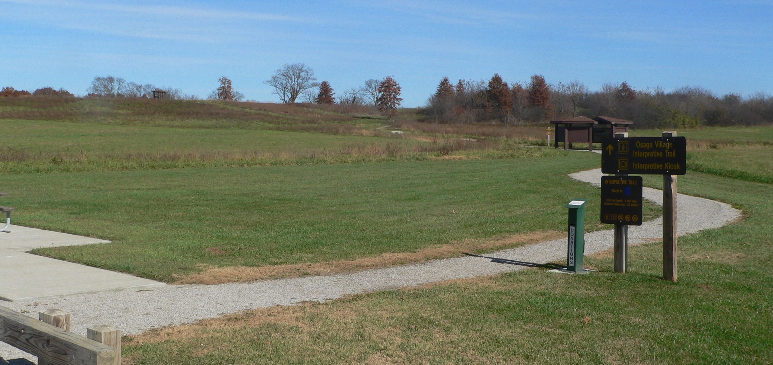
English: Osage Village State Historical Site, northwest of Harwood in Vernon County, Missouri. Camera is facing northeast from the parking lot. |
| Date | |
| Source | Own work |
| Author | Ammodramus |
Licensing
I, the copyright holder of this work, hereby publish it under the following license:
| This file is made available under the Creative Commons CC0 1.0 Universal Public Domain Dedication. | |
| The person who associated a work with this deed has dedicated the work to the
public domain by waiving all of their rights to the work worldwide under copyright law, including all related and neighboring rights, to the extent allowed by law. You can copy, modify, distribute and perform the work, even for commercial purposes, all without asking permission.
|
| Camera location | | View this and other nearby images on: OpenStreetMap |
|
|---|
File history
Click on a date/time to view the file as it appeared at that time.
| Date/Time | Thumbnail | Dimensions | User | Comment | |
|---|---|---|---|---|---|
| current | 13:29, 21 November 2017 |
| 2,559 × 1,209 (776 KB) | Ammodramus | User created page with UploadWizard |
File usage
The following pages on the English Wikipedia use this file (pages on other projects are not listed):
Global file usage
The following other wikis use this file:
- Usage on www.wikidata.org
Metadata
Size of this preview:
800 × 378 pixels. Other resolutions:
320 × 151 pixels |
640 × 302 pixels |
1,024 × 484 pixels |
1,280 × 605 pixels |
2,559 × 1,209 pixels.
Original file (2,559 × 1,209 pixels, file size: 776 KB, MIME type: image/jpeg)
| This is a file from the
Wikimedia Commons. Information from its
description page there is shown below. Commons is a freely licensed media file repository. You can help. |
Summary
| Description |
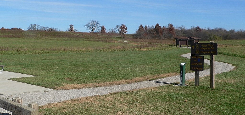
English: Osage Village State Historical Site, northwest of Harwood in Vernon County, Missouri. Camera is facing northeast from the parking lot. |
| Date | |
| Source | Own work |
| Author | Ammodramus |
Licensing
I, the copyright holder of this work, hereby publish it under the following license:
| This file is made available under the Creative Commons CC0 1.0 Universal Public Domain Dedication. | |
| The person who associated a work with this deed has dedicated the work to the
public domain by waiving all of their rights to the work worldwide under copyright law, including all related and neighboring rights, to the extent allowed by law. You can copy, modify, distribute and perform the work, even for commercial purposes, all without asking permission.
|
| Camera location | | View this and other nearby images on: OpenStreetMap |
|
|---|
File history
Click on a date/time to view the file as it appeared at that time.
| Date/Time | Thumbnail | Dimensions | User | Comment | |
|---|---|---|---|---|---|
| current | 13:29, 21 November 2017 |
| 2,559 × 1,209 (776 KB) | Ammodramus | User created page with UploadWizard |
File usage
The following pages on the English Wikipedia use this file (pages on other projects are not listed):
Global file usage
The following other wikis use this file:
- Usage on www.wikidata.org