
Original file (SVG file, nominally 1,181 × 1,013 pixels, file size: 1.55 MB)
| This is a file from the
Wikimedia Commons. Information from its
description page there is shown below. Commons is a freely licensed media file repository. You can help. |
Summary
| Description |
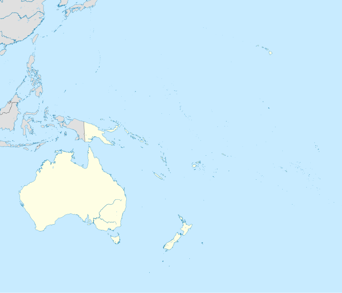
English: Location map of Oceania.
|
| Date | |
| Source | Own work |
| Author | Uwe Dedering |
| SVG development | This W3C-invalid
locator map was created with
Inkscape. |
Licensing
- You are free:
- to share – to copy, distribute and transmit the work
- to remix – to adapt the work
- Under the following conditions:
- attribution – You must give appropriate credit, provide a link to the license, and indicate if changes were made. You may do so in any reasonable manner, but not in any way that suggests the licensor endorses you or your use.
- share alike – If you remix, transform, or build upon the material, you must distribute your contributions under the same or compatible license as the original.

|
Permission is granted to copy, distribute and/or modify this document under the terms of the GNU Free Documentation License, Version 1.2 or any later version published by the Free Software Foundation; with no Invariant Sections, no Front-Cover Texts, and no Back-Cover Texts. A copy of the license is included in the section entitled GNU Free Documentation License. |
File history
Click on a date/time to view the file as it appeared at that time.
| Date/Time | Thumbnail | Dimensions | User | Comment | |
|---|---|---|---|---|---|
| current | 22:22, 31 March 2011 |
| 1,181 × 1,013 (1.55 MB) | Magog the Ogre | crop data outside of viewbox |
| 14:06, 28 November 2010 |
 | 1,181 × 1,013 (2.69 MB) | Uwe Dedering | {{Information |Description={{en|1= Location map of Oceania. * Projection: Lambert azimuthal equal-area projection. * Area of interest: :* N: 35.0° N :* S: -55.0° N :* W: 110.0° E :* E: 230.0° E (This is -130° E) * Projection center: :* NS: -10.0° N |
File usage
More than 100 pages use this file. The following list shows the first 100 pages that use this file only. A full list is available.
- 1987 Oceania Club Championship
- 1999 Oceania Club Championship
- 2001 Oceania Club Championship
- 2004 Summer Olympics torch relay
- 2005 Oceania Club Championship
- Abaiang
- Abemama
- Adelaide Airport
- Aranuka
- Arorae
- Atafu
- Auckland Airport
- Auckland Island
- Austral Islands
- Baker Island
- Banaba
- Bauerfield International Airport
- Beru (atoll)
- Bikini Atoll
- Birnie Island
- Bishop and Clerk Islets
- Bonriki International Airport
- Brisbane Airport
- Butaritari
- Cairns Airport
- Canberra Airport
- Canton Island
- Cassidy International Airport
- Christchurch Airport
- Cicia
- Commonwealth Games
- Darwin International Airport
- Enderbury Island
- Erromango
- Faa'a International Airport
- Fakaofo
- Faleolo International Airport
- Geography of Nauru
- Gold Coast Airport
- Hobart Airport
- Honiara International Airport
- Howland Island
- Jacquemart Island
- Jarvis Island
- Judge and Clerk Islets
- Kingman Reef
- Kuria (atoll)
- La Tontouta International Airport
- Line Islands
- Maiana
- Makatea
- Makin (atoll)
- Malden Island
- Manra
- Marakei
- Marotiri
- Marshall Islands International Airport
- McKean Island
- Melbourne Airport
- Mount Hagen Airport
- Nadi International Airport
- Nauru International Airport
- Nausori International Airport
- Newcastle Airport (New South Wales)
- Nihonjin gakkō
- Nikumaroro
- Nikunau
- Nonouti
- Norfolk Island Airport
- North Island
- Nukunonu
- Nuribenua
- Ogasawara National Park
- Onotoa
- Orona
- Penrhyn atoll
- Perth Airport
- Phoenix Islands
- Port Moresby International Airport
- Rarotonga
- Rarotonga International Airport
- Rawaki
- Rose Atoll
- South Island
- South Tarawa
- Sunshine Coast Airport
- Super Rugby
- Swains Island
- Sydney Airport
- Tabiteuea
- Tabuaeran
- Tamana, Kiribati
- Tarawa
- Teraina
- The Mole (Australian TV series)
- Tofia
- Vanimo Airport
- Vostok Island
- Waitangi, Chatham Islands
- Wellington Airport
View more links to this file.
Global file usage
The following other wikis use this file:
- Usage on af.wikipedia.org
- Usage on an.wikipedia.org
- Usage on ar.wikipedia.org
- Usage on ast.wikipedia.org
- Usage on azb.wikipedia.org
- Usage on az.wikipedia.org
- Usage on ban.wikipedia.org
- Usage on ba.wikipedia.org
- Usage on be-tarask.wikipedia.org
- Usage on be.wikipedia.org
- Usage on bg.wikipedia.org
- Usage on bh.wikipedia.org
- Usage on bn.wikipedia.org
- Usage on br.wikipedia.org
- Usage on ca.wikipedia.org
- Usage on ceb.wikipedia.org
- Usage on cs.wikipedia.org
- Usage on da.wikipedia.org
- Usage on de.wikipedia.org
- Kaloko-Dammbruch
- Kwajalein Missile Range
- Lapita
- Wikipedia:Kartenwerkstatt/Positionskarten/Andere
- Optus
- Benutzer:Uwe Dedering
- Mahina (Französisch-Polynesien)
- Pirae
- Vorlage:Positionskarte Ozeanien
- Wikipedia:Kartenwerkstatt/Archiv/2010-11
- Benutzer:Herzi Pinki/Vorlage:PositionskarteX ISO/Test
- Benutzer Diskussion:SteveK/Archiv2012
View more global usage of this file.
Original file (SVG file, nominally 1,181 × 1,013 pixels, file size: 1.55 MB)
| This is a file from the
Wikimedia Commons. Information from its
description page there is shown below. Commons is a freely licensed media file repository. You can help. |
Summary
| Description |
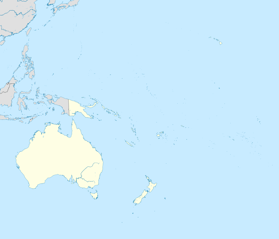
English: Location map of Oceania.
|
| Date | |
| Source | Own work |
| Author | Uwe Dedering |
| SVG development | This W3C-invalid
locator map was created with
Inkscape. |
Licensing
- You are free:
- to share – to copy, distribute and transmit the work
- to remix – to adapt the work
- Under the following conditions:
- attribution – You must give appropriate credit, provide a link to the license, and indicate if changes were made. You may do so in any reasonable manner, but not in any way that suggests the licensor endorses you or your use.
- share alike – If you remix, transform, or build upon the material, you must distribute your contributions under the same or compatible license as the original.
|
|
Permission is granted to copy, distribute and/or modify this document under the terms of the GNU Free Documentation License, Version 1.2 or any later version published by the Free Software Foundation; with no Invariant Sections, no Front-Cover Texts, and no Back-Cover Texts. A copy of the license is included in the section entitled GNU Free Documentation License. |
File history
Click on a date/time to view the file as it appeared at that time.
| Date/Time | Thumbnail | Dimensions | User | Comment | |
|---|---|---|---|---|---|
| current | 22:22, 31 March 2011 |
| 1,181 × 1,013 (1.55 MB) | Magog the Ogre | crop data outside of viewbox |
| 14:06, 28 November 2010 |
| 1,181 × 1,013 (2.69 MB) | Uwe Dedering | {{Information |Description={{en|1= Location map of Oceania. * Projection: Lambert azimuthal equal-area projection. * Area of interest: :* N: 35.0° N :* S: -55.0° N :* W: 110.0° E :* E: 230.0° E (This is -130° E) * Projection center: :* NS: -10.0° N |
File usage
More than 100 pages use this file. The following list shows the first 100 pages that use this file only. A full list is available.
- 1987 Oceania Club Championship
- 1999 Oceania Club Championship
- 2001 Oceania Club Championship
- 2004 Summer Olympics torch relay
- 2005 Oceania Club Championship
- Abaiang
- Abemama
- Adelaide Airport
- Aranuka
- Arorae
- Atafu
- Auckland Airport
- Auckland Island
- Austral Islands
- Baker Island
- Banaba
- Bauerfield International Airport
- Beru (atoll)
- Bikini Atoll
- Birnie Island
- Bishop and Clerk Islets
- Bonriki International Airport
- Brisbane Airport
- Butaritari
- Cairns Airport
- Canberra Airport
- Canton Island
- Cassidy International Airport
- Christchurch Airport
- Cicia
- Commonwealth Games
- Darwin International Airport
- Enderbury Island
- Erromango
- Faa'a International Airport
- Fakaofo
- Faleolo International Airport
- Geography of Nauru
- Gold Coast Airport
- Hobart Airport
- Honiara International Airport
- Howland Island
- Jacquemart Island
- Jarvis Island
- Judge and Clerk Islets
- Kingman Reef
- Kuria (atoll)
- La Tontouta International Airport
- Line Islands
- Maiana
- Makatea
- Makin (atoll)
- Malden Island
- Manra
- Marakei
- Marotiri
- Marshall Islands International Airport
- McKean Island
- Melbourne Airport
- Mount Hagen Airport
- Nadi International Airport
- Nauru International Airport
- Nausori International Airport
- Newcastle Airport (New South Wales)
- Nihonjin gakkō
- Nikumaroro
- Nikunau
- Nonouti
- Norfolk Island Airport
- North Island
- Nukunonu
- Nuribenua
- Ogasawara National Park
- Onotoa
- Orona
- Penrhyn atoll
- Perth Airport
- Phoenix Islands
- Port Moresby International Airport
- Rarotonga
- Rarotonga International Airport
- Rawaki
- Rose Atoll
- South Island
- South Tarawa
- Sunshine Coast Airport
- Super Rugby
- Swains Island
- Sydney Airport
- Tabiteuea
- Tabuaeran
- Tamana, Kiribati
- Tarawa
- Teraina
- The Mole (Australian TV series)
- Tofia
- Vanimo Airport
- Vostok Island
- Waitangi, Chatham Islands
- Wellington Airport
View more links to this file.
Global file usage
The following other wikis use this file:
- Usage on af.wikipedia.org
- Usage on an.wikipedia.org
- Usage on ar.wikipedia.org
- Usage on ast.wikipedia.org
- Usage on azb.wikipedia.org
- Usage on az.wikipedia.org
- Usage on ban.wikipedia.org
- Usage on ba.wikipedia.org
- Usage on be-tarask.wikipedia.org
- Usage on be.wikipedia.org
- Usage on bg.wikipedia.org
- Usage on bh.wikipedia.org
- Usage on bn.wikipedia.org
- Usage on br.wikipedia.org
- Usage on ca.wikipedia.org
- Usage on ceb.wikipedia.org
- Usage on cs.wikipedia.org
- Usage on da.wikipedia.org
- Usage on de.wikipedia.org
- Kaloko-Dammbruch
- Kwajalein Missile Range
- Lapita
- Wikipedia:Kartenwerkstatt/Positionskarten/Andere
- Optus
- Benutzer:Uwe Dedering
- Mahina (Französisch-Polynesien)
- Pirae
- Vorlage:Positionskarte Ozeanien
- Wikipedia:Kartenwerkstatt/Archiv/2010-11
- Benutzer:Herzi Pinki/Vorlage:PositionskarteX ISO/Test
- Benutzer Diskussion:SteveK/Archiv2012
View more global usage of this file.