
Size of this PNG preview of this SVG file:
453 × 599 pixels. Other resolutions:
181 × 240 pixels |
363 × 480 pixels |
581 × 768 pixels |
774 × 1,024 pixels |
1,549 × 2,048 pixels |
506 × 669 pixels.
Original file (SVG file, nominally 506 × 669 pixels, file size: 960 KB)
| This is a file from the
Wikimedia Commons. Information from its
description page there is shown below. Commons is a freely licensed media file repository. You can help. |
Summary
| Description |
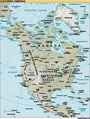
English: North America |
| Source | CIA World Factbook |
| Author | |
| Other versions |
|
| SVG development |


Licensing
This image is in the
public domain because it contains materials that originally came from the United States
Central Intelligence Agency's
World Factbook.
|
 |
File history
Click on a date/time to view the file as it appeared at that time.
| Date/Time | Thumbnail | Dimensions | User | Comment | |
|---|---|---|---|---|---|
| current | 17:53, 17 May 2018 |
| 506 × 669 (960 KB) | Glrx | version="1.1"; delete i:knockout="off" |
| 17:46, 17 May 2018 |
 | 506 × 669 (962 KB) | Glrx | try image/jpeg | |
| 17:52, 24 January 2006 |
 | 506 × 669 (962 KB) | Moyogo | stripping useless stuff | |
| 20:34, 23 January 2006 |
 | 506 × 669 (1.37 MB) | Sanao | North America<br /> Origin : CIA World Factbook Category:SVG maps Category:North America |
File usage
The following pages on the English Wikipedia use this file (pages on other projects are not listed):
Global file usage
The following other wikis use this file:
- Usage on ca.wikipedia.org
- Usage on da.wikipedia.org
- Usage on el.wikipedia.org
- Usage on es.wikibooks.org
- Usage on fr.wikipedia.org
- Usage on gl.wikipedia.org
- Usage on gv.wikipedia.org
- Usage on ja.wikipedia.org
- Usage on mg.wikipedia.org
- Usage on ml.wikipedia.org
- Usage on pl.wiktionary.org
- Indeks:Niemiecki - Kraje Ameryki
- Indeks:Francuski - Kraje Ameryki
- Indeks:Hiszpański - Kraje Ameryki
- Indeks:Serbski - Kraje Ameryki
- Indeks:Chorwacki - Kraje Ameryki
- Indeks:Portugalski - Kraje Ameryki
- Indeks:Niderlandzki - Kraje Ameryki
- Indeks:Nowogrecki - Kraje Ameryki
- Indeks:Bułgarski - Kraje Ameryki
- Северна Америка
- Indeks:Włoski - Kraje Ameryki
- Indeks:Arabski - Kraje Ameryki
- Indeks:Baskijski - Kraje Ameryki
- Usage on ro.wikipedia.org
- Usage on sk.wikipedia.org
- Usage on sv.wikipedia.org
Metadata
Size of this PNG preview of this SVG file:
453 × 599 pixels. Other resolutions:
181 × 240 pixels |
363 × 480 pixels |
581 × 768 pixels |
774 × 1,024 pixels |
1,549 × 2,048 pixels |
506 × 669 pixels.
Original file (SVG file, nominally 506 × 669 pixels, file size: 960 KB)
| This is a file from the
Wikimedia Commons. Information from its
description page there is shown below. Commons is a freely licensed media file repository. You can help. |
Summary
| Description |
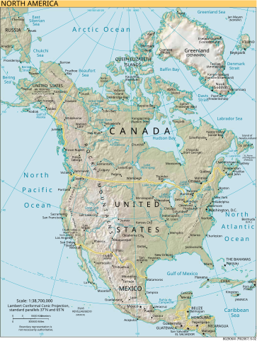
English: North America |
| Source | CIA World Factbook |
| Author | |
| Other versions |
|
| SVG development |
Licensing
This image is in the
public domain because it contains materials that originally came from the United States
Central Intelligence Agency's
World Factbook.
|
|
File history
Click on a date/time to view the file as it appeared at that time.
| Date/Time | Thumbnail | Dimensions | User | Comment | |
|---|---|---|---|---|---|
| current | 17:53, 17 May 2018 |
| 506 × 669 (960 KB) | Glrx | version="1.1"; delete i:knockout="off" |
| 17:46, 17 May 2018 |
| 506 × 669 (962 KB) | Glrx | try image/jpeg | |
| 17:52, 24 January 2006 |
| 506 × 669 (962 KB) | Moyogo | stripping useless stuff | |
| 20:34, 23 January 2006 |
| 506 × 669 (1.37 MB) | Sanao | North America<br /> Origin : CIA World Factbook Category:SVG maps Category:North America |
File usage
The following pages on the English Wikipedia use this file (pages on other projects are not listed):
Global file usage
The following other wikis use this file:
- Usage on ca.wikipedia.org
- Usage on da.wikipedia.org
- Usage on el.wikipedia.org
- Usage on es.wikibooks.org
- Usage on fr.wikipedia.org
- Usage on gl.wikipedia.org
- Usage on gv.wikipedia.org
- Usage on ja.wikipedia.org
- Usage on mg.wikipedia.org
- Usage on ml.wikipedia.org
- Usage on pl.wiktionary.org
- Indeks:Niemiecki - Kraje Ameryki
- Indeks:Francuski - Kraje Ameryki
- Indeks:Hiszpański - Kraje Ameryki
- Indeks:Serbski - Kraje Ameryki
- Indeks:Chorwacki - Kraje Ameryki
- Indeks:Portugalski - Kraje Ameryki
- Indeks:Niderlandzki - Kraje Ameryki
- Indeks:Nowogrecki - Kraje Ameryki
- Indeks:Bułgarski - Kraje Ameryki
- Северна Америка
- Indeks:Włoski - Kraje Ameryki
- Indeks:Arabski - Kraje Ameryki
- Indeks:Baskijski - Kraje Ameryki
- Usage on ro.wikipedia.org
- Usage on sk.wikipedia.org
- Usage on sv.wikipedia.org