
Original file (1,181 × 958 pixels, file size: 1.13 MB, MIME type: image/jpeg)
| This is a file from the
Wikimedia Commons. Information from its
description page there is shown below. Commons is a freely licensed media file repository. You can help. |
Summary
| Description |
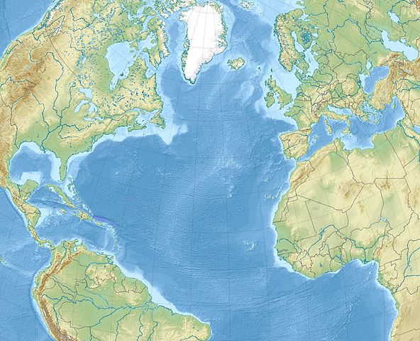
English: Relief location map of North_Atlantic_Ocean.
|
| Date | |
| Source | Own work |
| Author | Uwe Dedering |
Licensing
- You are free:
- to share – to copy, distribute and transmit the work
- to remix – to adapt the work
- Under the following conditions:
- attribution – You must give appropriate credit, provide a link to the license, and indicate if changes were made. You may do so in any reasonable manner, but not in any way that suggests the licensor endorses you or your use.
- share alike – If you remix, transform, or build upon the material, you must distribute your contributions under the same or compatible license as the original.

|
Permission is granted to copy, distribute and/or modify this document under the terms of the GNU Free Documentation License, Version 1.2 or any later version published by the Free Software Foundation; with no Invariant Sections, no Front-Cover Texts, and no Back-Cover Texts. A copy of the license is included in the section entitled GNU Free Documentation License. |
File history
Click on a date/time to view the file as it appeared at that time.
| Date/Time | Thumbnail | Dimensions | User | Comment | |
|---|---|---|---|---|---|
| current | 11:20, 4 December 2010 |
| 1,181 × 958 (1.13 MB) | Uwe Dedering | {{Information |Description={{en|1= Relief location map of North_Atlantic_Ocean. * Projection: Lambert azimuthal equal-area projection. * Area of interest: :* N: 80.0° N :* S: -10.0° N :* W: -90.0° E :* E: 20.0° E * Projection center: :* NS: 35.0° N : |
File usage
More than 100 pages use this file. The following list shows the first 100 pages that use this file only. A full list is available.
- 1941 Gloria Fault earthquake
- 1975 North Atlantic earthquake
- Abaco Islands
- Adams Key
- Air Transat Flight 236
- Amelia Island
- Anastasia Island
- Azores–Gibraltar Transform Fault
- Beerenberg
- Black Hammock Island
- Blount Island
- Boca Chita Key
- Bogotá
- Caesar's Rock
- Cockspur Island
- Convoy HX 231
- Eglin Air Force Base
- Elliott Key
- Francis S. Gabreski Air National Guard Base
- Glorious First of June
- Gulf of Maine
- HX convoys
- Historic Town of St George and Related Fortifications, Bermuda
- Homestead Air Reserve Base
- Hurlburt Field
- Hutchinson Island (Florida)
- Ilulissat
- Isola di Lolando
- Jupiter Island
- Landscape of the Pico Island Vineyard Culture
- Little Tybee Island
- MV Abosso
- MV Empire Star (1935)
- MV Melbourne Star (1936)
- Man-O-War Cay
- McGuire Air Force Base
- Meig's Key
- Naval Air Station Joint Reserve Base Willow Grove
- North Hutchinson Island
- Northern Patrol
- Old Rhodes Key
- PGA Grand Slam of Golf
- Panama City
- Paradise Island
- Patrick Space Force Base
- Ponce de León Island
- Pope Field
- Porgy Key
- Port Royal Island
- RAF Mildenhall
- Ragged Keys
- Reid Key
- Rubicon Keys
- SS Aguila (1916)
- SS Anselm (1935)
- SS Avoceta
- SS Burgondier
- SS Calabria (1922)
- SS Ceramic
- SS Clan Chisholm (1937)
- SS Empire Tower
- SS Michael E
- SS Peveril (1884)
- SS Primrose Hill
- SS Wahehe (1922)
- Sabrina Island (Azores)
- Saint Helena Island (South Carolina)
- Sands Key
- Seymour Johnson Air Force Base
- Shaw Air Force Base
- Singer Island
- Soldier Key
- Strait of Gibraltar
- Thousand Islands (Cocoa Beach)
- Totten Key
- Treasure Cay
- Tyndall Air Force Base
- Westover Air Reserve Base
- Wreck of the Titanic
- User:Ty654/List of earthquakes exceeding magnitude 8+
- User:Ty654/List of earthquakes from 1900-1949 exceeding magnitude 7+
- User:Ty654/List of earthquakes from 1910-1919 exceeding magnitude 6+
- User:Ty654/List of earthquakes from 1920-1929 exceeding magnitude 6+
- User:Ty654/List of earthquakes from 1930-1939 exceeding magnitude 6+
- User:Ty654/List of earthquakes from 1940-1949 exceeding magnitude 6+
- User:Ty654/List of earthquakes from 1950-1954 exceeding magnitude 6+
- User:Ty654/List of earthquakes from 1950-1999 exceeding magnitude 7+
- User:Ty654/List of earthquakes from 1955-1959 exceeding magnitude 6+
- User:Ty654/List of earthquakes from 1960-1964 exceeding magnitude 6+
- User:Ty654/List of earthquakes from 1965-1969 exceeding magnitude 6+
- User:Ty654/List of earthquakes from 1970-1974 exceeding magnitude 6+
- User:Ty654/List of earthquakes from 1975-1979 exceeding magnitude 6+
- User:Ty654/List of earthquakes from 1980-1984 exceeding magnitude 6+
- User:Ty654/List of earthquakes from 1985-1989 exceeding magnitude 6+
- User:Ty654/List of earthquakes from 1990-1994 exceeding magnitude 6+
- User:Ty654/List of earthquakes from 1995-1999 exceeding magnitude 6+
- User:Ty654/List of earthquakes from 2000-2004 exceeding magnitude 6+
- User:Ty654/List of earthquakes from 2000-present exceeding magnitude 7+
- User:Ty654/List of earthquakes from 2005-2009 exceeding magnitude 6+
- User talk:Keith-264/sandbox
View more links to this file.
Global file usage
The following other wikis use this file:
- Usage on ar.wikipedia.org
- Usage on ast.wikipedia.org
- Usage on az.wikipedia.org
- Usage on be-tarask.wikipedia.org
- Usage on be.wikipedia.org
- Usage on ceb.wikipedia.org
- Usage on ce.wikipedia.org
- Usage on ckb.wikipedia.org
- Usage on de.wikipedia.org
- Usage on el.wikipedia.org
- Usage on eo.wikipedia.org
- Usage on es.wikipedia.org
- Usage on et.wikipedia.org
- Usage on fa.wikipedia.org
View more global usage of this file.
Original file (1,181 × 958 pixels, file size: 1.13 MB, MIME type: image/jpeg)
| This is a file from the
Wikimedia Commons. Information from its
description page there is shown below. Commons is a freely licensed media file repository. You can help. |
Summary
| Description |
English: Relief location map of North_Atlantic_Ocean.
|
| Date | |
| Source | Own work |
| Author | Uwe Dedering |
Licensing
- You are free:
- to share – to copy, distribute and transmit the work
- to remix – to adapt the work
- Under the following conditions:
- attribution – You must give appropriate credit, provide a link to the license, and indicate if changes were made. You may do so in any reasonable manner, but not in any way that suggests the licensor endorses you or your use.
- share alike – If you remix, transform, or build upon the material, you must distribute your contributions under the same or compatible license as the original.
|
|
Permission is granted to copy, distribute and/or modify this document under the terms of the GNU Free Documentation License, Version 1.2 or any later version published by the Free Software Foundation; with no Invariant Sections, no Front-Cover Texts, and no Back-Cover Texts. A copy of the license is included in the section entitled GNU Free Documentation License. |
File history
Click on a date/time to view the file as it appeared at that time.
| Date/Time | Thumbnail | Dimensions | User | Comment | |
|---|---|---|---|---|---|
| current | 11:20, 4 December 2010 |
| 1,181 × 958 (1.13 MB) | Uwe Dedering | {{Information |Description={{en|1= Relief location map of North_Atlantic_Ocean. * Projection: Lambert azimuthal equal-area projection. * Area of interest: :* N: 80.0° N :* S: -10.0° N :* W: -90.0° E :* E: 20.0° E * Projection center: :* NS: 35.0° N : |
File usage
More than 100 pages use this file. The following list shows the first 100 pages that use this file only. A full list is available.
- 1941 Gloria Fault earthquake
- 1975 North Atlantic earthquake
- Abaco Islands
- Adams Key
- Air Transat Flight 236
- Amelia Island
- Anastasia Island
- Azores–Gibraltar Transform Fault
- Beerenberg
- Black Hammock Island
- Blount Island
- Boca Chita Key
- Bogotá
- Caesar's Rock
- Cockspur Island
- Convoy HX 231
- Eglin Air Force Base
- Elliott Key
- Francis S. Gabreski Air National Guard Base
- Glorious First of June
- Gulf of Maine
- HX convoys
- Historic Town of St George and Related Fortifications, Bermuda
- Homestead Air Reserve Base
- Hurlburt Field
- Hutchinson Island (Florida)
- Ilulissat
- Isola di Lolando
- Jupiter Island
- Landscape of the Pico Island Vineyard Culture
- Little Tybee Island
- MV Abosso
- MV Empire Star (1935)
- MV Melbourne Star (1936)
- Man-O-War Cay
- McGuire Air Force Base
- Meig's Key
- Naval Air Station Joint Reserve Base Willow Grove
- North Hutchinson Island
- Northern Patrol
- Old Rhodes Key
- PGA Grand Slam of Golf
- Panama City
- Paradise Island
- Patrick Space Force Base
- Ponce de León Island
- Pope Field
- Porgy Key
- Port Royal Island
- RAF Mildenhall
- Ragged Keys
- Reid Key
- Rubicon Keys
- SS Aguila (1916)
- SS Anselm (1935)
- SS Avoceta
- SS Burgondier
- SS Calabria (1922)
- SS Ceramic
- SS Clan Chisholm (1937)
- SS Empire Tower
- SS Michael E
- SS Peveril (1884)
- SS Primrose Hill
- SS Wahehe (1922)
- Sabrina Island (Azores)
- Saint Helena Island (South Carolina)
- Sands Key
- Seymour Johnson Air Force Base
- Shaw Air Force Base
- Singer Island
- Soldier Key
- Strait of Gibraltar
- Thousand Islands (Cocoa Beach)
- Totten Key
- Treasure Cay
- Tyndall Air Force Base
- Westover Air Reserve Base
- Wreck of the Titanic
- User:Ty654/List of earthquakes exceeding magnitude 8+
- User:Ty654/List of earthquakes from 1900-1949 exceeding magnitude 7+
- User:Ty654/List of earthquakes from 1910-1919 exceeding magnitude 6+
- User:Ty654/List of earthquakes from 1920-1929 exceeding magnitude 6+
- User:Ty654/List of earthquakes from 1930-1939 exceeding magnitude 6+
- User:Ty654/List of earthquakes from 1940-1949 exceeding magnitude 6+
- User:Ty654/List of earthquakes from 1950-1954 exceeding magnitude 6+
- User:Ty654/List of earthquakes from 1950-1999 exceeding magnitude 7+
- User:Ty654/List of earthquakes from 1955-1959 exceeding magnitude 6+
- User:Ty654/List of earthquakes from 1960-1964 exceeding magnitude 6+
- User:Ty654/List of earthquakes from 1965-1969 exceeding magnitude 6+
- User:Ty654/List of earthquakes from 1970-1974 exceeding magnitude 6+
- User:Ty654/List of earthquakes from 1975-1979 exceeding magnitude 6+
- User:Ty654/List of earthquakes from 1980-1984 exceeding magnitude 6+
- User:Ty654/List of earthquakes from 1985-1989 exceeding magnitude 6+
- User:Ty654/List of earthquakes from 1990-1994 exceeding magnitude 6+
- User:Ty654/List of earthquakes from 1995-1999 exceeding magnitude 6+
- User:Ty654/List of earthquakes from 2000-2004 exceeding magnitude 6+
- User:Ty654/List of earthquakes from 2000-present exceeding magnitude 7+
- User:Ty654/List of earthquakes from 2005-2009 exceeding magnitude 6+
- User talk:Keith-264/sandbox
View more links to this file.
Global file usage
The following other wikis use this file:
- Usage on ar.wikipedia.org
- Usage on ast.wikipedia.org
- Usage on az.wikipedia.org
- Usage on be-tarask.wikipedia.org
- Usage on be.wikipedia.org
- Usage on ceb.wikipedia.org
- Usage on ce.wikipedia.org
- Usage on ckb.wikipedia.org
- Usage on de.wikipedia.org
- Usage on el.wikipedia.org
- Usage on eo.wikipedia.org
- Usage on es.wikipedia.org
- Usage on et.wikipedia.org
- Usage on fa.wikipedia.org
View more global usage of this file.