
Size of this preview:
800 × 598 pixels. Other resolutions:
320 × 239 pixels |
640 × 478 pixels |
1,024 × 765 pixels |
1,280 × 957 pixels |
1,901 × 1,421 pixels.
Original file (1,901 × 1,421 pixels, file size: 3 MB, MIME type: image/png)
| This is a file from the
Wikimedia Commons. Information from its
description page there is shown below. Commons is a freely licensed media file repository. You can help. |
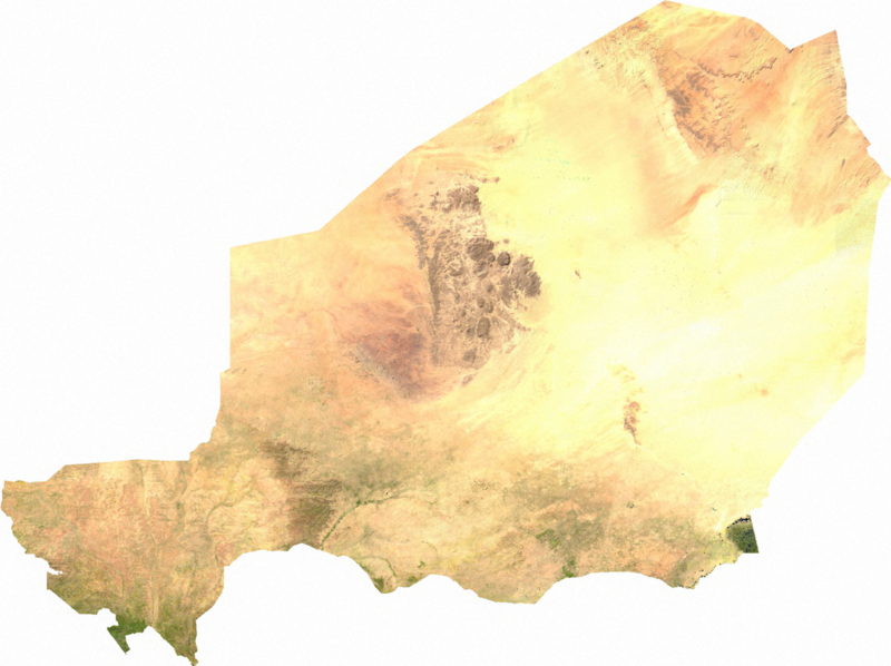
ECW to TIFF to PNG (compression level 9).
| This file is in the
public domain, because it was generated by a user, using free sources available at
The Map Library.
Note that this does not include the maps in the Global Administrative Areas section of the homepage. |
File history
Click on a date/time to view the file as it appeared at that time.
| Date/Time | Thumbnail | Dimensions | User | Comment | |
|---|---|---|---|---|---|
| current | 02:44, 14 July 2006 |
| 1,901 × 1,421 (3 MB) | Unquietwiki | ECW to TIFF to PNG (compression level 9). {{PD-MapLibrary}} |
File usage
The following pages on the English Wikipedia use this file (pages on other projects are not listed):
- 2010 Sahel famine
- Geography of Niger
- Niger
- User:MrWooHoo/Archive 4
- User talk:-revi/2015-04
- User talk:A.Minkowiski
- User talk:A Dutch Panda
- User talk:AmaryllisGardener/Archive 5
- User talk:Another Believer/Archive 12
- User talk:Bananasoldier/Archive 2
- User talk:Becky Sayles/Archive 11
- User talk:CFCF/Archive 5
- User talk:CSJJ104/Archive 1
- User talk:CanadianDude1/Archives/ 2015/April
- User talk:Captain Assassin!/Archive 18
- User talk:Casliber/Archive 48
- User talk:ChamithN/Archive 18
- User talk:Chess/Archive 8
- User talk:ChrisGualtieri/Archive 21
- User talk:Coin945/Archive 5
- User talk:CopyEdit Bliss
- User talk:CyberXRef/Archive 3
- User talk:Davey2010/Archive 2015 1
- User talk:Dfrr
- User talk:EMachine03/Archive
- User talk:Epicgenius/Archive/2015/Apr
- User talk:Esoxid
- User talk:EuroCarGT/Archives/2015/April
- User talk:Evad37/Archive 4
- User talk:GDibyendu/archive6
- User talk:Geirfuglasker
- User talk:GiantSnowman/2015
- User talk:Gongshow/Archive 11
- User talk:HectorAE/Archive 2
- User talk:Horai 551
- User talk:ITTechWriterA
- User talk:Jesus Presley/Archive
- User talk:Jethro B
- User talk:Jim Carter/Archive 7
- User talk:JohnChrysostom/ArXiV10
- User talk:John Carter/Archive 2
- User talk:K6ka/Archive 10
- User talk:K6ka/Archives/2015/April
- User talk:Kenanwang
- User talk:Khamar/Archive 4
- User talk:MPinchuk (WMF) (usurped)
- User talk:Marek69/Archive 23
- User talk:Millelacs/Archive 9
- User talk:Miszatomic/Archive 4
- User talk:NickPenguin/Archive 5
- User talk:Northamerica1000/Archive 30
- User talk:PhnomPencil/Archive2
- User talk:PointsofNoReturn/Archive 1
- User talk:Pratyya Ghosh/Archives/32 (2015-04)
- User talk:Presidentman/Archives/ 18
- User talk:Quenhitran/Archive 9
- User talk:Qwertyxp2000/Archives/2015/April
- User talk:Rcsprinter123/Archives/44
- User talk:Revolution1221
- User talk:RexRowan/Archive 8
- User talk:Rsrikanth05/Archive April 2015
- User talk:Ryan Vesey/Archive 32
- User talk:SL93/Archive 7
- User talk:Sahara4u/Archive 3
- User talk:Sanskari/Archive 19
- User talk:Scalhotrod/Archive 34
- User talk:Simplysavvy
- User talk:Smileguy91/Archive 5
- User talk:SpeedReader/Archive 7
- User talk:Stuartyeates/Archive 18
- User talk:Technical 13/2015/2
- User talk:Theopolisme/Archive 21
- User talk:Tolly4bolly/Archive 12
- User talk:Tom Morris/Archive 55
- User talk:Vacation9/Archives/2015/April
- User talk:WaitingForConnection
- User talk:Wakanebe Wizard
- User talk:Wer900/Archive1
- User talk:Wikiuser13/Archive 21
- User talk:WordSeventeen/Archive 3
- User talk:Xyphoid
- User talk:Ypnypn/Archive 8
- Wikipedia talk:Articles for improvement/Archive 15
Global file usage
The following other wikis use this file:
- Usage on ar.wikipedia.org
- Usage on bg.wikipedia.org
- Usage on bn.wikipedia.org
- Usage on ca.wikipedia.org
- Usage on da.wikipedia.org
- Usage on de.wikipedia.org
- Usage on es.wikipedia.org
- Usage on fr.wikipedia.org
- Usage on gl.wikipedia.org
- Usage on ha.wikipedia.org
- Usage on hr.wikipedia.org
- Usage on hu.wikipedia.org
- Usage on hy.wikipedia.org
- Usage on ig.wikipedia.org
- Usage on ka.wikipedia.org
- Usage on kk.wikipedia.org
- Usage on lt.wikipedia.org
- Usage on mdf.wikipedia.org
- Usage on mt.wikipedia.org
- Usage on pl.wikipedia.org
- Usage on pt.wikipedia.org
- Usage on ru.wikipedia.org
- Usage on tl.wikipedia.org
- Usage on tr.wikipedia.org
- Usage on tum.wikipedia.org
- Usage on uk.wikipedia.org
- Usage on vi.wikipedia.org
Size of this preview:
800 × 598 pixels. Other resolutions:
320 × 239 pixels |
640 × 478 pixels |
1,024 × 765 pixels |
1,280 × 957 pixels |
1,901 × 1,421 pixels.
Original file (1,901 × 1,421 pixels, file size: 3 MB, MIME type: image/png)
| This is a file from the
Wikimedia Commons. Information from its
description page there is shown below. Commons is a freely licensed media file repository. You can help. |
ECW to TIFF to PNG (compression level 9).
| This file is in the
public domain, because it was generated by a user, using free sources available at
The Map Library.
Note that this does not include the maps in the Global Administrative Areas section of the homepage. |
File history
Click on a date/time to view the file as it appeared at that time.
| Date/Time | Thumbnail | Dimensions | User | Comment | |
|---|---|---|---|---|---|
| current | 02:44, 14 July 2006 |
| 1,901 × 1,421 (3 MB) | Unquietwiki | ECW to TIFF to PNG (compression level 9). {{PD-MapLibrary}} |
File usage
The following pages on the English Wikipedia use this file (pages on other projects are not listed):
- 2010 Sahel famine
- Geography of Niger
- Niger
- User:MrWooHoo/Archive 4
- User talk:-revi/2015-04
- User talk:A.Minkowiski
- User talk:A Dutch Panda
- User talk:AmaryllisGardener/Archive 5
- User talk:Another Believer/Archive 12
- User talk:Bananasoldier/Archive 2
- User talk:Becky Sayles/Archive 11
- User talk:CFCF/Archive 5
- User talk:CSJJ104/Archive 1
- User talk:CanadianDude1/Archives/ 2015/April
- User talk:Captain Assassin!/Archive 18
- User talk:Casliber/Archive 48
- User talk:ChamithN/Archive 18
- User talk:Chess/Archive 8
- User talk:ChrisGualtieri/Archive 21
- User talk:Coin945/Archive 5
- User talk:CopyEdit Bliss
- User talk:CyberXRef/Archive 3
- User talk:Davey2010/Archive 2015 1
- User talk:Dfrr
- User talk:EMachine03/Archive
- User talk:Epicgenius/Archive/2015/Apr
- User talk:Esoxid
- User talk:EuroCarGT/Archives/2015/April
- User talk:Evad37/Archive 4
- User talk:GDibyendu/archive6
- User talk:Geirfuglasker
- User talk:GiantSnowman/2015
- User talk:Gongshow/Archive 11
- User talk:HectorAE/Archive 2
- User talk:Horai 551
- User talk:ITTechWriterA
- User talk:Jesus Presley/Archive
- User talk:Jethro B
- User talk:Jim Carter/Archive 7
- User talk:JohnChrysostom/ArXiV10
- User talk:John Carter/Archive 2
- User talk:K6ka/Archive 10
- User talk:K6ka/Archives/2015/April
- User talk:Kenanwang
- User talk:Khamar/Archive 4
- User talk:MPinchuk (WMF) (usurped)
- User talk:Marek69/Archive 23
- User talk:Millelacs/Archive 9
- User talk:Miszatomic/Archive 4
- User talk:NickPenguin/Archive 5
- User talk:Northamerica1000/Archive 30
- User talk:PhnomPencil/Archive2
- User talk:PointsofNoReturn/Archive 1
- User talk:Pratyya Ghosh/Archives/32 (2015-04)
- User talk:Presidentman/Archives/ 18
- User talk:Quenhitran/Archive 9
- User talk:Qwertyxp2000/Archives/2015/April
- User talk:Rcsprinter123/Archives/44
- User talk:Revolution1221
- User talk:RexRowan/Archive 8
- User talk:Rsrikanth05/Archive April 2015
- User talk:Ryan Vesey/Archive 32
- User talk:SL93/Archive 7
- User talk:Sahara4u/Archive 3
- User talk:Sanskari/Archive 19
- User talk:Scalhotrod/Archive 34
- User talk:Simplysavvy
- User talk:Smileguy91/Archive 5
- User talk:SpeedReader/Archive 7
- User talk:Stuartyeates/Archive 18
- User talk:Technical 13/2015/2
- User talk:Theopolisme/Archive 21
- User talk:Tolly4bolly/Archive 12
- User talk:Tom Morris/Archive 55
- User talk:Vacation9/Archives/2015/April
- User talk:WaitingForConnection
- User talk:Wakanebe Wizard
- User talk:Wer900/Archive1
- User talk:Wikiuser13/Archive 21
- User talk:WordSeventeen/Archive 3
- User talk:Xyphoid
- User talk:Ypnypn/Archive 8
- Wikipedia talk:Articles for improvement/Archive 15
Global file usage
The following other wikis use this file:
- Usage on ar.wikipedia.org
- Usage on bg.wikipedia.org
- Usage on bn.wikipedia.org
- Usage on ca.wikipedia.org
- Usage on da.wikipedia.org
- Usage on de.wikipedia.org
- Usage on es.wikipedia.org
- Usage on fr.wikipedia.org
- Usage on gl.wikipedia.org
- Usage on ha.wikipedia.org
- Usage on hr.wikipedia.org
- Usage on hu.wikipedia.org
- Usage on hy.wikipedia.org
- Usage on ig.wikipedia.org
- Usage on ka.wikipedia.org
- Usage on kk.wikipedia.org
- Usage on lt.wikipedia.org
- Usage on mdf.wikipedia.org
- Usage on mt.wikipedia.org
- Usage on pl.wikipedia.org
- Usage on pt.wikipedia.org
- Usage on ru.wikipedia.org
- Usage on tl.wikipedia.org
- Usage on tr.wikipedia.org
- Usage on tum.wikipedia.org
- Usage on uk.wikipedia.org
- Usage on vi.wikipedia.org