Photos • Location


Size of this preview:
800 × 600 pixels. Other resolutions:
320 × 240 pixels |
640 × 480 pixels |
1,024 × 768 pixels |
1,280 × 960 pixels |
2,048 × 1,536 pixels.
Original file (2,048 × 1,536 pixels, file size: 967 KB, MIME type: image/jpeg)
| This is a file from the
Wikimedia Commons. Information from its
description page there is shown below. Commons is a freely licensed media file repository. You can help. |
Summary
| Description |
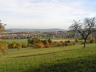
Deutsch: Die Gemeinde
Neu-Anspach im
Taunus. Fotografiert vom westlichen Rand, südlich des Ortsteils Rod am Berg. Im Hintergrund links der
Steinkopf, rechts das Köpperner Tal.
|
| Date | Taken on 27 October 2005 |
| Source | own photo |
| Author |
MdE
|
| Camera location |
| View this and other nearby images on: OpenStreetMap |
|
|---|
Licensing
This file is licensed under the
Creative Commons
Attribution-Share Alike 3.0 Unported license.
|

File history
Click on a date/time to view the file as it appeared at that time.
| Date/Time | Thumbnail | Dimensions | User | Comment | |
|---|---|---|---|---|---|
| current | 11:08, 1 August 2006 |
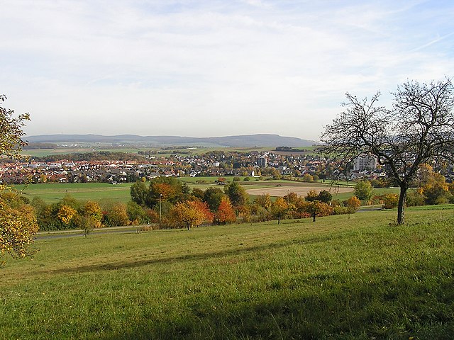
| 2,048 × 1,536 (967 KB) | MdE | {{Information |Description=de: Die Stadt Neu-Anspach im Taunus. Fotografiert vom nördlichen Rand der Stadt. Im Hintergrund links der Steinkopf, rechts das Köpperner Tal. en: [[:en:Neu-Anspach|Neu-Ans |
File usage
The following pages on the English Wikipedia use this file (pages on other projects are not listed):
Global file usage
The following other wikis use this file:
- Usage on azb.wikipedia.org
- Usage on de.wikipedia.org
- Usage on eo.wikipedia.org
- Usage on kk.wikipedia.org
- Usage on no.wikipedia.org
- Usage on pms.wikipedia.org
- Usage on pt.wikipedia.org
- Usage on ru.wikipedia.org
- Usage on sl.wikipedia.org
- Usage on uk.wikipedia.org
Metadata
Size of this preview:
800 × 600 pixels. Other resolutions:
320 × 240 pixels |
640 × 480 pixels |
1,024 × 768 pixels |
1,280 × 960 pixels |
2,048 × 1,536 pixels.
Original file (2,048 × 1,536 pixels, file size: 967 KB, MIME type: image/jpeg)
| This is a file from the
Wikimedia Commons. Information from its
description page there is shown below. Commons is a freely licensed media file repository. You can help. |
Summary
| Description |
Deutsch: Die Gemeinde
Neu-Anspach im
Taunus. Fotografiert vom westlichen Rand, südlich des Ortsteils Rod am Berg. Im Hintergrund links der
Steinkopf, rechts das Köpperner Tal.
|
| Date | Taken on 27 October 2005 |
| Source | own photo |
| Author |
MdE
|
| Camera location |
| View this and other nearby images on: OpenStreetMap |
|
|---|
Licensing
This file is licensed under the
Creative Commons
Attribution-Share Alike 3.0 Unported license.
|
File history
Click on a date/time to view the file as it appeared at that time.
| Date/Time | Thumbnail | Dimensions | User | Comment | |
|---|---|---|---|---|---|
| current | 11:08, 1 August 2006 |
| 2,048 × 1,536 (967 KB) | MdE | {{Information |Description=de: Die Stadt Neu-Anspach im Taunus. Fotografiert vom nördlichen Rand der Stadt. Im Hintergrund links der Steinkopf, rechts das Köpperner Tal. en: [[:en:Neu-Anspach|Neu-Ans |
File usage
The following pages on the English Wikipedia use this file (pages on other projects are not listed):
Global file usage
The following other wikis use this file:
- Usage on azb.wikipedia.org
- Usage on de.wikipedia.org
- Usage on eo.wikipedia.org
- Usage on kk.wikipedia.org
- Usage on no.wikipedia.org
- Usage on pms.wikipedia.org
- Usage on pt.wikipedia.org
- Usage on ru.wikipedia.org
- Usage on sl.wikipedia.org
- Usage on uk.wikipedia.org