
Size of this PNG preview of this SVG file:
459 × 599 pixels. Other resolutions:
184 × 240 pixels |
368 × 480 pixels |
589 × 768 pixels |
785 × 1,024 pixels |
1,570 × 2,048 pixels |
1,264 × 1,649 pixels.
Original file (SVG file, nominally 1,264 × 1,649 pixels, file size: 592 KB)
| This is a file from the
Wikimedia Commons. Information from its
description page there is shown below. Commons is a freely licensed media file repository. You can help. |
Summary
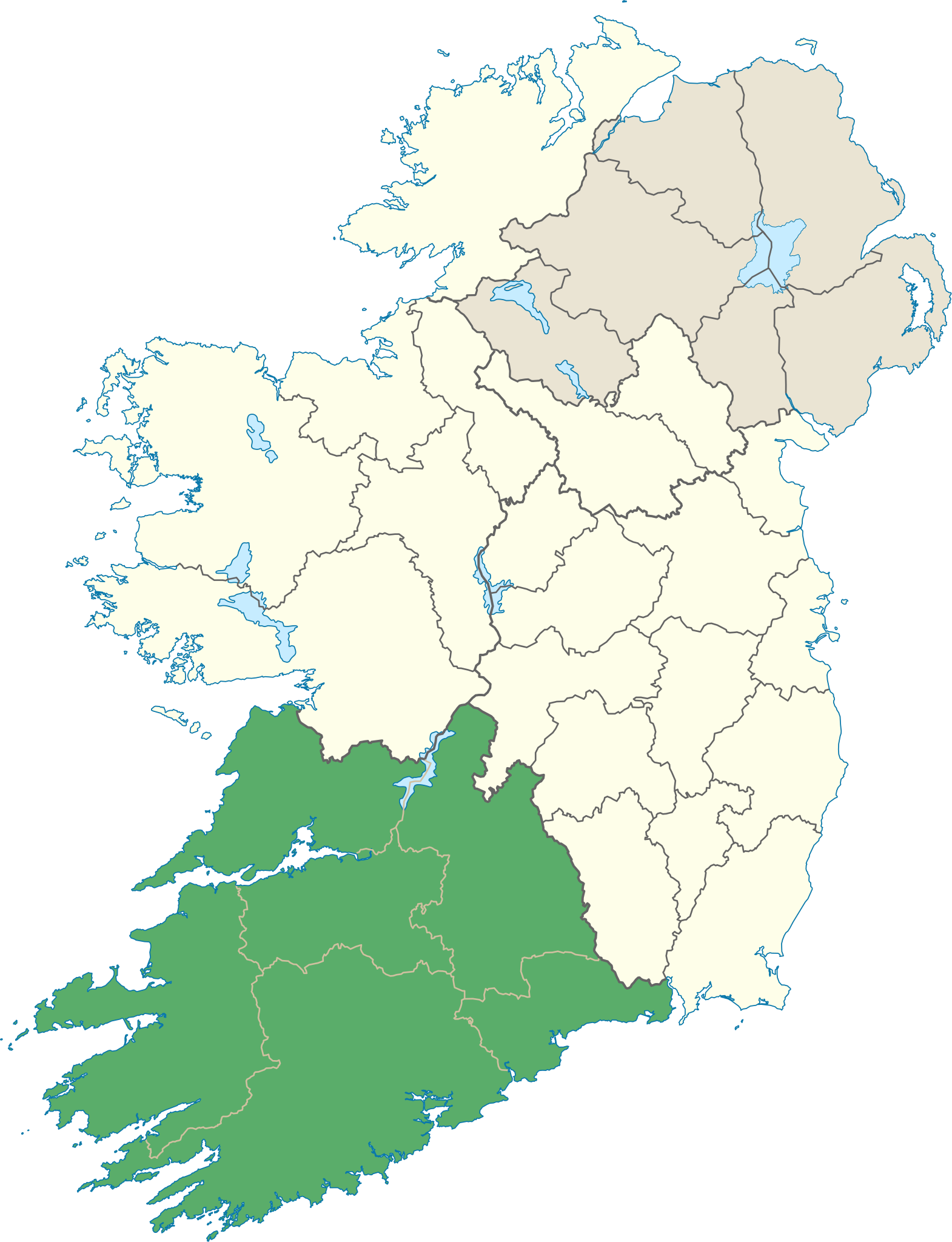
| Description | Locator map of Munster. |
| Date | (UTC) |
| Source | |
| Author |
|
Licensing
I, the copyright holder of this work, hereby publish it under the following license:
This file is licensed under the
Creative Commons
Attribution-Share Alike 3.0 Unported license.
- You are free:
- to share – to copy, distribute and transmit the work
- to remix – to adapt the work
- Under the following conditions:
- attribution – You must give appropriate credit, provide a link to the license, and indicate if changes were made. You may do so in any reasonable manner, but not in any way that suggests the licensor endorses you or your use.
- share alike – If you remix, transform, or build upon the material, you must distribute your contributions under the same or compatible license as the original.
File history
Click on a date/time to view the file as it appeared at that time.
| Date/Time | Thumbnail | Dimensions | User | Comment | |
|---|---|---|---|---|---|
| current | 14:25, 8 June 2013 |
| 1,264 × 1,649 (592 KB) | Setanta Saki | correcting aran islands not part of munster |
| 19:47, 7 January 2012 |
 | 1,450 × 1,807 (687 KB) | NikNaks | Removing modern boundaries | |
| 18:16, 7 January 2012 |
 | 1,450 × 1,807 (707 KB) | NikNaks | Updating to new map | |
| 17:53, 7 January 2012 |
 | 400 × 500 (281 KB) | NikNaks93 | == {{int:filedesc}} == {{Information |Description=Locator map of Munster. |Source=* File:Ireland_trad_counties_named.svg |Date=2012-01-07 17:50 (UTC) |Author=* File:Ireland_trad_counties_named.svg: *[[:File:Population_density_of_Ireland_map2002. |
File usage
The following pages on the English Wikipedia use this file (pages on other projects are not listed):
- 2021 Munster abuse case
- An Triúr Deirféar
- Ballyhoura Mountains
- Baurtregaum
- Beenkeragh
- Beenoskee
- Bentee
- Boggeragh Mountains
- Brassel Mountain
- Broaghnabinnia
- Caha Mountains
- Caher Mountain (Cork)
- Caher Mountain (Kerry)
- Caher West Top
- Caherconree
- Carhoo Hill
- Carrauntoohil
- Carron Mountain
- Cnoc an Chuillinn
- Cnoc na Péiste
- Cnoc na Toinne
- Comeragh Mountains
- Coomacarrea
- Croughaun Hill
- Cruach Mhór
- Derrynasaggart Mountains
- Devil's Bit
- Drung Hill
- Fauscoum
- Galtymore
- Geokaun
- Hag's Tooth, Kerry
- Hungry Hill
- Keeper Hill
- Knockanaffrin
- Knockanore Mountain
- Knockboy
- Knockmealdown
- Knockmealdown Mountains
- Knocknadobar
- Knocknafallia
- Knockoura
- List of Ireland-related topics
- List of Irish counties by highest point
- Lists of mountains in Ireland
- Lyracappul
- MacGillycuddy's Reeks
- Mangerton Mountain
- Maolán Buí
- Mount Brandon
- Mount Eagle (Ireland)
- Mount Gabriel
- Mount Hillary
- Mountains of the Central Dingle Peninsula
- Moylussa
- Mullaghanattin
- Mullaghanish
- Mullaghareirk Mountains
- Mullaghmore, County Clare
- Munster
- Musheramore
- Nowen Hill
- Paps of Anu
- Purple Mountain (Kerry)
- Seefin (Ballyhoura Mountains)
- Shehy Mountains
- Silvermine Mountains
- Slieve Aughty
- Slieve Mish Mountains
- Slieve Miskish Mountains
- Slievecallan
- Slievenamon
- South-West Irish English
- Stack's Mountains
- Stumpa Dúloigh
- Sugarloaf (County Cork)
- Sugarloaf Hill (Knockmealdowns)
- Temple Hill (Ireland)
- The Big Gun
- The Bones
- Torc Mountain
- User:Wmcnamara/Cliffs Of Dooneen
- Template:Mountains and hills of Munster
Global file usage
The following other wikis use this file:
- Usage on be.wikipedia.org
- Usage on cs.wikipedia.org
- Usage on da.wikipedia.org
- Usage on en.wiktionary.org
- Usage on es.wikipedia.org
- Usage on fa.wikipedia.org
- Usage on fr.wikipedia.org
- Usage on fr.wiktionary.org
- Usage on id.wikipedia.org
- Usage on it.wikipedia.org
- Usage on ja.wikipedia.org
- Usage on kab.wikipedia.org
- Usage on ka.wikipedia.org
- Usage on kk.wikipedia.org
- Usage on lv.wikipedia.org
- Usage on mk.wikipedia.org
- Usage on nl.wikipedia.org
- Usage on os.wikipedia.org
- Usage on ps.wikipedia.org
- Usage on ru.wikipedia.org
- Usage on sk.wikipedia.org
- Usage on sr.wikipedia.org
- Usage on tr.wikipedia.org
- Usage on uk.wikipedia.org
- Usage on ur.wikipedia.org
- Usage on vi.wikipedia.org
- Usage on zh-min-nan.wikipedia.org
- Usage on zh-yue.wikipedia.org
- Usage on zh.wikipedia.org
Metadata
Size of this PNG preview of this SVG file:
459 × 599 pixels. Other resolutions:
184 × 240 pixels |
368 × 480 pixels |
589 × 768 pixels |
785 × 1,024 pixels |
1,570 × 2,048 pixels |
1,264 × 1,649 pixels.
Original file (SVG file, nominally 1,264 × 1,649 pixels, file size: 592 KB)
| This is a file from the
Wikimedia Commons. Information from its
description page there is shown below. Commons is a freely licensed media file repository. You can help. |
Summary
| Description | Locator map of Munster. |
| Date | (UTC) |
| Source | |
| Author |
|
Licensing
I, the copyright holder of this work, hereby publish it under the following license:
This file is licensed under the
Creative Commons
Attribution-Share Alike 3.0 Unported license.
- You are free:
- to share – to copy, distribute and transmit the work
- to remix – to adapt the work
- Under the following conditions:
- attribution – You must give appropriate credit, provide a link to the license, and indicate if changes were made. You may do so in any reasonable manner, but not in any way that suggests the licensor endorses you or your use.
- share alike – If you remix, transform, or build upon the material, you must distribute your contributions under the same or compatible license as the original.
File history
Click on a date/time to view the file as it appeared at that time.
| Date/Time | Thumbnail | Dimensions | User | Comment | |
|---|---|---|---|---|---|
| current | 14:25, 8 June 2013 |
| 1,264 × 1,649 (592 KB) | Setanta Saki | correcting aran islands not part of munster |
| 19:47, 7 January 2012 |
| 1,450 × 1,807 (687 KB) | NikNaks | Removing modern boundaries | |
| 18:16, 7 January 2012 |
| 1,450 × 1,807 (707 KB) | NikNaks | Updating to new map | |
| 17:53, 7 January 2012 |
| 400 × 500 (281 KB) | NikNaks93 | == {{int:filedesc}} == {{Information |Description=Locator map of Munster. |Source=* File:Ireland_trad_counties_named.svg |Date=2012-01-07 17:50 (UTC) |Author=* File:Ireland_trad_counties_named.svg: *[[:File:Population_density_of_Ireland_map2002. |
File usage
The following pages on the English Wikipedia use this file (pages on other projects are not listed):
- 2021 Munster abuse case
- An Triúr Deirféar
- Ballyhoura Mountains
- Baurtregaum
- Beenkeragh
- Beenoskee
- Bentee
- Boggeragh Mountains
- Brassel Mountain
- Broaghnabinnia
- Caha Mountains
- Caher Mountain (Cork)
- Caher Mountain (Kerry)
- Caher West Top
- Caherconree
- Carhoo Hill
- Carrauntoohil
- Carron Mountain
- Cnoc an Chuillinn
- Cnoc na Péiste
- Cnoc na Toinne
- Comeragh Mountains
- Coomacarrea
- Croughaun Hill
- Cruach Mhór
- Derrynasaggart Mountains
- Devil's Bit
- Drung Hill
- Fauscoum
- Galtymore
- Geokaun
- Hag's Tooth, Kerry
- Hungry Hill
- Keeper Hill
- Knockanaffrin
- Knockanore Mountain
- Knockboy
- Knockmealdown
- Knockmealdown Mountains
- Knocknadobar
- Knocknafallia
- Knockoura
- List of Ireland-related topics
- List of Irish counties by highest point
- Lists of mountains in Ireland
- Lyracappul
- MacGillycuddy's Reeks
- Mangerton Mountain
- Maolán Buí
- Mount Brandon
- Mount Eagle (Ireland)
- Mount Gabriel
- Mount Hillary
- Mountains of the Central Dingle Peninsula
- Moylussa
- Mullaghanattin
- Mullaghanish
- Mullaghareirk Mountains
- Mullaghmore, County Clare
- Munster
- Musheramore
- Nowen Hill
- Paps of Anu
- Purple Mountain (Kerry)
- Seefin (Ballyhoura Mountains)
- Shehy Mountains
- Silvermine Mountains
- Slieve Aughty
- Slieve Mish Mountains
- Slieve Miskish Mountains
- Slievecallan
- Slievenamon
- South-West Irish English
- Stack's Mountains
- Stumpa Dúloigh
- Sugarloaf (County Cork)
- Sugarloaf Hill (Knockmealdowns)
- Temple Hill (Ireland)
- The Big Gun
- The Bones
- Torc Mountain
- User:Wmcnamara/Cliffs Of Dooneen
- Template:Mountains and hills of Munster
Global file usage
The following other wikis use this file:
- Usage on be.wikipedia.org
- Usage on cs.wikipedia.org
- Usage on da.wikipedia.org
- Usage on en.wiktionary.org
- Usage on es.wikipedia.org
- Usage on fa.wikipedia.org
- Usage on fr.wikipedia.org
- Usage on fr.wiktionary.org
- Usage on id.wikipedia.org
- Usage on it.wikipedia.org
- Usage on ja.wikipedia.org
- Usage on kab.wikipedia.org
- Usage on ka.wikipedia.org
- Usage on kk.wikipedia.org
- Usage on lv.wikipedia.org
- Usage on mk.wikipedia.org
- Usage on nl.wikipedia.org
- Usage on os.wikipedia.org
- Usage on ps.wikipedia.org
- Usage on ru.wikipedia.org
- Usage on sk.wikipedia.org
- Usage on sr.wikipedia.org
- Usage on tr.wikipedia.org
- Usage on uk.wikipedia.org
- Usage on ur.wikipedia.org
- Usage on vi.wikipedia.org
- Usage on zh-min-nan.wikipedia.org
- Usage on zh-yue.wikipedia.org
- Usage on zh.wikipedia.org