Photos • Location


Size of this preview:
800 × 450 pixels. Other resolutions:
320 × 180 pixels |
640 × 360 pixels |
1,024 × 576 pixels |
1,280 × 720 pixels |
2,816 × 1,584 pixels.
Original file (2,816 × 1,584 pixels, file size: 1.02 MB, MIME type: image/jpeg)
| This is a file from the
Wikimedia Commons. Information from its
description page there is shown below. Commons is a freely licensed media file repository. You can help. |
|
This is an image of a place or building that is listed on the
National Register of Historic Places in the
United States of America. Its reference number is
72000722. |
| Camera location |
| View this and other nearby images on: OpenStreetMap |
|
|---|
| Description |
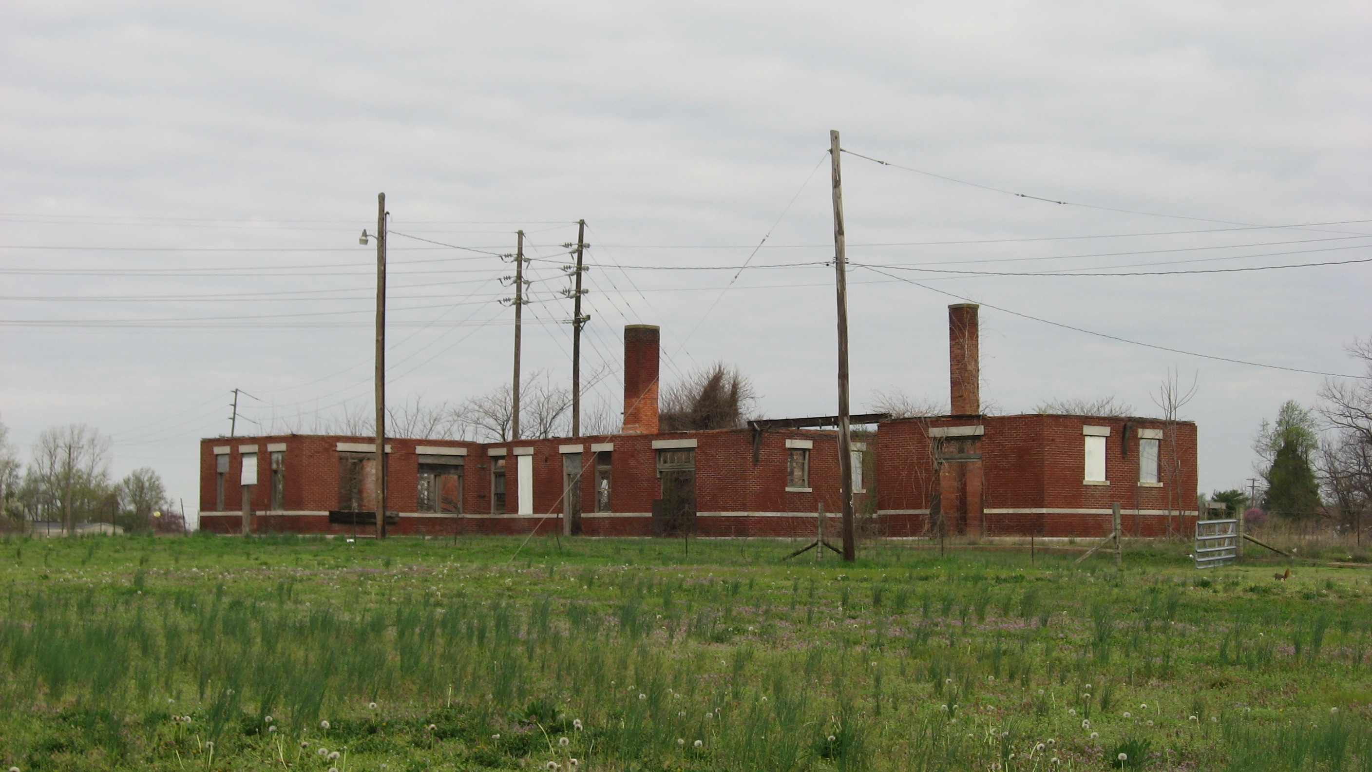
English: Ruins of the
Missouri Pacific Depot in
Charleston,
Missouri,
United States. Built in 1916, it is listed on the
National Register of Historic Places. |
||
| Date | Taken on 12 April 2013 | ||
| Source | Own work | ||
| Author | Nyttend | ||
| Permission ( Reusing this file) |
|
File history
Click on a date/time to view the file as it appeared at that time.
| Date/Time | Thumbnail | Dimensions | User | Comment | |
|---|---|---|---|---|---|
| current | 03:41, 18 April 2013 |
| 2,816 × 1,584 (1.02 MB) | Nyttend | {{NRHP|72000722}} {{Location|36|55|22|N|89|21|28|W}} {{Information |Description={{en|Ruins of the {{w|Missouri Pacific Depot (Charleston, Missouri)|Missouri Pacific Depot}} in {{w|Charleston, Missouri|Charleston}}, {{w|Missouri}}, {{w|United States}}. ... |
File usage
The following pages on the English Wikipedia use this file (pages on other projects are not listed):
Global file usage
The following other wikis use this file:
- Usage on de.wikipedia.org
- Usage on www.wikidata.org
Metadata
Size of this preview:
800 × 450 pixels. Other resolutions:
320 × 180 pixels |
640 × 360 pixels |
1,024 × 576 pixels |
1,280 × 720 pixels |
2,816 × 1,584 pixels.
Original file (2,816 × 1,584 pixels, file size: 1.02 MB, MIME type: image/jpeg)
| This is a file from the
Wikimedia Commons. Information from its
description page there is shown below. Commons is a freely licensed media file repository. You can help. |
|
This is an image of a place or building that is listed on the
National Register of Historic Places in the
United States of America. Its reference number is
72000722. |
| Camera location |
| View this and other nearby images on: OpenStreetMap |
|
|---|
| Description |
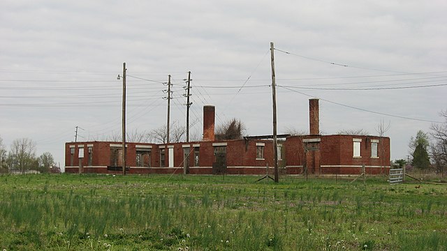
English: Ruins of the
Missouri Pacific Depot in
Charleston,
Missouri,
United States. Built in 1916, it is listed on the
National Register of Historic Places. |
||
| Date | Taken on 12 April 2013 | ||
| Source | Own work | ||
| Author | Nyttend | ||
| Permission ( Reusing this file) |
|
File history
Click on a date/time to view the file as it appeared at that time.
| Date/Time | Thumbnail | Dimensions | User | Comment | |
|---|---|---|---|---|---|
| current | 03:41, 18 April 2013 |
| 2,816 × 1,584 (1.02 MB) | Nyttend | {{NRHP|72000722}} {{Location|36|55|22|N|89|21|28|W}} {{Information |Description={{en|Ruins of the {{w|Missouri Pacific Depot (Charleston, Missouri)|Missouri Pacific Depot}} in {{w|Charleston, Missouri|Charleston}}, {{w|Missouri}}, {{w|United States}}. ... |
File usage
The following pages on the English Wikipedia use this file (pages on other projects are not listed):
Global file usage
The following other wikis use this file:
- Usage on de.wikipedia.org
- Usage on www.wikidata.org