Original file (4,927 × 3,327 pixels, file size: 21.61 MB, MIME type: image/jpeg)
| This is a file from the
Wikimedia Commons. Information from its
description page there is shown below. Commons is a freely licensed media file repository. You can help. |
Summary
| Description |
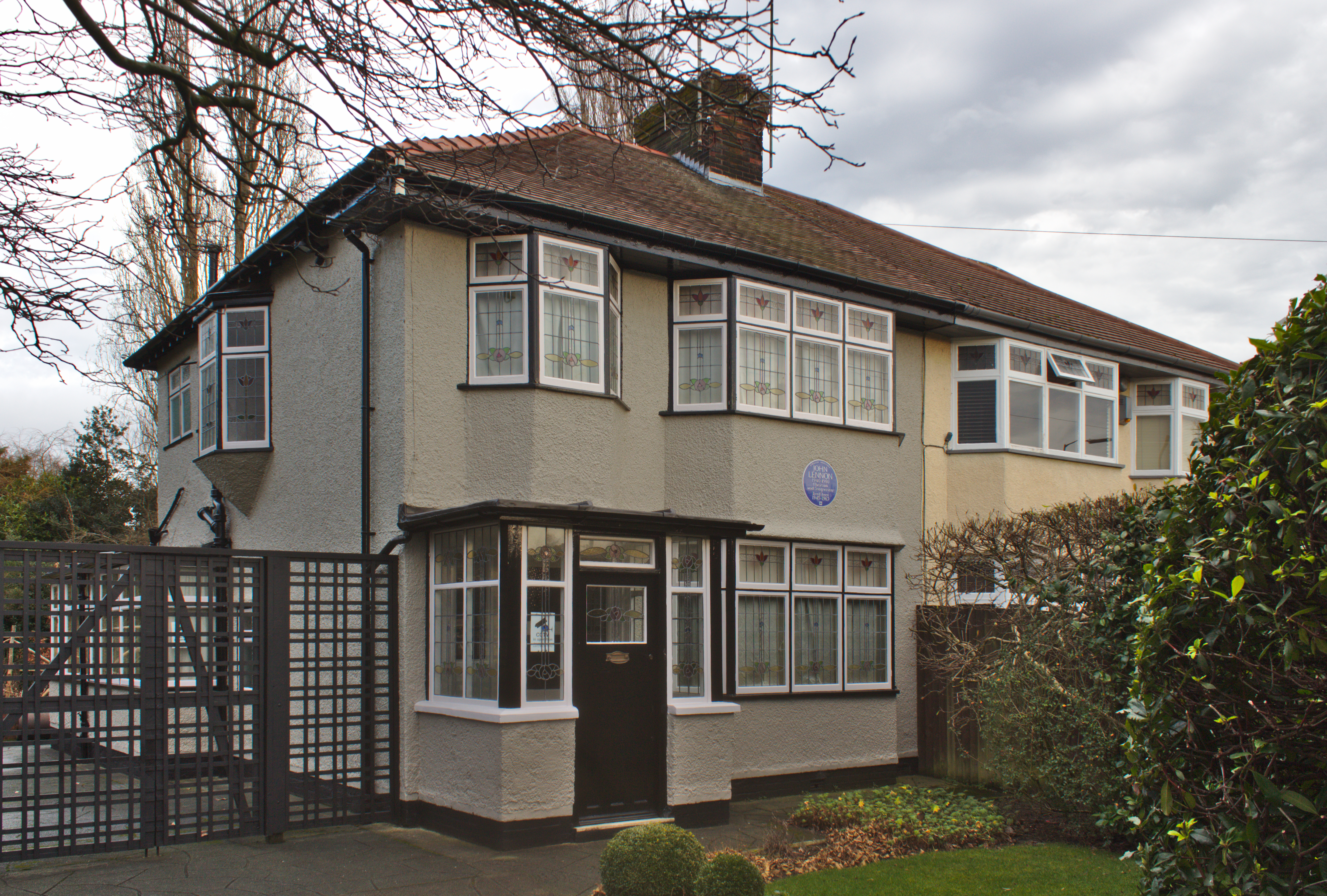
English: 251 Menlove Avenue, Woolton, Liverpool, the childhood home of John Lennon. |
| Date | Taken on 7 January 2020 13:58:42 |
| Source | Own work |
| Author | Rodhullandemu |
| Object location |
| View this and other nearby images on: OpenStreetMap |
|
|---|
Licensing

|
The copyright holder of this file, User:Rodhullandemu, allows anyone to use it for any purpose, provided that the copyright holder is properly attributed. Redistribution, derivative work, commercial use, and all other use is permitted. |
Attribution:
By Phil Nash from Wikimedia Commons CC BY-SA 4.0 & GFDL Views
|

|
This image has been assessed under the valued image criteria and is considered the most valued image on Commons within the scope: 251 Menlove Avenue (Mendips). You can see its nomination here. |
File history
Click on a date/time to view the file as it appeared at that time.
| Date/Time | Thumbnail | Dimensions | User | Comment | |
|---|---|---|---|---|---|
| current | 16:49, 8 January 2020 |
| 4,927 × 3,327 (21.61 MB) | Rodhullandemu | User created page with UploadWizard |
File usage
Global file usage
The following other wikis use this file:
- Usage on ca.wikipedia.org
- Usage on de.wikipedia.org
- Usage on es.wikipedia.org
- Usage on fi.wikipedia.org
- Usage on fr.wikipedia.org
- Usage on he.wikivoyage.org
- Usage on ka.wikipedia.org
- Usage on nl.wikipedia.org
- Usage on pl.wikipedia.org
- Usage on ru.wikipedia.org
- Usage on www.wikidata.org
Metadata
Original file (4,927 × 3,327 pixels, file size: 21.61 MB, MIME type: image/jpeg)
| This is a file from the
Wikimedia Commons. Information from its
description page there is shown below. Commons is a freely licensed media file repository. You can help. |
Summary
| Description |
English: 251 Menlove Avenue, Woolton, Liverpool, the childhood home of John Lennon. |
| Date | Taken on 7 January 2020 13:58:42 |
| Source | Own work |
| Author | Rodhullandemu |
| Object location |
| View this and other nearby images on: OpenStreetMap |
|
|---|
Licensing
|
|
The copyright holder of this file, User:Rodhullandemu, allows anyone to use it for any purpose, provided that the copyright holder is properly attributed. Redistribution, derivative work, commercial use, and all other use is permitted. |
Attribution:
By Phil Nash from Wikimedia Commons CC BY-SA 4.0 & GFDL Views
|
|
|
This image has been assessed under the valued image criteria and is considered the most valued image on Commons within the scope: 251 Menlove Avenue (Mendips). You can see its nomination here. |
File history
Click on a date/time to view the file as it appeared at that time.
| Date/Time | Thumbnail | Dimensions | User | Comment | |
|---|---|---|---|---|---|
| current | 16:49, 8 January 2020 |
| 4,927 × 3,327 (21.61 MB) | Rodhullandemu | User created page with UploadWizard |
File usage
Global file usage
The following other wikis use this file:
- Usage on ca.wikipedia.org
- Usage on de.wikipedia.org
- Usage on es.wikipedia.org
- Usage on fi.wikipedia.org
- Usage on fr.wikipedia.org
- Usage on he.wikivoyage.org
- Usage on ka.wikipedia.org
- Usage on nl.wikipedia.org
- Usage on pl.wikipedia.org
- Usage on ru.wikipedia.org
- Usage on www.wikidata.org