
Original file (SVG file, nominally 628 × 360 pixels, file size: 16 KB)
| This is a file from the
Wikimedia Commons. Information from its
description page there is shown below. Commons is a freely licensed media file repository. You can help. |
Summary
| Description |
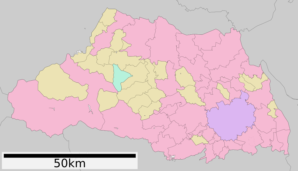
English: Map of Saitama prefecture, Japan
日本語: 埼玉県の地図 |
||
| Date | (UTC) | ||
| Source | ja:File:包括自治体区画図 11000.svg | ||
| Author | ja:User:Lincun | ||
| Permission ( Reusing this file) |
|
Licensing

|
Permission is granted to copy, distribute and/or modify this document under the terms of the GNU Free Documentation License, Version 1.2 or any later version published by the Free Software Foundation; with no Invariant Sections, no Front-Cover Texts, and no Back-Cover Texts. A copy of the license is included in the section entitled GNU Free Documentation License. |
- You are free:
- to share – to copy, distribute and transmit the work
- to remix – to adapt the work
- Under the following conditions:
- attribution – You must give appropriate credit, provide a link to the license, and indicate if changes were made. You may do so in any reasonable manner, but not in any way that suggests the licensor endorses you or your use.
- share alike – If you remix, transform, or build upon the material, you must distribute your contributions under the same or compatible license as the original.
File history
Click on a date/time to view the file as it appeared at that time.
| Date/Time | Thumbnail | Dimensions | User | Comment | |
|---|---|---|---|---|---|
| current | 18:40, 1 April 2013 |
| 628 × 360 (16 KB) | Moogsi | latest version (2013-02-12) of ja:file:包括自治体区画図 11000.svg, changes: 白岡町を市制。鳩ヶ谷市と川口市を合併。 |
| 19:50, 10 October 2011 |
 | 628 × 360 (17 KB) | Haaninjo | New version based on 2010.03.24 version of ja:file:包括自治体区画図 11000.svg, updated to reflect 2011.10.11 merger of Hatogaya into Kawaguchi. | |
| 14:54, 23 November 2009 |
 | 800 × 512 (24 KB) | Monaneko | {{Information |Description={{en|1=Map of Saitama prefecture, Japan}} {{ja|1=埼玉県の地図}} |Source= ja:File:包括自治体区画図 11000.svg |Author= ja:User:Lincun |Date=2007-11-20 12:55 (UTC) |Permission= |other_versions= }} [[Category: |
File usage
Global file usage
The following other wikis use this file:
- Usage on es.wikipedia.org
- Usage on gl.wikipedia.org
- Usage on id.wikipedia.org
- Usage on incubator.wikimedia.org
- Usage on ja.wikipedia.org
- 西武ドーム
- 埼玉スタジアム2002
- さいたま市駒場スタジアム
- 氷川女体神社
- 調神社
- 国営武蔵丘陵森林公園
- 加須インターチェンジ
- ヤクルト戸田球場
- ロッテ浦和球場
- 所沢航空記念公園
- 所沢航空発祥記念館
- 埼玉県道349号広木折原線
- 氷川神社
- 栃木県道・群馬県道・埼玉県道7号佐野行田線
- 熊谷スポーツ文化公園
- 秩父神社
- 埼玉県営大宮公園野球場
- 喜多院
- 岩槻城
- 忍城
- 埼玉県立久喜北陽高等学校
- 小田原征伐
- 新上武大橋
- 羊山公園
- 埼玉古墳群
- 稲荷山古墳 (行田市)
- 松郷 (所沢市)
- 入間基地
- 高麗神社
- 金鑚神社
- 権現山古墳群 (ふじみ野市)
- 松山城 (武蔵国)
- 栄和 (さいたま市)
- 埼玉県平和資料館
- 関山貝塚
- 埼玉県立熊谷高等学校
- 早稲田大学本庄高等学院
- 西武第二球場
- 川越城
- 鉢形城
- 筑波大学附属坂戸高等学校
- 箭弓稲荷神社 (東松山市)
- 西武園ゆうえんち
- 正法寺 (東松山市)
- 吉見百穴
- 埼玉県立松山女子高等学校
View more global usage of this file.
Metadata
Original file (SVG file, nominally 628 × 360 pixels, file size: 16 KB)
| This is a file from the
Wikimedia Commons. Information from its
description page there is shown below. Commons is a freely licensed media file repository. You can help. |
Summary
| Description |
English: Map of Saitama prefecture, Japan
日本語: 埼玉県の地図 |
||
| Date | (UTC) | ||
| Source | ja:File:包括自治体区画図 11000.svg | ||
| Author | ja:User:Lincun | ||
| Permission ( Reusing this file) |
|
Licensing
|
|
Permission is granted to copy, distribute and/or modify this document under the terms of the GNU Free Documentation License, Version 1.2 or any later version published by the Free Software Foundation; with no Invariant Sections, no Front-Cover Texts, and no Back-Cover Texts. A copy of the license is included in the section entitled GNU Free Documentation License. |
- You are free:
- to share – to copy, distribute and transmit the work
- to remix – to adapt the work
- Under the following conditions:
- attribution – You must give appropriate credit, provide a link to the license, and indicate if changes were made. You may do so in any reasonable manner, but not in any way that suggests the licensor endorses you or your use.
- share alike – If you remix, transform, or build upon the material, you must distribute your contributions under the same or compatible license as the original.
File history
Click on a date/time to view the file as it appeared at that time.
| Date/Time | Thumbnail | Dimensions | User | Comment | |
|---|---|---|---|---|---|
| current | 18:40, 1 April 2013 |
| 628 × 360 (16 KB) | Moogsi | latest version (2013-02-12) of ja:file:包括自治体区画図 11000.svg, changes: 白岡町を市制。鳩ヶ谷市と川口市を合併。 |
| 19:50, 10 October 2011 |
| 628 × 360 (17 KB) | Haaninjo | New version based on 2010.03.24 version of ja:file:包括自治体区画図 11000.svg, updated to reflect 2011.10.11 merger of Hatogaya into Kawaguchi. | |
| 14:54, 23 November 2009 |
| 800 × 512 (24 KB) | Monaneko | {{Information |Description={{en|1=Map of Saitama prefecture, Japan}} {{ja|1=埼玉県の地図}} |Source= ja:File:包括自治体区画図 11000.svg |Author= ja:User:Lincun |Date=2007-11-20 12:55 (UTC) |Permission= |other_versions= }} [[Category: |
File usage
Global file usage
The following other wikis use this file:
- Usage on es.wikipedia.org
- Usage on gl.wikipedia.org
- Usage on id.wikipedia.org
- Usage on incubator.wikimedia.org
- Usage on ja.wikipedia.org
- 西武ドーム
- 埼玉スタジアム2002
- さいたま市駒場スタジアム
- 氷川女体神社
- 調神社
- 国営武蔵丘陵森林公園
- 加須インターチェンジ
- ヤクルト戸田球場
- ロッテ浦和球場
- 所沢航空記念公園
- 所沢航空発祥記念館
- 埼玉県道349号広木折原線
- 氷川神社
- 栃木県道・群馬県道・埼玉県道7号佐野行田線
- 熊谷スポーツ文化公園
- 秩父神社
- 埼玉県営大宮公園野球場
- 喜多院
- 岩槻城
- 忍城
- 埼玉県立久喜北陽高等学校
- 小田原征伐
- 新上武大橋
- 羊山公園
- 埼玉古墳群
- 稲荷山古墳 (行田市)
- 松郷 (所沢市)
- 入間基地
- 高麗神社
- 金鑚神社
- 権現山古墳群 (ふじみ野市)
- 松山城 (武蔵国)
- 栄和 (さいたま市)
- 埼玉県平和資料館
- 関山貝塚
- 埼玉県立熊谷高等学校
- 早稲田大学本庄高等学院
- 西武第二球場
- 川越城
- 鉢形城
- 筑波大学附属坂戸高等学校
- 箭弓稲荷神社 (東松山市)
- 西武園ゆうえんち
- 正法寺 (東松山市)
- 吉見百穴
- 埼玉県立松山女子高等学校
View more global usage of this file.