
Size of this PNG preview of this SVG file:
673 × 600 pixels. Other resolutions:
269 × 240 pixels |
539 × 480 pixels |
862 × 768 pixels |
1,149 × 1,024 pixels |
2,299 × 2,048 pixels |
1,669 × 1,487 pixels.
Original file (SVG file, nominally 1,669 × 1,487 pixels, file size: 2.51 MB)
| This is a file from the
Wikimedia Commons. Information from its
description page there is shown below. Commons is a freely licensed media file repository. You can help. |
Summary
| Description |
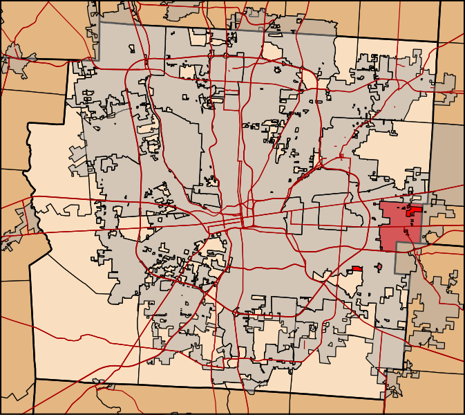
English: Map of Franklin County, Ohio highlighting Truro Township |
| Date | |
| Source | Own work, TIGER data |
| Author | Ibagli |
Licensing
I, the copyright holder of this work, hereby publish it under the following license:
| This file is made available under the Creative Commons CC0 1.0 Universal Public Domain Dedication. | |
| The person who associated a work with this deed has dedicated the work to the
public domain by waiving all of their rights to the work worldwide under copyright law, including all related and neighboring rights, to the extent allowed by law. You can copy, modify, distribute and perform the work, even for commercial purposes, all without asking permission.
|
File history
Click on a date/time to view the file as it appeared at that time.
| Date/Time | Thumbnail | Dimensions | User | Comment | |
|---|---|---|---|---|---|
| current | 05:16, 16 February 2012 |
| 1,669 × 1,487 (2.51 MB) | Ibagli | Try again |
| 05:12, 16 February 2012 |
 | 1,669 × 1,487 (2.51 MB) | Ibagli | fix | |
| 05:10, 16 February 2012 |
 | 1,669 × 1,487 (2.51 MB) | Ibagli | {{Information |Description ={{en|1=Map of Franklin County, Ohio highlighting Truro Township}} |Source ={{own}}, TIGER data |Author = Ibagli |Date =2012-02-15 |Permission = |other_versions = }} [[Category:Ma |
File usage
The following pages on the English Wikipedia use this file (pages on other projects are not listed):
Global file usage
The following other wikis use this file:
- Usage on eu.wikipedia.org
- Usage on fa.wikipedia.org
- Usage on pt.wikipedia.org
- Usage on www.wikidata.org
- Usage on zh.wikipedia.org
Metadata
Size of this PNG preview of this SVG file:
673 × 600 pixels. Other resolutions:
269 × 240 pixels |
539 × 480 pixels |
862 × 768 pixels |
1,149 × 1,024 pixels |
2,299 × 2,048 pixels |
1,669 × 1,487 pixels.
Original file (SVG file, nominally 1,669 × 1,487 pixels, file size: 2.51 MB)
| This is a file from the
Wikimedia Commons. Information from its
description page there is shown below. Commons is a freely licensed media file repository. You can help. |
Summary
| Description |
English: Map of Franklin County, Ohio highlighting Truro Township |
| Date | |
| Source | Own work, TIGER data |
| Author | Ibagli |
Licensing
I, the copyright holder of this work, hereby publish it under the following license:
| This file is made available under the Creative Commons CC0 1.0 Universal Public Domain Dedication. | |
| The person who associated a work with this deed has dedicated the work to the
public domain by waiving all of their rights to the work worldwide under copyright law, including all related and neighboring rights, to the extent allowed by law. You can copy, modify, distribute and perform the work, even for commercial purposes, all without asking permission.
|
File history
Click on a date/time to view the file as it appeared at that time.
| Date/Time | Thumbnail | Dimensions | User | Comment | |
|---|---|---|---|---|---|
| current | 05:16, 16 February 2012 |
| 1,669 × 1,487 (2.51 MB) | Ibagli | Try again |
| 05:12, 16 February 2012 |
| 1,669 × 1,487 (2.51 MB) | Ibagli | fix | |
| 05:10, 16 February 2012 |
| 1,669 × 1,487 (2.51 MB) | Ibagli | {{Information |Description ={{en|1=Map of Franklin County, Ohio highlighting Truro Township}} |Source ={{own}}, TIGER data |Author = Ibagli |Date =2012-02-15 |Permission = |other_versions = }} [[Category:Ma |
File usage
The following pages on the English Wikipedia use this file (pages on other projects are not listed):
Global file usage
The following other wikis use this file:
- Usage on eu.wikipedia.org
- Usage on fa.wikipedia.org
- Usage on pt.wikipedia.org
- Usage on www.wikidata.org
- Usage on zh.wikipedia.org