
Original file (SVG file, nominally 803 × 1,458 pixels, file size: 434 KB)
| This is a file from the
Wikimedia Commons. Information from its
description page there is shown below. Commons is a freely licensed media file repository. You can help. |
Summary
| Description |
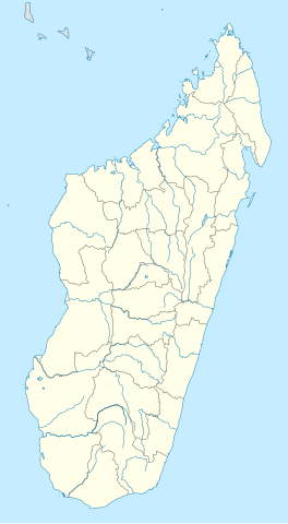
Deutsch: Positionskarte von
Madagaskar
Quadratische Plattkarte, N-S-Streckung 105 %. Geographische Begrenzung der Karte:
English: Location map of
Madagascar
Equirectangular projection, N/S stretching 105 %. Geographic limits of the map:
|
| Date | |
| Source |
own work, using
|
| Author | NordNordWest |

|
This map has been made or improved in the German
Kartenwerkstatt (Map Lab). You can
propose maps to improve as well.
|
Licensing

|
Permission is granted to copy, distribute and/or modify this document under the terms of the GNU Free Documentation License, Version 1.2 or any later version published by the Free Software Foundation; with no Invariant Sections, no Front-Cover Texts, and no Back-Cover Texts. A copy of the license is included in the section entitled GNU Free Documentation License. |
- You are free:
- to share – to copy, distribute and transmit the work
- to remix – to adapt the work
- Under the following conditions:
- attribution – You must give appropriate credit, provide a link to the license, and indicate if changes were made. You may do so in any reasonable manner, but not in any way that suggests the licensor endorses you or your use.
- share alike – If you remix, transform, or build upon the material, you must distribute your contributions under the same or compatible license as the original.
File history
Click on a date/time to view the file as it appeared at that time.
| Date/Time | Thumbnail | Dimensions | User | Comment | |
|---|---|---|---|---|---|
| current | 15:51, 23 September 2009 |
| 803 × 1,458 (434 KB) | NordNordWest | |
| 19:26, 14 October 2008 |
 | 803 × 1,458 (368 KB) | NordNordWest | {{Information |Description= {{de|Positionskarte von Madagaskar}} Quadratische Plattkarte, N-S-Streckung 105 %. Geographische Begrenzung der Karte: * N: 11.3° S * S: 26.0° S * W: 42.5° O * O: 51.0° O {{en|Location map of [[:en:Madaga |
File usage
More than 100 pages use this file. The following list shows the first 100 pages that use this file only. A full list is available.
- Alakamisy, Fianarantsoa
- Ambalabe Airport
- Ambanja
- Ambatofinandrahana
- Ambatomainty
- Ambatomainty Airport
- Ambatondrazaka Airport
- Ambenja
- Ambilobe
- Ambohimahamasina
- Amborovy Airport
- Ambositra
- Amparafaravola
- Analalava
- Analalava Airport
- Andapa
- Andavadoaka
- Andoany
- Anjozorobe
- Ankaratra
- Ankavandra Airport
- Anorotsangana
- Antalaha
- Antanifotsy
- Antsalova
- Antsalova Airport
- Antsiafabositra
- Antsirabato Airport
- Antsirabe
- Antsiranana
- Antsohimbondrona
- Arrachart Airport
- Banc du Geyser
- Battle of Madagascar
- Befotaka
- Belo sur Tsiribihina Airport
- Bemolanga
- Besalampy
- Besalampy Airport
- Betroka
- Brickaville
- Farafangana Airport
- Fascene Airport
- Fenoarivo Atsinanana
- Fianarantsoa
- Fianarantsoa Airport
- Fort-Dauphin (Madagascar)
- Iakora
- Ihosy
- Ikalamavony
- Ikongo
- Ivato International Airport
- Kandreho
- Mahajanga
- Mahalevona
- Maintirano
- Maintirano Airport
- Manakara
- Manakara Airport
- Mananara Nord Airport
- Mananjary Airport
- Mandritsara Airport
- Manja Airport
- Maroantsetra
- Maroantsetra Airport
- Marosakoa
- Miandrivazo Airport
- Mitsinjo
- Morafenobe Airport
- Morombe
- Morombe Airport
- Morondava
- Morondava Airport
- Nosy Be
- Nosy Boraha
- Port Bergé Airport
- Ranotsara
- Sahasinaka
- Sainte Marie Airport
- Sambava Airport
- Sitampiky
- Soalala Airport
- Soavina
- Solila
- Tambohorano
- Tambohorano Airport
- Toamasina
- Toamasina Ambalamanasy Airport
- Tolagnaro Airport
- Toliara
- Toliara Airport
- Tsaratanana Airport
- Tsiroanomandidy
- Tsiroanomandidy Airport
- Tsivory
- Vangaindrano
- Vatolaivy
- Vatomandry
- Vohemar
- Vohemar Airport
View more links to this file.
Global file usage
The following other wikis use this file:
- Usage on af.wikipedia.org
- Usage on am.wikipedia.org
- Usage on an.wikipedia.org
- Usage on ar.wikipedia.org
- Usage on ast.wikipedia.org
- Usage on azb.wikipedia.org
- ماداقاسکار دؤیوشو
- تواماسینا
- تولیارا
- امبوهیمالزا، سامباوا
- امبینانیفاهو
- تلانارو
- امبالوائو
- امباتولامپی
- امبودیهارینا
- امپاهانا
- امپوهیب
- اموهیترالانانا
- امبلآباد، آنتالیا
- ماروفناریتا
- امبالانیرانا
- امبانقو
- امبالاواتو
- انداینقو
- امپاسیپاتسی قار
- انداسیب، مورامانقا
- امبوهیماندراس، امبالاوائو
- امباتولاوا
- امباتوندرازاک سابرباین
- امباتولای، مایندریوازو
- امباریمانینقا
- انالالیری
- امبواساری، مورامانقا
- امبوانقیب
- امبوتاکا
- امبوهیدرونانو
- وسینا
- امباکرینی
- امبالاسوا
View more global usage of this file.
Metadata
Original file (SVG file, nominally 803 × 1,458 pixels, file size: 434 KB)
| This is a file from the
Wikimedia Commons. Information from its
description page there is shown below. Commons is a freely licensed media file repository. You can help. |
Summary
| Description |
Deutsch: Positionskarte von
Madagaskar
Quadratische Plattkarte, N-S-Streckung 105 %. Geographische Begrenzung der Karte:
English: Location map of
Madagascar
Equirectangular projection, N/S stretching 105 %. Geographic limits of the map:
|
| Date | |
| Source |
own work, using
|
| Author | NordNordWest |
|
|
This map has been made or improved in the German
Kartenwerkstatt (Map Lab). You can
propose maps to improve as well.
|
Licensing
|
|
Permission is granted to copy, distribute and/or modify this document under the terms of the GNU Free Documentation License, Version 1.2 or any later version published by the Free Software Foundation; with no Invariant Sections, no Front-Cover Texts, and no Back-Cover Texts. A copy of the license is included in the section entitled GNU Free Documentation License. |
- You are free:
- to share – to copy, distribute and transmit the work
- to remix – to adapt the work
- Under the following conditions:
- attribution – You must give appropriate credit, provide a link to the license, and indicate if changes were made. You may do so in any reasonable manner, but not in any way that suggests the licensor endorses you or your use.
- share alike – If you remix, transform, or build upon the material, you must distribute your contributions under the same or compatible license as the original.
File history
Click on a date/time to view the file as it appeared at that time.
| Date/Time | Thumbnail | Dimensions | User | Comment | |
|---|---|---|---|---|---|
| current | 15:51, 23 September 2009 |
| 803 × 1,458 (434 KB) | NordNordWest | |
| 19:26, 14 October 2008 |
| 803 × 1,458 (368 KB) | NordNordWest | {{Information |Description= {{de|Positionskarte von Madagaskar}} Quadratische Plattkarte, N-S-Streckung 105 %. Geographische Begrenzung der Karte: * N: 11.3° S * S: 26.0° S * W: 42.5° O * O: 51.0° O {{en|Location map of [[:en:Madaga |
File usage
More than 100 pages use this file. The following list shows the first 100 pages that use this file only. A full list is available.
- Alakamisy, Fianarantsoa
- Ambalabe Airport
- Ambanja
- Ambatofinandrahana
- Ambatomainty
- Ambatomainty Airport
- Ambatondrazaka Airport
- Ambenja
- Ambilobe
- Ambohimahamasina
- Amborovy Airport
- Ambositra
- Amparafaravola
- Analalava
- Analalava Airport
- Andapa
- Andavadoaka
- Andoany
- Anjozorobe
- Ankaratra
- Ankavandra Airport
- Anorotsangana
- Antalaha
- Antanifotsy
- Antsalova
- Antsalova Airport
- Antsiafabositra
- Antsirabato Airport
- Antsirabe
- Antsiranana
- Antsohimbondrona
- Arrachart Airport
- Banc du Geyser
- Battle of Madagascar
- Befotaka
- Belo sur Tsiribihina Airport
- Bemolanga
- Besalampy
- Besalampy Airport
- Betroka
- Brickaville
- Farafangana Airport
- Fascene Airport
- Fenoarivo Atsinanana
- Fianarantsoa
- Fianarantsoa Airport
- Fort-Dauphin (Madagascar)
- Iakora
- Ihosy
- Ikalamavony
- Ikongo
- Ivato International Airport
- Kandreho
- Mahajanga
- Mahalevona
- Maintirano
- Maintirano Airport
- Manakara
- Manakara Airport
- Mananara Nord Airport
- Mananjary Airport
- Mandritsara Airport
- Manja Airport
- Maroantsetra
- Maroantsetra Airport
- Marosakoa
- Miandrivazo Airport
- Mitsinjo
- Morafenobe Airport
- Morombe
- Morombe Airport
- Morondava
- Morondava Airport
- Nosy Be
- Nosy Boraha
- Port Bergé Airport
- Ranotsara
- Sahasinaka
- Sainte Marie Airport
- Sambava Airport
- Sitampiky
- Soalala Airport
- Soavina
- Solila
- Tambohorano
- Tambohorano Airport
- Toamasina
- Toamasina Ambalamanasy Airport
- Tolagnaro Airport
- Toliara
- Toliara Airport
- Tsaratanana Airport
- Tsiroanomandidy
- Tsiroanomandidy Airport
- Tsivory
- Vangaindrano
- Vatolaivy
- Vatomandry
- Vohemar
- Vohemar Airport
View more links to this file.
Global file usage
The following other wikis use this file:
- Usage on af.wikipedia.org
- Usage on am.wikipedia.org
- Usage on an.wikipedia.org
- Usage on ar.wikipedia.org
- Usage on ast.wikipedia.org
- Usage on azb.wikipedia.org
- ماداقاسکار دؤیوشو
- تواماسینا
- تولیارا
- امبوهیمالزا، سامباوا
- امبینانیفاهو
- تلانارو
- امبالوائو
- امباتولامپی
- امبودیهارینا
- امپاهانا
- امپوهیب
- اموهیترالانانا
- امبلآباد، آنتالیا
- ماروفناریتا
- امبالانیرانا
- امبانقو
- امبالاواتو
- انداینقو
- امپاسیپاتسی قار
- انداسیب، مورامانقا
- امبوهیماندراس، امبالاوائو
- امباتولاوا
- امباتوندرازاک سابرباین
- امباتولای، مایندریوازو
- امباریمانینقا
- انالالیری
- امبواساری، مورامانقا
- امبوانقیب
- امبوتاکا
- امبوهیدرونانو
- وسینا
- امباکرینی
- امبالاسوا
View more global usage of this file.