LocationSamoa.png (248 × 156 pixels, file size: 3 KB, MIME type: image/png)
| This is a file from the
Wikimedia Commons. Information from its
description page there is shown below. Commons is a freely licensed media file repository. You can help. |
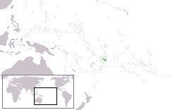
Location map for the
Samoa.
Originally created for English Wikipedia by
Vardion.
| |
This work has been released into the
public domain by its author,
Vardion, at the
English Wikipedia project. This applies worldwide. In case this is not legally possible: |
File history
Click on a date/time to view the file as it appeared at that time.
| Date/Time | Thumbnail | Dimensions | User | Comment | |
|---|---|---|---|---|---|
| current | 00:28, 5 September 2010 |
| 248 × 156 (3 KB) | Ras67 | cropped and squeezed |
| 15:20, 21 December 2004 |
 | 250 × 158 (6 KB) | EugeneZelenko | Location map for the Samoa.<br/>Originally created for English Wikipedia by Vardion.<br/>{{PD}}<br/> Category:Country locator maps |
File usage
Global file usage
The following other wikis use this file:
- Usage on af.wikipedia.org
- Usage on ar.wikipedia.org
- قرار مجلس الأمن التابع للأمم المتحدة رقم 399
- معاملة المثليين في ساموا
- مستخدم:جار الله/قائمة صور مقالات العلاقات الثنائية
- العلاقات الأمريكية الساموية
- العلاقات الأنغولية الساموية
- العلاقات الساموية الكورية الجنوبية
- العلاقات الإريترية الساموية
- العلاقات الساموية السويسرية
- العلاقات الألمانية الساموية
- العلاقات الساموية الليختنشتانية
- العلاقات البوليفية الساموية
- العلاقات الساموية الموزمبيقية
- العلاقات الألبانية الساموية
- العلاقات البلجيكية الساموية
- العلاقات الإثيوبية الساموية
- العلاقات البيلاروسية الساموية
- العلاقات الساموية الطاجيكستانية
- العلاقات الروسية الساموية
- العلاقات الرومانية الساموية
- العلاقات الأرجنتينية الساموية
- العلاقات الساموية الغامبية
- العلاقات الساموية القبرصية
- العلاقات الساموية السيراليونية
- العلاقات الساموية النيبالية
- العلاقات الساموية الليبيرية
- العلاقات التشيكية الساموية
- العلاقات الساموية الميانمارية
- العلاقات الساموية الكندية
- العلاقات السعودية الساموية
- العلاقات الزيمبابوية الساموية
- العلاقات الإسرائيلية الساموية
- العلاقات البالاوية الساموية
- العلاقات الساموية المالية
- العلاقات الساموية النيجيرية
- العلاقات اليمنية الساموية
- العلاقات الساموية الفانواتية
- العلاقات الغابونية الساموية
- العلاقات البنمية الساموية
- العلاقات الساموية الكوبية
- العلاقات الجورجية الساموية
- العلاقات التونسية الساموية
- العلاقات الساموية الكورية الشمالية
- العلاقات الهندية الساموية
- العلاقات اليابانية الساموية
- العلاقات الإيطالية الساموية
- العلاقات الساموية الناوروية
- العلاقات الأسترالية الساموية
- العلاقات الزامبية الساموية
- العلاقات الساموية الفيجية
View more global usage of this file.
LocationSamoa.png (248 × 156 pixels, file size: 3 KB, MIME type: image/png)
| This is a file from the
Wikimedia Commons. Information from its
description page there is shown below. Commons is a freely licensed media file repository. You can help. |
Location map for the
Samoa.
Originally created for English Wikipedia by
Vardion.
| |
This work has been released into the
public domain by its author,
Vardion, at the
English Wikipedia project. This applies worldwide. In case this is not legally possible: |
File history
Click on a date/time to view the file as it appeared at that time.
| Date/Time | Thumbnail | Dimensions | User | Comment | |
|---|---|---|---|---|---|
| current | 00:28, 5 September 2010 |
| 248 × 156 (3 KB) | Ras67 | cropped and squeezed |
| 15:20, 21 December 2004 |
| 250 × 158 (6 KB) | EugeneZelenko | Location map for the Samoa.<br/>Originally created for English Wikipedia by Vardion.<br/>{{PD}}<br/> Category:Country locator maps |
File usage
Global file usage
The following other wikis use this file:
- Usage on af.wikipedia.org
- Usage on ar.wikipedia.org
- قرار مجلس الأمن التابع للأمم المتحدة رقم 399
- معاملة المثليين في ساموا
- مستخدم:جار الله/قائمة صور مقالات العلاقات الثنائية
- العلاقات الأمريكية الساموية
- العلاقات الأنغولية الساموية
- العلاقات الساموية الكورية الجنوبية
- العلاقات الإريترية الساموية
- العلاقات الساموية السويسرية
- العلاقات الألمانية الساموية
- العلاقات الساموية الليختنشتانية
- العلاقات البوليفية الساموية
- العلاقات الساموية الموزمبيقية
- العلاقات الألبانية الساموية
- العلاقات البلجيكية الساموية
- العلاقات الإثيوبية الساموية
- العلاقات البيلاروسية الساموية
- العلاقات الساموية الطاجيكستانية
- العلاقات الروسية الساموية
- العلاقات الرومانية الساموية
- العلاقات الأرجنتينية الساموية
- العلاقات الساموية الغامبية
- العلاقات الساموية القبرصية
- العلاقات الساموية السيراليونية
- العلاقات الساموية النيبالية
- العلاقات الساموية الليبيرية
- العلاقات التشيكية الساموية
- العلاقات الساموية الميانمارية
- العلاقات الساموية الكندية
- العلاقات السعودية الساموية
- العلاقات الزيمبابوية الساموية
- العلاقات الإسرائيلية الساموية
- العلاقات البالاوية الساموية
- العلاقات الساموية المالية
- العلاقات الساموية النيجيرية
- العلاقات اليمنية الساموية
- العلاقات الساموية الفانواتية
- العلاقات الغابونية الساموية
- العلاقات البنمية الساموية
- العلاقات الساموية الكوبية
- العلاقات الجورجية الساموية
- العلاقات التونسية الساموية
- العلاقات الساموية الكورية الشمالية
- العلاقات الهندية الساموية
- العلاقات اليابانية الساموية
- العلاقات الإيطالية الساموية
- العلاقات الساموية الناوروية
- العلاقات الأسترالية الساموية
- العلاقات الزامبية الساموية
- العلاقات الساموية الفيجية
View more global usage of this file.