
Size of this preview:
800 × 407 pixels. Other resolutions:
320 × 163 pixels |
640 × 326 pixels |
1,024 × 521 pixels |
1,280 × 651 pixels |
2,759 × 1,404 pixels.
Original file (2,759 × 1,404 pixels, file size: 99 KB, MIME type: image/png)
| This is a file from the
Wikimedia Commons. Information from its
description page there is shown below. Commons is a freely licensed media file repository. You can help. |

|
File:Location of America.svg is a vector version of this file. It should be used in place of this PNG file when not inferior.
File:LocationAmericas.png →
File:Location of America.svg
For more information, see
Help:SVG. |
 |
Summary
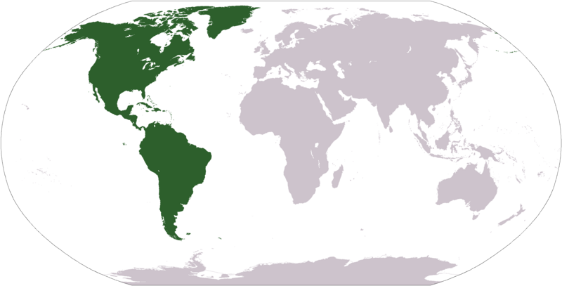
Deutsch: Weltkarte mit Fokus auf
Amerika
English: World map depicting
America
Esperanto: Mondmapo bildiganta
Amerikon
Español: Ubicación de
América
map adapted from PDF world map at CIA World Fact Book
Licensing
This image is in the
public domain because it contains materials that originally came from the United States
Central Intelligence Agency's
World Factbook.
|
 |
File history
Click on a date/time to view the file as it appeared at that time.
| Date/Time | Thumbnail | Dimensions | User | Comment | |
|---|---|---|---|---|---|
| current | 12:31, 19 January 2008 |
| 2,759 × 1,404 (99 KB) | F l a n k e r | Transparency |
| 19:11, 12 October 2005 |
 | 2,759 × 1,404 (55 KB) | E Pluribus Anthony~commonswiki | World map: Americas (location) | |
| 15:06, 29 April 2005 |
 | 1,377 × 699 (16 KB) | Ghalas | Extracted from CIA World Factbook PDF world map, then rasterized and colored. {{PD-USGov-CIA-WF}} |
File usage
The following pages on the English Wikipedia use this file (pages on other projects are not listed):
- Americas
- Archaeology of Brazil
- Basque colonization of the Americas
- British colonization of the Americas
- Christopher Columbus
- Council of the Indies
- European colonization of the Americas
- Former colonies and territories in Canada
- French colonization of the Americas
- Historiography of Colonial Spanish America
- History of Latin America
- History of the Americas
- History of the Caribbean
- Indigenous peoples of the North American Southwest
- List of Mesoamerican pyramids
- List of pre-Columbian cultures
- Lithic period in Mesoamerica
- Mesoamerican chronology
- New Navarre
- New Spain
- Peopling of the Americas
- Periodization of pre-Columbian Peru
- Population history of the Indigenous peoples of the Americas
- Pre-Columbian Peru
- Russian colonization of North America
- Scottish colonization of the Americas
- Southwestern archaeology
- Spanish colonization of the Americas
- Spanish conquest of New Granada
- Spanish missions in South America
- Talk:History of South America/sandbox
- User:Berk/Stuff2
- User:Bouncingnewsgreen
- User:Centralismo/Userboxes
- User:CnrFallon
- User:David Kernow/Template:Continents of the world
- User:David Kernow/Template:Regions of the world
- User:Deavenger
- User:Giovannil713
- User:Half-kratos21
- User:InforManiac/Navbox10
- User:Leobold1/Research Articles/The World
- User:Leyah22
- User:Mwindo
- User:Neil Clancy
- User:Nurg/Template:Continents of the world
- User:Rahlgd/Userboxes
- User:RealIK17
- User:Scootercatter/sandMendos
- User:Secret Saturdays
- User:Solfeo957/Americas monetary union
- User:TerranBoy
- User:TheUnabashedUkrainian
- User:Theloniuscrow
- User:Vasko Kelich
- User:Whlee/UBX/amhistgeek
- Wikipedia:Userboxes/Politics/Multinational
- Template:History of the Americas
- Category:History of the Americas
Global file usage
The following other wikis use this file:
- Usage on als.wikipedia.org
- Usage on ar.wikipedia.org
- البحر الأبيض المتوسط
- آسيا
- أوروبا
- قارة
- المحيط الهندي
- المحيط الهادئ
- القارة القطبية الجنوبية
- أوقيانوسيا
- حضارة المايا
- أمريكا الشمالية
- أمريكا الجنوبية
- أوروبا الشرقية
- القطب الشمالي
- أوروبا الوسطى
- أوروبا الشمالية
- القوقاز
- شمال إفريقيا
- بحر
- تاريخ أمريكا الشمالية
- المنطقة القطبية الجنوبية
- المحيط المتجمد الشمالي
- القرن الإفريقي
- غرب آسيا
- آسيا الوسطى
- جنوب آسيا
- شرق آسيا
- جنوب شرق آسيا
- المحيط الجنوبي
- الكاريبي
- أمريكا الوسطى
- جزر الأنتيل
- أوروبا الغربية
- شرق إفريقيا
- ميلانيزيا
- بولنيزيا
- ميكرونيسيا
- بوابة:آسيا
- بوابة:أوروبا
- بوابة:الأمريكيتان
- أمريكا اللاتينية
- غرب إفريقيا
- العالم الجديد
- الشرق الأدنى
- الشعوب الأصلية في الأمريكتين
- القطب الجنوبي
- محيط (جغرافيا)
- الأمريكتان
- شبه القارة الهندية
- الاستعمار الأوروبي للأمريكيتين
View more global usage of this file.
Size of this preview:
800 × 407 pixels. Other resolutions:
320 × 163 pixels |
640 × 326 pixels |
1,024 × 521 pixels |
1,280 × 651 pixels |
2,759 × 1,404 pixels.
Original file (2,759 × 1,404 pixels, file size: 99 KB, MIME type: image/png)
| This is a file from the
Wikimedia Commons. Information from its
description page there is shown below. Commons is a freely licensed media file repository. You can help. |
|
|
File:Location of America.svg is a vector version of this file. It should be used in place of this PNG file when not inferior.
File:LocationAmericas.png →
File:Location of America.svg
For more information, see
Help:SVG. |
|
Summary
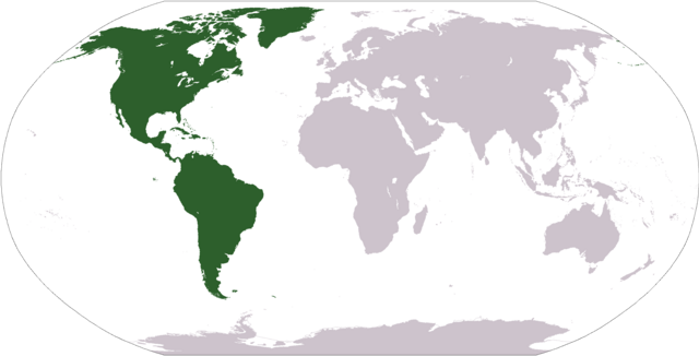
Deutsch: Weltkarte mit Fokus auf
Amerika
English: World map depicting
America
Esperanto: Mondmapo bildiganta
Amerikon
Español: Ubicación de
América
map adapted from PDF world map at CIA World Fact Book
Licensing
This image is in the
public domain because it contains materials that originally came from the United States
Central Intelligence Agency's
World Factbook.
|
|
File history
Click on a date/time to view the file as it appeared at that time.
| Date/Time | Thumbnail | Dimensions | User | Comment | |
|---|---|---|---|---|---|
| current | 12:31, 19 January 2008 |
| 2,759 × 1,404 (99 KB) | F l a n k e r | Transparency |
| 19:11, 12 October 2005 |
| 2,759 × 1,404 (55 KB) | E Pluribus Anthony~commonswiki | World map: Americas (location) | |
| 15:06, 29 April 2005 |
| 1,377 × 699 (16 KB) | Ghalas | Extracted from CIA World Factbook PDF world map, then rasterized and colored. {{PD-USGov-CIA-WF}} |
File usage
The following pages on the English Wikipedia use this file (pages on other projects are not listed):
- Americas
- Archaeology of Brazil
- Basque colonization of the Americas
- British colonization of the Americas
- Christopher Columbus
- Council of the Indies
- European colonization of the Americas
- Former colonies and territories in Canada
- French colonization of the Americas
- Historiography of Colonial Spanish America
- History of Latin America
- History of the Americas
- History of the Caribbean
- Indigenous peoples of the North American Southwest
- List of Mesoamerican pyramids
- List of pre-Columbian cultures
- Lithic period in Mesoamerica
- Mesoamerican chronology
- New Navarre
- New Spain
- Peopling of the Americas
- Periodization of pre-Columbian Peru
- Population history of the Indigenous peoples of the Americas
- Pre-Columbian Peru
- Russian colonization of North America
- Scottish colonization of the Americas
- Southwestern archaeology
- Spanish colonization of the Americas
- Spanish conquest of New Granada
- Spanish missions in South America
- Talk:History of South America/sandbox
- User:Berk/Stuff2
- User:Bouncingnewsgreen
- User:Centralismo/Userboxes
- User:CnrFallon
- User:David Kernow/Template:Continents of the world
- User:David Kernow/Template:Regions of the world
- User:Deavenger
- User:Giovannil713
- User:Half-kratos21
- User:InforManiac/Navbox10
- User:Leobold1/Research Articles/The World
- User:Leyah22
- User:Mwindo
- User:Neil Clancy
- User:Nurg/Template:Continents of the world
- User:Rahlgd/Userboxes
- User:RealIK17
- User:Scootercatter/sandMendos
- User:Secret Saturdays
- User:Solfeo957/Americas monetary union
- User:TerranBoy
- User:TheUnabashedUkrainian
- User:Theloniuscrow
- User:Vasko Kelich
- User:Whlee/UBX/amhistgeek
- Wikipedia:Userboxes/Politics/Multinational
- Template:History of the Americas
- Category:History of the Americas
Global file usage
The following other wikis use this file:
- Usage on als.wikipedia.org
- Usage on ar.wikipedia.org
- البحر الأبيض المتوسط
- آسيا
- أوروبا
- قارة
- المحيط الهندي
- المحيط الهادئ
- القارة القطبية الجنوبية
- أوقيانوسيا
- حضارة المايا
- أمريكا الشمالية
- أمريكا الجنوبية
- أوروبا الشرقية
- القطب الشمالي
- أوروبا الوسطى
- أوروبا الشمالية
- القوقاز
- شمال إفريقيا
- بحر
- تاريخ أمريكا الشمالية
- المنطقة القطبية الجنوبية
- المحيط المتجمد الشمالي
- القرن الإفريقي
- غرب آسيا
- آسيا الوسطى
- جنوب آسيا
- شرق آسيا
- جنوب شرق آسيا
- المحيط الجنوبي
- الكاريبي
- أمريكا الوسطى
- جزر الأنتيل
- أوروبا الغربية
- شرق إفريقيا
- ميلانيزيا
- بولنيزيا
- ميكرونيسيا
- بوابة:آسيا
- بوابة:أوروبا
- بوابة:الأمريكيتان
- أمريكا اللاتينية
- غرب إفريقيا
- العالم الجديد
- الشرق الأدنى
- الشعوب الأصلية في الأمريكتين
- القطب الجنوبي
- محيط (جغرافيا)
- الأمريكتان
- شبه القارة الهندية
- الاستعمار الأوروبي للأمريكيتين
View more global usage of this file.