
Original file (SVG file, nominally 1,450 × 1,807 pixels, file size: 686 KB)
| This is a file from the
Wikimedia Commons. Information from its
description page there is shown below. Commons is a freely licensed media file repository. You can help. |
Summary
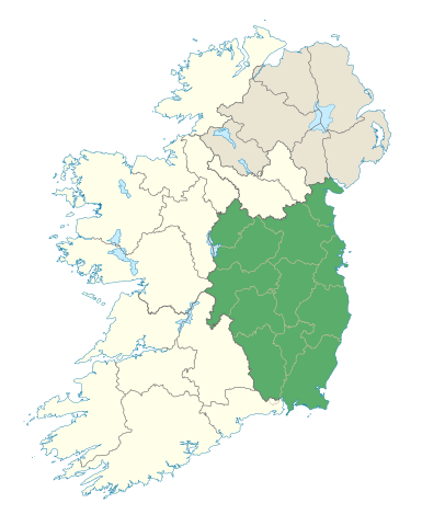
| Description | Locator map of Leinster. |
| Date | (UTC) |
| Source | |
| Author |
|
Licensing
- You are free:
- to share – to copy, distribute and transmit the work
- to remix – to adapt the work
- Under the following conditions:
- attribution – You must give appropriate credit, provide a link to the license, and indicate if changes were made. You may do so in any reasonable manner, but not in any way that suggests the licensor endorses you or your use.
- share alike – If you remix, transform, or build upon the material, you must distribute your contributions under the same or compatible license as the original.
File history
Click on a date/time to view the file as it appeared at that time.
| Date/Time | Thumbnail | Dimensions | User | Comment | |
|---|---|---|---|---|---|
| current | 19:48, 7 January 2012 |
| 1,450 × 1,807 (686 KB) | NikNaks | Removing modern boundaries |
| 18:10, 7 January 2012 |
 | 1,450 × 1,807 (707 KB) | NikNaks | More detailed map | |
| 17:52, 7 January 2012 |
 | 400 × 500 (281 KB) | NikNaks93 | == {{int:filedesc}} == {{Information |Description=Locator map of Leinster. |Source=* File:Ireland_trad_counties_named.svg |Date=2012-01-07 17:50 (UTC) |Author=* File:Ireland_trad_counties_named.svg: *[[:File:Population_density_of_Ireland_map2002 |
File usage
More than 100 pages use this file. The following list shows the first 100 pages that use this file only. A full list is available.
- Annagh Hill
- Arderin
- Barcam
- Barnaslingan
- Baunreaghcong
- Ben of Howth
- Benleagh
- Black Rock Mountain, County Wexford
- Blackstairs Mountain
- Blackstairs Mountains
- Brandon Hill
- Bray Head
- Camaderry
- Camenabologue
- Carn Clonhugh
- Carrick Mountain
- Carrickgollogan
- Carrigvore
- Carroll's Hill
- Castleconor
- Church Mountain
- Clermont Carn
- Cloghernagh
- Conavalla
- Cooley Mountains
- Coppanagh
- Corrigasleggaun
- Croaghaun, County Carlow
- Croghan Hill
- Croghan Mountain
- Crone Woods
- Cullahill Mountain
- Cupidstown Hill
- Dalkey Hill
- Djouce
- Duff Hill
- Dún Ailinne
- Farbreague
- Faughan Hill
- Garraunbaun
- Glenmalure
- Gravale
- Great Sugar Loaf
- Hill of Allen
- Hill of Ben
- Hill of Tara
- Hill of Uisneach
- Hill of Ward
- Keadeen Mountain
- Killiney Hill
- Kilmashogue
- Kippure
- Knockeyon
- Knocknamuck
- Larch Hill
- Leinster
- List of Ireland-related topics
- List of Irish counties by highest point
- List of mountains and hills of County Dublin
- Lists of mountains in Ireland
- Little Sugar Loaf
- Lobawn
- Lugduff
- Luggala
- Lugnaquilla
- Maulin
- Moanbane
- Montpelier Hill
- Mount Alto, Kilkenny
- Mount Leinster
- Mullacor
- Mullaghcleevaun
- Mullaghmast
- Mullaghmeen
- Naul Hills
- Ridge of Capard
- Seefingan
- Shielmartin Hill
- Silsean
- Slieve Bloom Mountains
- Slieve Foy
- Slieve na Calliagh
- Slieveardagh Hills
- Slieveboy
- Slievemaan
- Spahill and Clomantagh Hill
- Stillbrook Hill
- Sugarloaf (West Wicklow)
- Table Mountain (Wicklow)
- Tara Hill, County Wexford
- Three Rock Mountain
- Tibradden Mountain
- Tonduff
- Tonelagee
- Turlough Hill
- Two Rock
- War Hill
- Wicklow Mountains
- Wicklow Round
- Wolftrap Mountain
View more links to this file.
Global file usage
The following other wikis use this file:
- Usage on ar.wikipedia.org
- Usage on ast.wikipedia.org
- Usage on az.wikipedia.org
- Usage on be.wikipedia.org
- Usage on bg.wikipedia.org
- Usage on ca.wikipedia.org
- Usage on ceb.wikipedia.org
- Usage on cs.wikipedia.org
- Usage on da.wikipedia.org
- Usage on el.wikipedia.org
- Usage on eo.wikipedia.org
- Usage on es.wikipedia.org
- Usage on eu.wikipedia.org
- Usage on fa.wikipedia.org
- Usage on fr.wikipedia.org
- Usage on fr.wiktionary.org
- Usage on ga.wikipedia.org
- Usage on gl.wikipedia.org
- Usage on id.wikipedia.org
- Usage on it.wikipedia.org
- Usage on ja.wikipedia.org
- Usage on kab.wikipedia.org
- Usage on ka.wikipedia.org
- Usage on la.wikipedia.org
- Usage on lv.wikipedia.org
- Usage on mk.wikipedia.org
- Usage on mzn.wikipedia.org
- Usage on nl.wikipedia.org
- Usage on no.wikipedia.org
- Usage on os.wikipedia.org
- Usage on ps.wikipedia.org
- Usage on ru.wikipedia.org
- Usage on simple.wikipedia.org
- Usage on sk.wikipedia.org
- Usage on sr.wikipedia.org
- Usage on sv.wikipedia.org
- Usage on tr.wikipedia.org
- Usage on uk.wikipedia.org
- Usage on ur.wikipedia.org
- Usage on vi.wikipedia.org
- Usage on www.wikidata.org
View more global usage of this file.
Original file (SVG file, nominally 1,450 × 1,807 pixels, file size: 686 KB)
| This is a file from the
Wikimedia Commons. Information from its
description page there is shown below. Commons is a freely licensed media file repository. You can help. |
Summary
| Description | Locator map of Leinster. |
| Date | (UTC) |
| Source | |
| Author |
|
Licensing
- You are free:
- to share – to copy, distribute and transmit the work
- to remix – to adapt the work
- Under the following conditions:
- attribution – You must give appropriate credit, provide a link to the license, and indicate if changes were made. You may do so in any reasonable manner, but not in any way that suggests the licensor endorses you or your use.
- share alike – If you remix, transform, or build upon the material, you must distribute your contributions under the same or compatible license as the original.
File history
Click on a date/time to view the file as it appeared at that time.
| Date/Time | Thumbnail | Dimensions | User | Comment | |
|---|---|---|---|---|---|
| current | 19:48, 7 January 2012 |
| 1,450 × 1,807 (686 KB) | NikNaks | Removing modern boundaries |
| 18:10, 7 January 2012 |
| 1,450 × 1,807 (707 KB) | NikNaks | More detailed map | |
| 17:52, 7 January 2012 |
| 400 × 500 (281 KB) | NikNaks93 | == {{int:filedesc}} == {{Information |Description=Locator map of Leinster. |Source=* File:Ireland_trad_counties_named.svg |Date=2012-01-07 17:50 (UTC) |Author=* File:Ireland_trad_counties_named.svg: *[[:File:Population_density_of_Ireland_map2002 |
File usage
More than 100 pages use this file. The following list shows the first 100 pages that use this file only. A full list is available.
- Annagh Hill
- Arderin
- Barcam
- Barnaslingan
- Baunreaghcong
- Ben of Howth
- Benleagh
- Black Rock Mountain, County Wexford
- Blackstairs Mountain
- Blackstairs Mountains
- Brandon Hill
- Bray Head
- Camaderry
- Camenabologue
- Carn Clonhugh
- Carrick Mountain
- Carrickgollogan
- Carrigvore
- Carroll's Hill
- Castleconor
- Church Mountain
- Clermont Carn
- Cloghernagh
- Conavalla
- Cooley Mountains
- Coppanagh
- Corrigasleggaun
- Croaghaun, County Carlow
- Croghan Hill
- Croghan Mountain
- Crone Woods
- Cullahill Mountain
- Cupidstown Hill
- Dalkey Hill
- Djouce
- Duff Hill
- Dún Ailinne
- Farbreague
- Faughan Hill
- Garraunbaun
- Glenmalure
- Gravale
- Great Sugar Loaf
- Hill of Allen
- Hill of Ben
- Hill of Tara
- Hill of Uisneach
- Hill of Ward
- Keadeen Mountain
- Killiney Hill
- Kilmashogue
- Kippure
- Knockeyon
- Knocknamuck
- Larch Hill
- Leinster
- List of Ireland-related topics
- List of Irish counties by highest point
- List of mountains and hills of County Dublin
- Lists of mountains in Ireland
- Little Sugar Loaf
- Lobawn
- Lugduff
- Luggala
- Lugnaquilla
- Maulin
- Moanbane
- Montpelier Hill
- Mount Alto, Kilkenny
- Mount Leinster
- Mullacor
- Mullaghcleevaun
- Mullaghmast
- Mullaghmeen
- Naul Hills
- Ridge of Capard
- Seefingan
- Shielmartin Hill
- Silsean
- Slieve Bloom Mountains
- Slieve Foy
- Slieve na Calliagh
- Slieveardagh Hills
- Slieveboy
- Slievemaan
- Spahill and Clomantagh Hill
- Stillbrook Hill
- Sugarloaf (West Wicklow)
- Table Mountain (Wicklow)
- Tara Hill, County Wexford
- Three Rock Mountain
- Tibradden Mountain
- Tonduff
- Tonelagee
- Turlough Hill
- Two Rock
- War Hill
- Wicklow Mountains
- Wicklow Round
- Wolftrap Mountain
View more links to this file.
Global file usage
The following other wikis use this file:
- Usage on ar.wikipedia.org
- Usage on ast.wikipedia.org
- Usage on az.wikipedia.org
- Usage on be.wikipedia.org
- Usage on bg.wikipedia.org
- Usage on ca.wikipedia.org
- Usage on ceb.wikipedia.org
- Usage on cs.wikipedia.org
- Usage on da.wikipedia.org
- Usage on el.wikipedia.org
- Usage on eo.wikipedia.org
- Usage on es.wikipedia.org
- Usage on eu.wikipedia.org
- Usage on fa.wikipedia.org
- Usage on fr.wikipedia.org
- Usage on fr.wiktionary.org
- Usage on ga.wikipedia.org
- Usage on gl.wikipedia.org
- Usage on id.wikipedia.org
- Usage on it.wikipedia.org
- Usage on ja.wikipedia.org
- Usage on kab.wikipedia.org
- Usage on ka.wikipedia.org
- Usage on la.wikipedia.org
- Usage on lv.wikipedia.org
- Usage on mk.wikipedia.org
- Usage on mzn.wikipedia.org
- Usage on nl.wikipedia.org
- Usage on no.wikipedia.org
- Usage on os.wikipedia.org
- Usage on ps.wikipedia.org
- Usage on ru.wikipedia.org
- Usage on simple.wikipedia.org
- Usage on sk.wikipedia.org
- Usage on sr.wikipedia.org
- Usage on sv.wikipedia.org
- Usage on tr.wikipedia.org
- Usage on uk.wikipedia.org
- Usage on ur.wikipedia.org
- Usage on vi.wikipedia.org
- Usage on www.wikidata.org
View more global usage of this file.