Photos • Location


Size of this preview:
800 × 194 pixels. Other resolutions:
320 × 78 pixels |
640 × 155 pixels |
1,024 × 249 pixels |
3,909 × 949 pixels.
Original file (3,909 × 949 pixels, file size: 462 KB, MIME type: image/jpeg)
| This is a file from the
Wikimedia Commons. Information from its
description page there is shown below. Commons is a freely licensed media file repository. You can help. |
Summary
| Description |
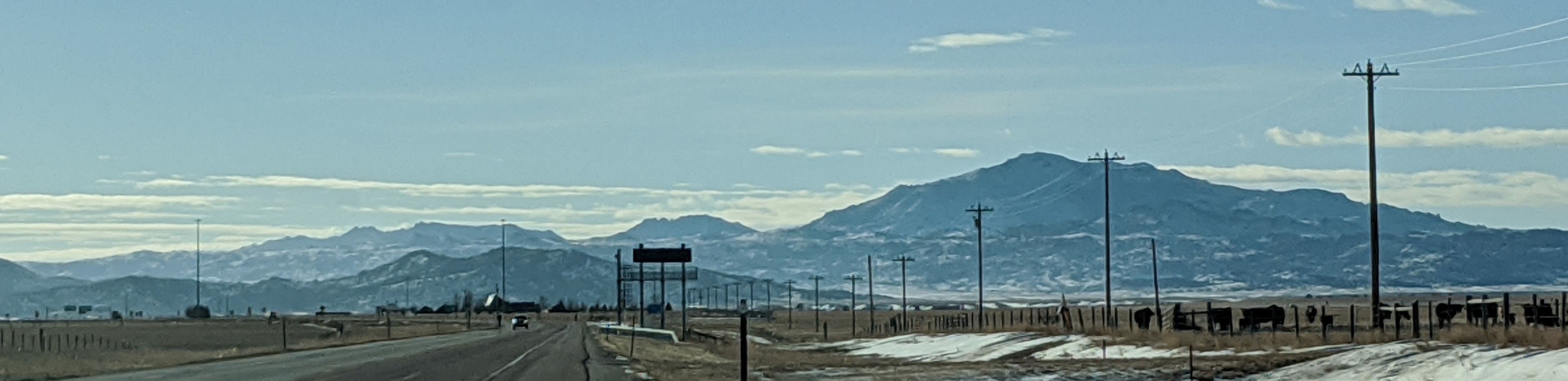
English: Laramie Mountains viewed from 40 miles on U.S. Route 26. From right to left: Laramie peak, South Mountain, and Bearhead Mountain. |
| Date | |
| Source | Own work |
| Author | Jamesmartin111 |
| Camera location | | View this and other nearby images on: OpenStreetMap |
|
|---|
Licensing
I, the copyright holder of this work, hereby publish it under the following license:
| This file is made available under the Creative Commons CC0 1.0 Universal Public Domain Dedication. | |
| The person who associated a work with this deed has dedicated the work to the
public domain by waiving all of their rights to the work worldwide under copyright law, including all related and neighboring rights, to the extent allowed by law. You can copy, modify, distribute and perform the work, even for commercial purposes, all without asking permission.
|
File history
Click on a date/time to view the file as it appeared at that time.
| Date/Time | Thumbnail | Dimensions | User | Comment | |
|---|---|---|---|---|---|
| current | 08:24, 4 March 2020 |
| 3,909 × 949 (462 KB) | Trainspike4792 | User created page with UploadWizard |
File usage
The following pages on the English Wikipedia use this file (pages on other projects are not listed):
Metadata
Size of this preview:
800 × 194 pixels. Other resolutions:
320 × 78 pixels |
640 × 155 pixels |
1,024 × 249 pixels |
3,909 × 949 pixels.
Original file (3,909 × 949 pixels, file size: 462 KB, MIME type: image/jpeg)
| This is a file from the
Wikimedia Commons. Information from its
description page there is shown below. Commons is a freely licensed media file repository. You can help. |
Summary
| Description |
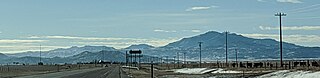
English: Laramie Mountains viewed from 40 miles on U.S. Route 26. From right to left: Laramie peak, South Mountain, and Bearhead Mountain. |
| Date | |
| Source | Own work |
| Author | Jamesmartin111 |
| Camera location | | View this and other nearby images on: OpenStreetMap |
|
|---|
Licensing
I, the copyright holder of this work, hereby publish it under the following license:
| This file is made available under the Creative Commons CC0 1.0 Universal Public Domain Dedication. | |
| The person who associated a work with this deed has dedicated the work to the
public domain by waiving all of their rights to the work worldwide under copyright law, including all related and neighboring rights, to the extent allowed by law. You can copy, modify, distribute and perform the work, even for commercial purposes, all without asking permission.
|
File history
Click on a date/time to view the file as it appeared at that time.
| Date/Time | Thumbnail | Dimensions | User | Comment | |
|---|---|---|---|---|---|
| current | 08:24, 4 March 2020 |
| 3,909 × 949 (462 KB) | Trainspike4792 | User created page with UploadWizard |
File usage
The following pages on the English Wikipedia use this file (pages on other projects are not listed):