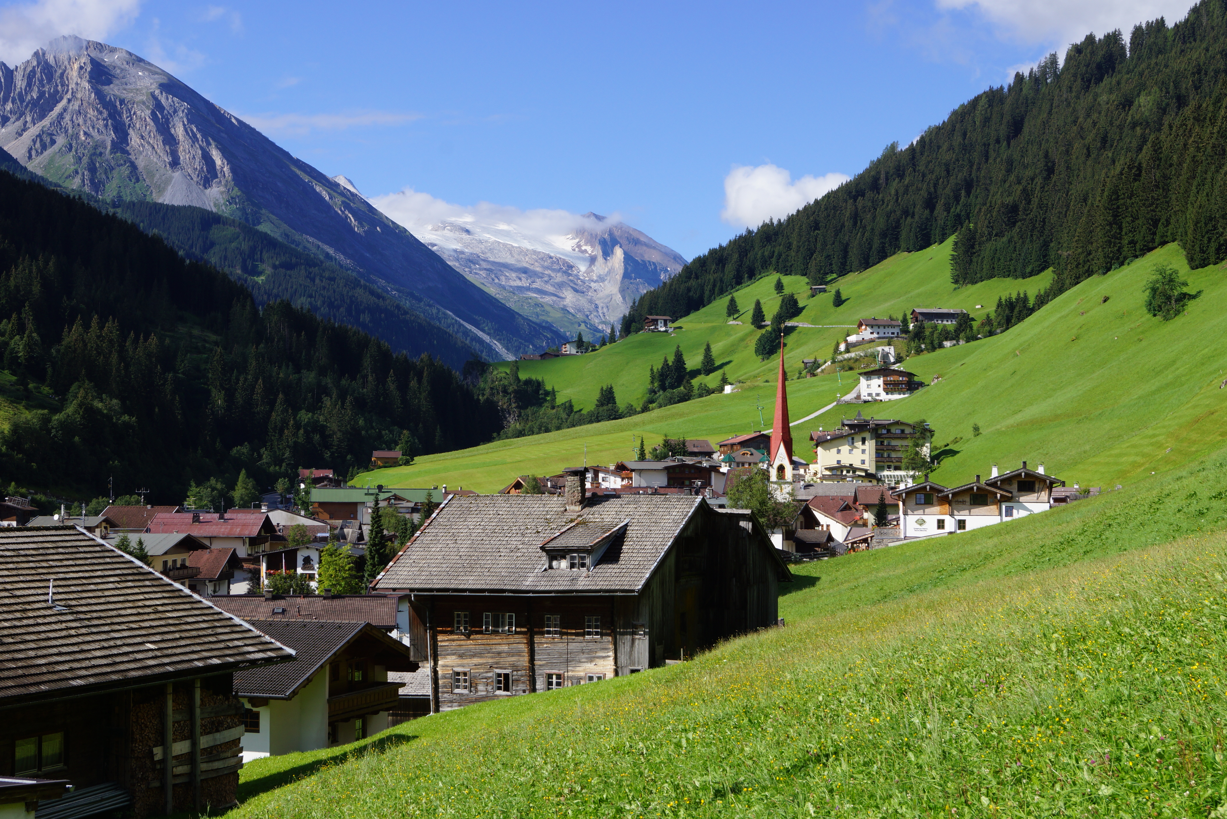
Deutsch: Tuxertal: Wir schauen von Lanersbach (Ortsrand nahe Seilbahn-Talstation auf 1.290 m) talein in südwestlicher Richtung zum
Hintertuxer Gletscher. Diese Talseite (orografisch links) gehört zu den Tuxer, die jenseitige zu den
Zillertaler Alpen.
to share – to copy, distribute and transmit the work
to remix – to adapt the work
Under the following conditions:
attribution – You must give appropriate credit, provide a link to the license, and indicate if changes were made. You may do so in any reasonable manner, but not in any way that suggests the licensor endorses you or your use.
share alike – If you remix, transform, or build upon the material, you must distribute your contributions under the
same or compatible license as the original.
Add a one-line explanation of what this file represents
Lanersbach [T] 1.281 m ü.A.
Долина Туксерталь: Мы смотрим на долину в юго-западном направлении от Ланерсбаха до ледника Хинтертукс. Эта сторона долины (орографически слева) относится к Альпам Туксера, а другая сторона - к Альпам Циллерталь.
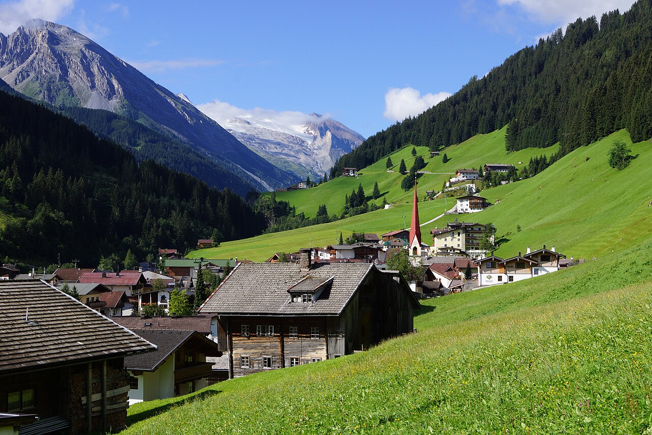


