
Original file (891 × 561 pixels, file size: 149 KB, MIME type: image/png)
| This is a file from the
Wikimedia Commons. Information from its
description page there is shown below. Commons is a freely licensed media file repository. You can help. |
Summary
| Description |
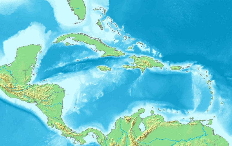
English: Map of the Caribbean and Central America.
Bounding box West -93°, South 7°, East -58°, North 28°. Center at 17°30′00″N 75°30′00″W / 17.50000°N 75.50000°W. |
| Date | |
| Source | Demis map server |
| Author | Demis map server |
| Other versions | Derivative works of this file: La2-demis-caribbean gs.png |
This image is in the
public domain because it came from the site
https://www.demis.nl/products/web-map-server/examples/ and was released by the
copyright holder. Permission is granted to copy, distribute and/or modify this map since it is based on free of copyright images from:
www.demis.nl. See also
approval email on de.wp and
its clarification.
|
| This work has been released into the
public domain by its
copyright holder,
www.demis.nl. This applies worldwide. In some countries this may not be legally possible; if so: www.demis.nl grants anyone the right to use this work for any purpose, without any conditions, unless such conditions are required by law.
|
File history
Click on a date/time to view the file as it appeared at that time.
| Date/Time | Thumbnail | Dimensions | User | Comment | |
|---|---|---|---|---|---|
| current | 05:10, 23 November 2018 |
| 891 × 561 (149 KB) | Opencooper | rm watermark |
| 13:20, 2 September 2005 |
 | 891 × 561 (170 KB) | LA2 | Map of the Carribean and Central America. Bounding box West -93°, South 7°, East -58°, North 28°. {{demis-pd}} category:maps of America |
File usage
More than 100 pages use this file. The following list shows the first 100 pages that use this file only. A full list is available.
- Antigua
- Ballast Key
- Battle of St. Lucia
- Bay Islands Department
- Belize City
- Bequia
- Big Coppitt Key
- Boca Chica Key
- Bocas del Dragón
- Boot Key
- Canouan
- Caribbean Sea
- Carriacou
- Cayman Brac
- Cayo Luis Peña
- Cayo Norte
- Cayos Cochinos
- Columbus Channel
- Crawl Key
- Culebrita
- Culpepper Island
- Dean's Blue Hole
- Desecheo Island
- Dildo Key
- Duck Key
- East Rockland Key
- Fat Deer Key
- French submarine Surcouf
- Galt Island (Florida)
- Gasparilla Island
- Geography of Barbados
- Geography of Grenada
- Geography of Jamaica
- Grand Cayman
- Grenadines
- Gulf of Batabanó
- Havana
- Isla de Cabras
- Keewaydin Island
- Key Largo
- Key Vaca
- Klein Bonaire
- Knights Key
- Knockemdown Key
- Lido Key
- Lime Cay
- Little Cayman
- Little Duck Key
- Little Torch Key
- Long Key
- Long Point Key
- Los Roques Archipelago
- Lower Matecumbe Key
- Mayreau
- Milwaukee Deep
- Missouri Key
- Monito Island
- Morant Cays
- Mustique
- Nassau, Bahamas
- Navy Island, Jamaica
- No Name Key
- Ohio Key
- Palm Island, Grenadines
- Panama City
- Park Key
- Pelican Island (Barbados)
- Petit Nevis
- Petit Saint Vincent
- Pine Island (Lee County, Florida)
- Plantation Key
- Prickly Pear Island
- RMS Rhone
- Ramrod Key
- Redonda
- Roatán
- Rockland Key
- Roncador Cay
- Saddlebunch Keys
- Saint Croix
- Saint John, U.S. Virgin Islands
- Saint Thomas, U.S. Virgin Islands
- Saint Vincent (Saint Vincent and the Grenadines)
- San Juan, Puerto Rico
- San Juan Islet
- Sandals Cay
- Santo Domingo
- Scout Key
- Serrana Bank
- Spanish Virgin Islands
- Stock Island
- Straits of Florida
- Sugarloaf Key
- Sunset Key
- Swan Islands, Honduras
- Terre-de-Bas Island
- Thatch Cay, U.S. Virgin Islands
- Union Island
- Upper Matecumbe Key
- Windley Key
View more links to this file.
Global file usage
The following other wikis use this file:
- Usage on am.wikipedia.org
- Usage on ar.wikipedia.org
- كريستوفر كولومبوس
- تصنيف:أمريكا الشمالية
- كوبا
- بليز
- أمريكا الشمالية
- سورينام
- غيانا
- جامايكا
- غرينادا
- تصنيف:جامايكا
- مونتسرات
- سانت فينسنت والغرينادين
- ترينيداد وتوباغو
- أروبا
- مارتينيك
- تصنيف:ترينيداد وتوباغو
- دولار بربادوسي
- باربادوس
- دولار بهامي
- ناساو
- نشيد جزر البهاما الوطني
- اللغة الهولندية
- .an
- .aw
- البحر الكاريبي
- الكاريبي
- جزر الأنتيل
- جزر الأنتيل الكبرى
- جزر الأنتيل الصغرى
- هسبنيولا
- بورتوريكو
- ترينيداد
- أنتيغوا وباربودا
- .vi
- جزر الأنتيل الهولندية
- جزر العذراء
- جمهورية الدومينيكان
- هايتي
- غوادلوب
- جزر العذراء البريطانية
- جزر العذراء الأمريكية
- دومينيكا
- تصنيف:جمهورية الدومينيكان
- تصنيف:الكاريبي
- سانت لوسيا
- علم أروبا
- سانت كيتس ونيفيس
- بيزو كوبي
- إيان فلمنغ
View more global usage of this file.
Metadata
Original file (891 × 561 pixels, file size: 149 KB, MIME type: image/png)
| This is a file from the
Wikimedia Commons. Information from its
description page there is shown below. Commons is a freely licensed media file repository. You can help. |
Summary
| Description |
English: Map of the Caribbean and Central America.
Bounding box West -93°, South 7°, East -58°, North 28°. Center at 17°30′00″N 75°30′00″W / 17.50000°N 75.50000°W. |
| Date | |
| Source | Demis map server |
| Author | Demis map server |
| Other versions | Derivative works of this file: La2-demis-caribbean gs.png |
This image is in the
public domain because it came from the site
https://www.demis.nl/products/web-map-server/examples/ and was released by the
copyright holder. Permission is granted to copy, distribute and/or modify this map since it is based on free of copyright images from:
www.demis.nl. See also
approval email on de.wp and
its clarification.
|
| This work has been released into the
public domain by its
copyright holder,
www.demis.nl. This applies worldwide. In some countries this may not be legally possible; if so: www.demis.nl grants anyone the right to use this work for any purpose, without any conditions, unless such conditions are required by law.
|
File history
Click on a date/time to view the file as it appeared at that time.
| Date/Time | Thumbnail | Dimensions | User | Comment | |
|---|---|---|---|---|---|
| current | 05:10, 23 November 2018 |
| 891 × 561 (149 KB) | Opencooper | rm watermark |
| 13:20, 2 September 2005 |
| 891 × 561 (170 KB) | LA2 | Map of the Carribean and Central America. Bounding box West -93°, South 7°, East -58°, North 28°. {{demis-pd}} category:maps of America |
File usage
More than 100 pages use this file. The following list shows the first 100 pages that use this file only. A full list is available.
- Antigua
- Ballast Key
- Battle of St. Lucia
- Bay Islands Department
- Belize City
- Bequia
- Big Coppitt Key
- Boca Chica Key
- Bocas del Dragón
- Boot Key
- Canouan
- Caribbean Sea
- Carriacou
- Cayman Brac
- Cayo Luis Peña
- Cayo Norte
- Cayos Cochinos
- Columbus Channel
- Crawl Key
- Culebrita
- Culpepper Island
- Dean's Blue Hole
- Desecheo Island
- Dildo Key
- Duck Key
- East Rockland Key
- Fat Deer Key
- French submarine Surcouf
- Galt Island (Florida)
- Gasparilla Island
- Geography of Barbados
- Geography of Grenada
- Geography of Jamaica
- Grand Cayman
- Grenadines
- Gulf of Batabanó
- Havana
- Isla de Cabras
- Keewaydin Island
- Key Largo
- Key Vaca
- Klein Bonaire
- Knights Key
- Knockemdown Key
- Lido Key
- Lime Cay
- Little Cayman
- Little Duck Key
- Little Torch Key
- Long Key
- Long Point Key
- Los Roques Archipelago
- Lower Matecumbe Key
- Mayreau
- Milwaukee Deep
- Missouri Key
- Monito Island
- Morant Cays
- Mustique
- Nassau, Bahamas
- Navy Island, Jamaica
- No Name Key
- Ohio Key
- Palm Island, Grenadines
- Panama City
- Park Key
- Pelican Island (Barbados)
- Petit Nevis
- Petit Saint Vincent
- Pine Island (Lee County, Florida)
- Plantation Key
- Prickly Pear Island
- RMS Rhone
- Ramrod Key
- Redonda
- Roatán
- Rockland Key
- Roncador Cay
- Saddlebunch Keys
- Saint Croix
- Saint John, U.S. Virgin Islands
- Saint Thomas, U.S. Virgin Islands
- Saint Vincent (Saint Vincent and the Grenadines)
- San Juan, Puerto Rico
- San Juan Islet
- Sandals Cay
- Santo Domingo
- Scout Key
- Serrana Bank
- Spanish Virgin Islands
- Stock Island
- Straits of Florida
- Sugarloaf Key
- Sunset Key
- Swan Islands, Honduras
- Terre-de-Bas Island
- Thatch Cay, U.S. Virgin Islands
- Union Island
- Upper Matecumbe Key
- Windley Key
View more links to this file.
Global file usage
The following other wikis use this file:
- Usage on am.wikipedia.org
- Usage on ar.wikipedia.org
- كريستوفر كولومبوس
- تصنيف:أمريكا الشمالية
- كوبا
- بليز
- أمريكا الشمالية
- سورينام
- غيانا
- جامايكا
- غرينادا
- تصنيف:جامايكا
- مونتسرات
- سانت فينسنت والغرينادين
- ترينيداد وتوباغو
- أروبا
- مارتينيك
- تصنيف:ترينيداد وتوباغو
- دولار بربادوسي
- باربادوس
- دولار بهامي
- ناساو
- نشيد جزر البهاما الوطني
- اللغة الهولندية
- .an
- .aw
- البحر الكاريبي
- الكاريبي
- جزر الأنتيل
- جزر الأنتيل الكبرى
- جزر الأنتيل الصغرى
- هسبنيولا
- بورتوريكو
- ترينيداد
- أنتيغوا وباربودا
- .vi
- جزر الأنتيل الهولندية
- جزر العذراء
- جمهورية الدومينيكان
- هايتي
- غوادلوب
- جزر العذراء البريطانية
- جزر العذراء الأمريكية
- دومينيكا
- تصنيف:جمهورية الدومينيكان
- تصنيف:الكاريبي
- سانت لوسيا
- علم أروبا
- سانت كيتس ونيفيس
- بيزو كوبي
- إيان فلمنغ
View more global usage of this file.