Photos • Location


Size of this preview:
415 × 599 pixels. Other resolutions:
166 × 240 pixels |
333 × 480 pixels |
532 × 768 pixels |
710 × 1,024 pixels |
1,701 × 2,454 pixels.
Original file (1,701 × 2,454 pixels, file size: 2.21 MB, MIME type: image/jpeg)
| This is a file from the
Wikimedia Commons. Information from its
description page there is shown below. Commons is a freely licensed media file repository. You can help. |
Summary
| Description |
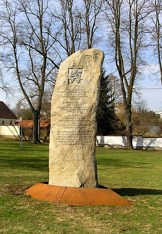
Čeština: Památník příslušníkům kombinovaného oddílu a Československé samostatné obrněné brigádě v Kyšicích u Plzně, slavnostně odhalený 8. května 2008. (V dubnu 1945 se od Čs. samostatné obrněné brigády obléhající francouzský přístav Dunkeque oddělilo 140 mužů, kteří utvořili symbolický kombinovaný oddíl pod vedením majora Sítka. Jeho oddíl, který nedostal povolení překročit americko-sovětskou demarkační linii a zapojit se do Pražského povstání, se v době kapitulace Německa nacházel právě v Kyšicích.)
English: Memorial to members of the combined detachment and the
Czechoslovak Independent Armoured Brigade in Kyšice village, Czech Republic |
| Date | |
| Source | Own work |
| Author | Czech Wikipedia user Packa |
| Permission ( Reusing this file) |
Attribution ShareAlike 3.0 |
| Camera location | | View this and other nearby images on: OpenStreetMap |
|
|---|
|
|
This photograph was taken within the scope of the '
Czech Municipalities Photographs' grant.
|
Licensing
This file is licensed under the
Creative Commons
Attribution-Share Alike 3.0 Unported license.
- You are free:
- to share – to copy, distribute and transmit the work
- to remix – to adapt the work
- Under the following conditions:
- attribution – You must give appropriate credit, provide a link to the license, and indicate if changes were made. You may do so in any reasonable manner, but not in any way that suggests the licensor endorses you or your use.
- share alike – If you remix, transform, or build upon the material, you must distribute your contributions under the same or compatible license as the original.
File history
Click on a date/time to view the file as it appeared at that time.
| Date/Time | Thumbnail | Dimensions | User | Comment | |
|---|---|---|---|---|---|
| current | 20:25, 3 April 2010 |
| 1,701 × 2,454 (2.21 MB) | Packa | {{Information |Description= {{cs| Památník osvobození v Kyšicích u Plzně}} {{en| World War II memorial in Kyšice village, Czech Republic}} |Source={{own}} |Date=2010-03-25 |Author=Czech Wikipedia user Packa |Permission=Attribution Sh |
File usage
The following pages on the English Wikipedia use this file (pages on other projects are not listed):
Global file usage
The following other wikis use this file:
- Usage on cs.wikipedia.org
- Usage on eo.wikipedia.org
- Usage on it.wikipedia.org
- Usage on nl.wikipedia.org
- Usage on uk.wikipedia.org
- Usage on www.wikidata.org
Metadata
Size of this preview:
415 × 599 pixels. Other resolutions:
166 × 240 pixels |
333 × 480 pixels |
532 × 768 pixels |
710 × 1,024 pixels |
1,701 × 2,454 pixels.
Original file (1,701 × 2,454 pixels, file size: 2.21 MB, MIME type: image/jpeg)
| This is a file from the
Wikimedia Commons. Information from its
description page there is shown below. Commons is a freely licensed media file repository. You can help. |
Summary
| Description |
Čeština: Památník příslušníkům kombinovaného oddílu a Československé samostatné obrněné brigádě v Kyšicích u Plzně, slavnostně odhalený 8. května 2008. (V dubnu 1945 se od Čs. samostatné obrněné brigády obléhající francouzský přístav Dunkeque oddělilo 140 mužů, kteří utvořili symbolický kombinovaný oddíl pod vedením majora Sítka. Jeho oddíl, který nedostal povolení překročit americko-sovětskou demarkační linii a zapojit se do Pražského povstání, se v době kapitulace Německa nacházel právě v Kyšicích.)
English: Memorial to members of the combined detachment and the
Czechoslovak Independent Armoured Brigade in Kyšice village, Czech Republic |
| Date | |
| Source | Own work |
| Author | Czech Wikipedia user Packa |
| Permission ( Reusing this file) |
Attribution ShareAlike 3.0 |
| Camera location | | View this and other nearby images on: OpenStreetMap |
|
|---|
|
|
This photograph was taken within the scope of the '
Czech Municipalities Photographs' grant.
|
Licensing
This file is licensed under the
Creative Commons
Attribution-Share Alike 3.0 Unported license.
- You are free:
- to share – to copy, distribute and transmit the work
- to remix – to adapt the work
- Under the following conditions:
- attribution – You must give appropriate credit, provide a link to the license, and indicate if changes were made. You may do so in any reasonable manner, but not in any way that suggests the licensor endorses you or your use.
- share alike – If you remix, transform, or build upon the material, you must distribute your contributions under the same or compatible license as the original.
File history
Click on a date/time to view the file as it appeared at that time.
| Date/Time | Thumbnail | Dimensions | User | Comment | |
|---|---|---|---|---|---|
| current | 20:25, 3 April 2010 |
| 1,701 × 2,454 (2.21 MB) | Packa | {{Information |Description= {{cs| Památník osvobození v Kyšicích u Plzně}} {{en| World War II memorial in Kyšice village, Czech Republic}} |Source={{own}} |Date=2010-03-25 |Author=Czech Wikipedia user Packa |Permission=Attribution Sh |
File usage
The following pages on the English Wikipedia use this file (pages on other projects are not listed):
Global file usage
The following other wikis use this file:
- Usage on cs.wikipedia.org
- Usage on eo.wikipedia.org
- Usage on it.wikipedia.org
- Usage on nl.wikipedia.org
- Usage on uk.wikipedia.org
- Usage on www.wikidata.org