Photos • Location


Size of this preview:
479 × 599 pixels. Other resolutions:
192 × 240 pixels |
384 × 480 pixels |
1,022 × 1,278 pixels.
Original file (1,022 × 1,278 pixels, file size: 731 KB, MIME type: image/jpeg)
| This is a file from the
Wikimedia Commons. Information from its
description page there is shown below. Commons is a freely licensed media file repository. You can help. |
Summary
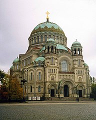
English: Морской собор, Кронштадт, Россия (сентябрь 2004)
This is a photo of a cultural heritage object in Russia, number:
7810287003
| |
|
|
This template and pages using it are maintained by the Russian WLM team. Please read the guidelines before making any changes that can affect the monuments database! |
| Object location |
| View this and other nearby images on: OpenStreetMap |
|
|---|
Licensing
| I, the copyright holder of this work, release this work into the
public domain. This applies worldwide. In some countries this may not be legally possible; if so: I grant anyone the right to use this work for any purpose, without any conditions, unless such conditions are required by law. |
File history
Click on a date/time to view the file as it appeared at that time.
| Date/Time | Thumbnail | Dimensions | User | Comment | |
|---|---|---|---|---|---|
| current | 13:02, 22 April 2006 |
| 1,022 × 1,278 (731 KB) | Volkov | Морской собор, Кронштадт, Россия (сентябрь 2004) Category:Kronstadt |
File usage
No pages on the English Wikipedia use this file (pages on other projects are not listed).
Global file usage
The following other wikis use this file:
- Usage on ar.wikipedia.org
- Usage on be.wikipedia.org
- Usage on ca.wikipedia.org
- Usage on ru.wikipedia.org
Metadata
Size of this preview:
479 × 599 pixels. Other resolutions:
192 × 240 pixels |
384 × 480 pixels |
1,022 × 1,278 pixels.
Original file (1,022 × 1,278 pixels, file size: 731 KB, MIME type: image/jpeg)
| This is a file from the
Wikimedia Commons. Information from its
description page there is shown below. Commons is a freely licensed media file repository. You can help. |
Summary
English: Морской собор, Кронштадт, Россия (сентябрь 2004)
This is a photo of a cultural heritage object in Russia, number:
7810287003
| |
|
|
This template and pages using it are maintained by the Russian WLM team. Please read the guidelines before making any changes that can affect the monuments database! |
| Object location |
| View this and other nearby images on: OpenStreetMap |
|
|---|
Licensing
| I, the copyright holder of this work, release this work into the
public domain. This applies worldwide. In some countries this may not be legally possible; if so: I grant anyone the right to use this work for any purpose, without any conditions, unless such conditions are required by law. |
File history
Click on a date/time to view the file as it appeared at that time.
| Date/Time | Thumbnail | Dimensions | User | Comment | |
|---|---|---|---|---|---|
| current | 13:02, 22 April 2006 |
| 1,022 × 1,278 (731 KB) | Volkov | Морской собор, Кронштадт, Россия (сентябрь 2004) Category:Kronstadt |
File usage
No pages on the English Wikipedia use this file (pages on other projects are not listed).
Global file usage
The following other wikis use this file:
- Usage on ar.wikipedia.org
- Usage on be.wikipedia.org
- Usage on ca.wikipedia.org
- Usage on ru.wikipedia.org