Photos • Location


Size of this preview:
658 × 600 pixels. Other resolutions:
263 × 240 pixels |
527 × 480 pixels |
843 × 768 pixels |
1,124 × 1,024 pixels |
1,378 × 1,256 pixels.
Original file (1,378 × 1,256 pixels, file size: 1.24 MB, MIME type: image/jpeg)
| This is a file from the
Wikimedia Commons. Information from its
description page there is shown below. Commons is a freely licensed media file repository. You can help. |
|
|
This is a photo of a monument in Norway, number:
84807 in the
Norwegian Directorate for Cultural Heritage database.
|
Summary
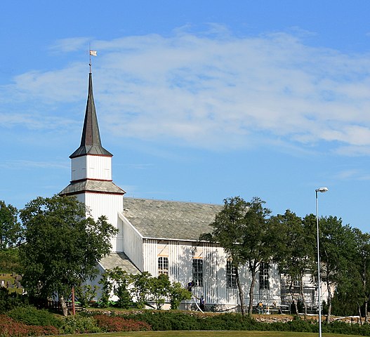
| Description | Kolvereid church, Nærøy, Nord-Trøndelag, Norway. |
| Date | |
| Source | Own work |
| Author | Mahlum |
| Camera location |
| View this and other nearby images on: OpenStreetMap |
|
|---|
Licensing
| This work has been released into the
public domain by its author, I,
Mahlum. This applies worldwide. In some countries this may not be legally possible; if so: I, Mahlum grants anyone the right to use this work for any purpose, without any conditions, unless such conditions are required by law. |
File history
Click on a date/time to view the file as it appeared at that time.
| Date/Time | Thumbnail | Dimensions | User | Comment | |
|---|---|---|---|---|---|
| current | 11:49, 31 July 2007 |
| 1,378 × 1,256 (1.24 MB) | Mahlum | {{Information |Description=Kolvereid church, Nærøy, Nord-Trøndelag, Norway. |Source=self-made |Date=2007-07-27. |Author= Mahlum }} Category:Nærøy Category:Churches of Nord-Trøndelag |
File usage
The following pages on the English Wikipedia use this file (pages on other projects are not listed):
Global file usage
The following other wikis use this file:
- Usage on arz.wikipedia.org
- Usage on bg.wikipedia.org
- Usage on de.wikipedia.org
- Usage on fa.wikipedia.org
- Usage on fi.wikipedia.org
- Usage on is.wikipedia.org
- Usage on nl.wikipedia.org
- Usage on nn.wikipedia.org
- Usage on no.wikipedia.org
- Usage on ru.wikipedia.org
- Usage on www.wikidata.org
Metadata
Size of this preview:
658 × 600 pixels. Other resolutions:
263 × 240 pixels |
527 × 480 pixels |
843 × 768 pixels |
1,124 × 1,024 pixels |
1,378 × 1,256 pixels.
Original file (1,378 × 1,256 pixels, file size: 1.24 MB, MIME type: image/jpeg)
| This is a file from the
Wikimedia Commons. Information from its
description page there is shown below. Commons is a freely licensed media file repository. You can help. |
|
|
This is a photo of a monument in Norway, number:
84807 in the
Norwegian Directorate for Cultural Heritage database.
|
Summary
| Description | Kolvereid church, Nærøy, Nord-Trøndelag, Norway. |
| Date | |
| Source | Own work |
| Author | Mahlum |
| Camera location |
| View this and other nearby images on: OpenStreetMap |
|
|---|
Licensing
| This work has been released into the
public domain by its author, I,
Mahlum. This applies worldwide. In some countries this may not be legally possible; if so: I, Mahlum grants anyone the right to use this work for any purpose, without any conditions, unless such conditions are required by law. |
File history
Click on a date/time to view the file as it appeared at that time.
| Date/Time | Thumbnail | Dimensions | User | Comment | |
|---|---|---|---|---|---|
| current | 11:49, 31 July 2007 |
| 1,378 × 1,256 (1.24 MB) | Mahlum | {{Information |Description=Kolvereid church, Nærøy, Nord-Trøndelag, Norway. |Source=self-made |Date=2007-07-27. |Author= Mahlum }} Category:Nærøy Category:Churches of Nord-Trøndelag |
File usage
The following pages on the English Wikipedia use this file (pages on other projects are not listed):
Global file usage
The following other wikis use this file:
- Usage on arz.wikipedia.org
- Usage on bg.wikipedia.org
- Usage on de.wikipedia.org
- Usage on fa.wikipedia.org
- Usage on fi.wikipedia.org
- Usage on is.wikipedia.org
- Usage on nl.wikipedia.org
- Usage on nn.wikipedia.org
- Usage on no.wikipedia.org
- Usage on ru.wikipedia.org
- Usage on www.wikidata.org