
Original file (1,000 × 1,100 pixels, file size: 860 KB, MIME type: image/jpeg)
| This is a file from the
Wikimedia Commons. Information from its
description page there is shown below. Commons is a freely licensed media file repository. You can help. |
Summary
| Description |
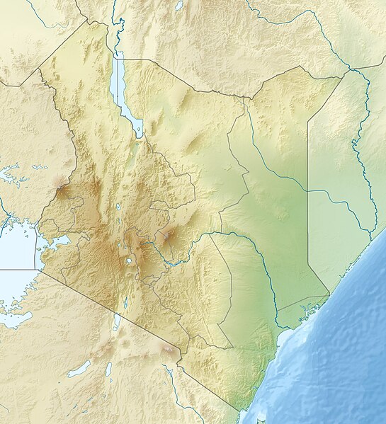
English: Location map of Kenya
Equirectangular projection. Strechted by 100.0%. Geographic limits of the map:
|
| Date | |
| Source | Own work |
| Author | Uwe Dedering |
| Other versions |
|

Licensing
- You are free:
- to share – to copy, distribute and transmit the work
- to remix – to adapt the work
- Under the following conditions:
- attribution – You must give appropriate credit, provide a link to the license, and indicate if changes were made. You may do so in any reasonable manner, but not in any way that suggests the licensor endorses you or your use.
- share alike – If you remix, transform, or build upon the material, you must distribute your contributions under the same or compatible license as the original.

|
Permission is granted to copy, distribute and/or modify this document under the terms of the GNU Free Documentation License, Version 1.2 or any later version published by the Free Software Foundation; with no Invariant Sections, no Front-Cover Texts, and no Back-Cover Texts. A copy of the license is included in the section entitled GNU Free Documentation License. |
File history
Click on a date/time to view the file as it appeared at that time.
| Date/Time | Thumbnail | Dimensions | User | Comment | |
|---|---|---|---|---|---|
| current | 11:41, 24 April 2010 |
| 1,000 × 1,100 (860 KB) | Uwe Dedering | {{Information |Description={{en|1=|Location map of Kenya Equirectangular projection. Strechted by 100.0%. Geographic limits of the map: * N: 6.0° N * S: -5.0° N * W: 33.0° E * E: 43.0° E Made with Natural Earth. Free vector and raster map data @ natur |
File usage
More than 100 pages use this file. The following list shows the first 100 pages that use this file only. A full list is available.
- Aberdare National Park
- Aberdare Range
- Amboseli National Park
- Arawale National Reserve
- Boni National Reserve
- Broglio Space Center
- Buffalo Springs National Reserve
- Central Island
- Cherang'any Hills
- Elmenteita Badlands
- Embu, Kenya
- Emuruangogolak
- Enkapune Ya Muto
- Fort Jesus
- Gitaru Hydroelectric Power Station
- Great Rift Valley, Kenya
- Hell's Gate National Park
- Hyrax Hill
- Kakamega
- Kalokol Pillar Site
- Kamburu Dam
- Kenya Open
- Kerio Valley
- Kerio Valley National Reserve
- Kerugoya
- Kiambere Hydroelectric Power Station
- Kigio Wildlife Conservancy
- Kinangop Plateau
- Kindaruma Hydroelectric Power Station
- Kisumu
- Kisumu Impala Sanctuary
- Kora National Park
- Korosi
- Lake Baringo
- Lake Bogoria
- Lake Bogoria National Reserve
- Lake Elmenteita
- Lake Jipe
- Lake Kamnarok
- Lake Logipi
- Lake Magadi
- Lake Naivasha
- Lake Nakuru
- Lake Solai
- Lake Turkana
- Lake Turkana National Parks
- Lamu Fort
- Lapurr Sandstone
- Losiolo Escarpment
- Maasai Mara
- Mara Triangle
- Marsabit National Park
- Matthews Range
- Mau Escarpment
- Menengai
- Meru National Park
- Mochongoi
- Mombasa
- Mombasa Marine National Park and Reserve
- Mount Elgon
- Mount Homa
- Mount Kenya
- Mount Kenya National Park
- Mount Kinangop
- Mount Kipipiri
- Mount Kulal
- Mount Longonot
- Mount Mtelo
- Mount Ng'iro
- Mount Satima
- Mount Silali
- Mount Suswa
- Moyale Airport
- Msambweni
- Nairobi
- Nairobi National Park
- Nairobi River
- Namarunu
- Nguruman Escarpment
- Ol Arabel
- Ol Doinyo Eburru
- Ol Donyo Sabuk
- Olkaria
- Paka (volcano)
- Ruins of Gedi
- Ruma National Park
- Saiwa Swamp National Park
- Samburu National Reserve
- Shaba National Reserve
- Shimba Hills National Reserve
- Shompole Conservancy
- Sibiloi National Park
- Suguta Valley
- Tana River Delta Ramsar Site
- The Barrier (Kenya)
- Thika Dam
- Turkwel Hydroelectric Power Station
- Umoja, Kenya
- Waseges River
- Witu Forest
View more links to this file.
Global file usage
The following other wikis use this file:
- Usage on als.wikipedia.org
- Usage on ar.wikipedia.org
- Usage on arz.wikipedia.org
- Usage on azb.wikipedia.org
- Usage on az.wikipedia.org
- Usage on ban.wikipedia.org
- Usage on ba.wikipedia.org
- Usage on be.wikipedia.org
- Usage on bg.wikipedia.org
View more global usage of this file.
Metadata
Original file (1,000 × 1,100 pixels, file size: 860 KB, MIME type: image/jpeg)
| This is a file from the
Wikimedia Commons. Information from its
description page there is shown below. Commons is a freely licensed media file repository. You can help. |
Summary
| Description |
English: Location map of Kenya
Equirectangular projection. Strechted by 100.0%. Geographic limits of the map:
|
| Date | |
| Source | Own work |
| Author | Uwe Dedering |
| Other versions |
|
Licensing
- You are free:
- to share – to copy, distribute and transmit the work
- to remix – to adapt the work
- Under the following conditions:
- attribution – You must give appropriate credit, provide a link to the license, and indicate if changes were made. You may do so in any reasonable manner, but not in any way that suggests the licensor endorses you or your use.
- share alike – If you remix, transform, or build upon the material, you must distribute your contributions under the same or compatible license as the original.
|
|
Permission is granted to copy, distribute and/or modify this document under the terms of the GNU Free Documentation License, Version 1.2 or any later version published by the Free Software Foundation; with no Invariant Sections, no Front-Cover Texts, and no Back-Cover Texts. A copy of the license is included in the section entitled GNU Free Documentation License. |
File history
Click on a date/time to view the file as it appeared at that time.
| Date/Time | Thumbnail | Dimensions | User | Comment | |
|---|---|---|---|---|---|
| current | 11:41, 24 April 2010 |
| 1,000 × 1,100 (860 KB) | Uwe Dedering | {{Information |Description={{en|1=|Location map of Kenya Equirectangular projection. Strechted by 100.0%. Geographic limits of the map: * N: 6.0° N * S: -5.0° N * W: 33.0° E * E: 43.0° E Made with Natural Earth. Free vector and raster map data @ natur |
File usage
More than 100 pages use this file. The following list shows the first 100 pages that use this file only. A full list is available.
- Aberdare National Park
- Aberdare Range
- Amboseli National Park
- Arawale National Reserve
- Boni National Reserve
- Broglio Space Center
- Buffalo Springs National Reserve
- Central Island
- Cherang'any Hills
- Elmenteita Badlands
- Embu, Kenya
- Emuruangogolak
- Enkapune Ya Muto
- Fort Jesus
- Gitaru Hydroelectric Power Station
- Great Rift Valley, Kenya
- Hell's Gate National Park
- Hyrax Hill
- Kakamega
- Kalokol Pillar Site
- Kamburu Dam
- Kenya Open
- Kerio Valley
- Kerio Valley National Reserve
- Kerugoya
- Kiambere Hydroelectric Power Station
- Kigio Wildlife Conservancy
- Kinangop Plateau
- Kindaruma Hydroelectric Power Station
- Kisumu
- Kisumu Impala Sanctuary
- Kora National Park
- Korosi
- Lake Baringo
- Lake Bogoria
- Lake Bogoria National Reserve
- Lake Elmenteita
- Lake Jipe
- Lake Kamnarok
- Lake Logipi
- Lake Magadi
- Lake Naivasha
- Lake Nakuru
- Lake Solai
- Lake Turkana
- Lake Turkana National Parks
- Lamu Fort
- Lapurr Sandstone
- Losiolo Escarpment
- Maasai Mara
- Mara Triangle
- Marsabit National Park
- Matthews Range
- Mau Escarpment
- Menengai
- Meru National Park
- Mochongoi
- Mombasa
- Mombasa Marine National Park and Reserve
- Mount Elgon
- Mount Homa
- Mount Kenya
- Mount Kenya National Park
- Mount Kinangop
- Mount Kipipiri
- Mount Kulal
- Mount Longonot
- Mount Mtelo
- Mount Ng'iro
- Mount Satima
- Mount Silali
- Mount Suswa
- Moyale Airport
- Msambweni
- Nairobi
- Nairobi National Park
- Nairobi River
- Namarunu
- Nguruman Escarpment
- Ol Arabel
- Ol Doinyo Eburru
- Ol Donyo Sabuk
- Olkaria
- Paka (volcano)
- Ruins of Gedi
- Ruma National Park
- Saiwa Swamp National Park
- Samburu National Reserve
- Shaba National Reserve
- Shimba Hills National Reserve
- Shompole Conservancy
- Sibiloi National Park
- Suguta Valley
- Tana River Delta Ramsar Site
- The Barrier (Kenya)
- Thika Dam
- Turkwel Hydroelectric Power Station
- Umoja, Kenya
- Waseges River
- Witu Forest
View more links to this file.
Global file usage
The following other wikis use this file:
- Usage on als.wikipedia.org
- Usage on ar.wikipedia.org
- Usage on arz.wikipedia.org
- Usage on azb.wikipedia.org
- Usage on az.wikipedia.org
- Usage on ban.wikipedia.org
- Usage on ba.wikipedia.org
- Usage on be.wikipedia.org
- Usage on bg.wikipedia.org
View more global usage of this file.