Size of this preview:
575 × 600 pixels. Other resolutions:
230 × 240 pixels |
460 × 480 pixels |
736 × 768 pixels |
982 × 1,024 pixels |
2,066 × 2,155 pixels.
Original file (2,066 × 2,155 pixels, file size: 1.08 MB, MIME type: image/png)
| This is a file from the
Wikimedia Commons. Information from its
description page there is shown below. Commons is a freely licensed media file repository. You can help. |
| Description |
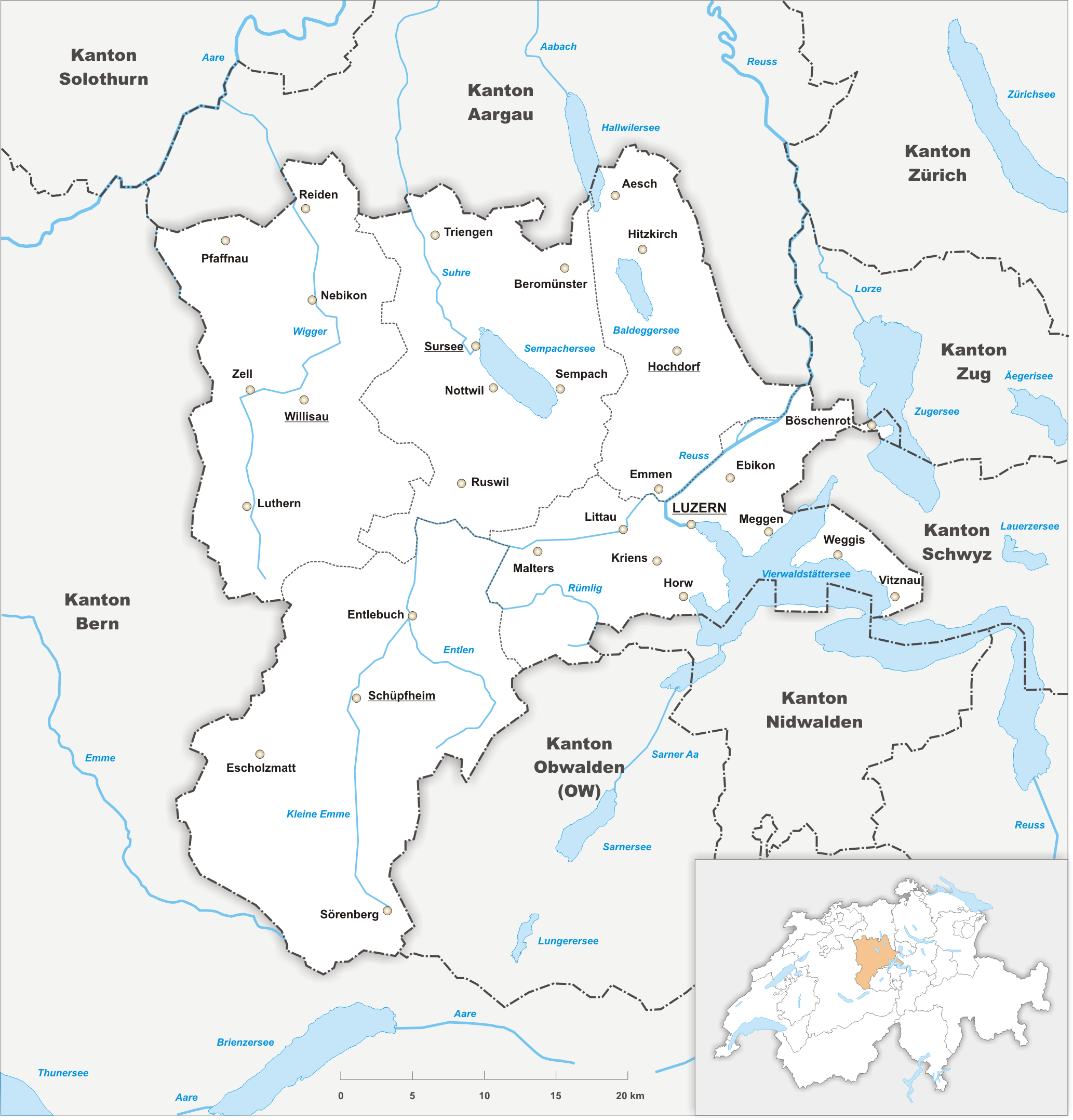
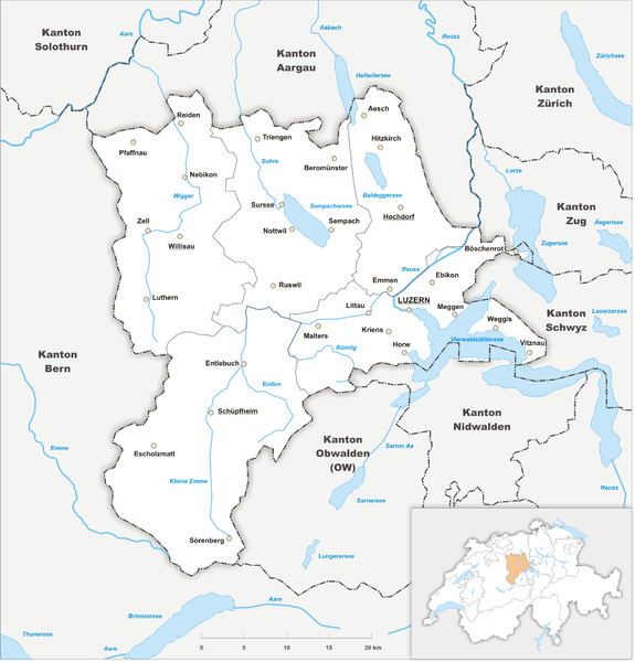
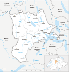
Deutsch: Karte des
Kanton Luzern. |
||||||||
| Date | |||||||||
| Source | Own work | ||||||||
| Author | Tschubby | ||||||||
| Permission ( Reusing this file) |
I, the copyright holder of this work, hereby publish it under the following licenses:
This file is licensed under the
Creative Commons Attribution-Share Alike
2.5 Generic,
2.0 Generic and
1.0 Generic license.
You may select the license of your choice. |

File history
Click on a date/time to view the file as it appeared at that time.
| Date/Time | Thumbnail | Dimensions | User | Comment | |
|---|---|---|---|---|---|
| current | 17:06, 27 October 2009 |
| 2,066 × 2,155 (1.08 MB) | Tschubby | {{Information |Description= |Source= |Date= |Author= |Permission= |other_versions= }} |
| 16:36, 27 October 2009 |
 | 2,066 × 2,155 (1.08 MB) | Tschubby | {{Information |Description= |Source= |Date= |Author= |Permission= |other_versions= }} | |
| 20:49, 26 October 2009 |
 | 2,066 × 2,155 (1.08 MB) | Tschubby | {{Information |Description= {{de| Karte des Kanton Luzern.}} |Source={{own}} |Date= 26.10.2009 |Author= Tschubby |Permission= {{self|GFDL|Cc-by-sa-3.0-migrated|Cc-by-sa-2.5,2.0,1.0}} }} [[Category:Maps of the c |
File usage
The following pages on the English Wikipedia use this file (pages on other projects are not listed):
Global file usage
The following other wikis use this file:
- Usage on als.wikipedia.org
- Usage on de.wikipedia.org
- Usage on es.wikipedia.org
- Usage on hr.wikipedia.org
- Usage on simple.wikipedia.org
- Usage on sr.wikipedia.org
- Usage on th.wikipedia.org
- Usage on ur.wikipedia.org
- Usage on vi.wikipedia.org
- Usage on zh.wikipedia.org
Size of this preview:
575 × 600 pixels. Other resolutions:
230 × 240 pixels |
460 × 480 pixels |
736 × 768 pixels |
982 × 1,024 pixels |
2,066 × 2,155 pixels.
Original file (2,066 × 2,155 pixels, file size: 1.08 MB, MIME type: image/png)
| This is a file from the
Wikimedia Commons. Information from its
description page there is shown below. Commons is a freely licensed media file repository. You can help. |
| Description |
Deutsch: Karte des
Kanton Luzern. |
||||||||
| Date | |||||||||
| Source | Own work | ||||||||
| Author | Tschubby | ||||||||
| Permission ( Reusing this file) |
I, the copyright holder of this work, hereby publish it under the following licenses:
This file is licensed under the
Creative Commons Attribution-Share Alike
2.5 Generic,
2.0 Generic and
1.0 Generic license.
You may select the license of your choice. |
File history
Click on a date/time to view the file as it appeared at that time.
| Date/Time | Thumbnail | Dimensions | User | Comment | |
|---|---|---|---|---|---|
| current | 17:06, 27 October 2009 |
| 2,066 × 2,155 (1.08 MB) | Tschubby | {{Information |Description= |Source= |Date= |Author= |Permission= |other_versions= }} |
| 16:36, 27 October 2009 |
| 2,066 × 2,155 (1.08 MB) | Tschubby | {{Information |Description= |Source= |Date= |Author= |Permission= |other_versions= }} | |
| 20:49, 26 October 2009 |
| 2,066 × 2,155 (1.08 MB) | Tschubby | {{Information |Description= {{de| Karte des Kanton Luzern.}} |Source={{own}} |Date= 26.10.2009 |Author= Tschubby |Permission= {{self|GFDL|Cc-by-sa-3.0-migrated|Cc-by-sa-2.5,2.0,1.0}} }} [[Category:Maps of the c |
File usage
The following pages on the English Wikipedia use this file (pages on other projects are not listed):
Global file usage
The following other wikis use this file:
- Usage on als.wikipedia.org
- Usage on de.wikipedia.org
- Usage on es.wikipedia.org
- Usage on hr.wikipedia.org
- Usage on simple.wikipedia.org
- Usage on sr.wikipedia.org
- Usage on th.wikipedia.org
- Usage on ur.wikipedia.org
- Usage on vi.wikipedia.org
- Usage on zh.wikipedia.org