
Original file (614 × 1,141 pixels, file size: 179 KB, MIME type: image/jpeg)
| This is a file from the
Wikimedia Commons. Information from its
description page there is shown below. Commons is a freely licensed media file repository. You can help. |

|
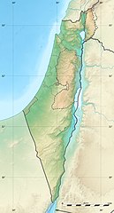
The boundaries on this map show the de facto situation. This is just one of several different views on the subject (see COM:NPOV). |
Summary
| Camera location |
| View this and other nearby images on: OpenStreetMap |
|
|---|
| Description |
Deutsch: Positionskarte von
Israel. De-facto-Situation.
Quadratische Plattkarte, N-S-Streckung 115 %. Geographische Begrenzung der Karte: English: Location map of
Israel. De facto situation.
Français : Carte physique vierge d'
Israël, destinée à la géolocalisation.
Equirectangular projection, N/S stretching 115 %.
Geographic limits of the map:
|
||
| Date | |||
| Source |
Topographic background map: Own work
|
||
| Author | Eric Gaba ( Sting - fr:Sting) and NordNordWest | ||
| Permission ( Reusing this file) |
|
||
| Other versions |
|
||
| JPG development |
|


Licensing

|
Permission is granted to copy, distribute and/or modify this document under the terms of the GNU Free Documentation License, Version 1.2 or any later version published by the Free Software Foundation; with no Invariant Sections, no Front-Cover Texts, and no Back-Cover Texts. A copy of the license is included in the section entitled GNU Free Documentation License. |
- You are free:
- to share – to copy, distribute and transmit the work
- to remix – to adapt the work
- Under the following conditions:
- attribution – You must give appropriate credit, provide a link to the license, and indicate if changes were made. You may do so in any reasonable manner, but not in any way that suggests the licensor endorses you or your use.
- share alike – If you remix, transform, or build upon the material, you must distribute your contributions under the same or compatible license as the original.
File history
Click on a date/time to view the file as it appeared at that time.
| Date/Time | Thumbnail | Dimensions | User | Comment | |
|---|---|---|---|---|---|
| current | 22:49, 3 August 2011 |
| 614 × 1,141 (179 KB) | Sting | == {{int:filedesc}} == {{Location|31|24|00|N|35|00|00|E|scale:2000000}} {{Information |Description= {{de|Positionskarte von Israel. De-facto-Situation.}} Quadratische Plattkarte, N-S-Streckung 115 %. Geographische Begrenzung der Karte: {{en |
File usage
More than 100 pages use this file. The following list shows the first 100 pages that use this file only. A full list is available.
- 'En Esur
- Abu Zurayq
- Acts 10
- Acts 12
- Acts 23
- Acts 24
- Acts 25
- Acts 26
- Acts 8
- Adullam
- Amud Cave
- Ashkelon
- Baháʼí World Centre buildings
- Bar'am National Park
- Bareket Observatory
- Bat Yam
- Battle of Cresson
- Battle of Fahl
- Battle of Hattin
- Battle of Jericho
- Battle of Megiddo (15th century BC)
- Battle of Megiddo (609 BC)
- Battle of Mount Tabor (1799)
- Battle of the Yarmuk
- Beit She'arim necropolis
- Bersabe
- Bnei Brak
- Cafarlet
- Chezib of Judah
- Council of Jamnia
- Dan (ancient city)
- Dead Sea
- Degania Dam
- Eilat Mountains
- First siege of Arsuf
- Geography of Israel
- Gesher (archaeological site)
- Givatayim Observatory
- HaYonim Cave
- Herzliya
- Holon
- Imad Abu Zahra
- Incense Route – Desert Cities in the Negev
- Israel
- Judaean Mountains
- Korazim Plateau
- Ktzi'ot Prison
- Makhtesh Ramon
- Manot Cave
- Maresha
- Mishash Formation
- Misliya Cave
- Mount Arbel
- Mount Betarim
- Mount Harif
- Mount Meron
- Mount Nitai
- Mount Ramon
- Mount Tabor
- Munhata
- Nahal Amud
- Nahal Hemar Cave
- Nahal Me'arot Nature Reserve
- Nahal Oren (archaeological site)
- Nazeh Darwazi
- Negev Mountains
- Petah Tikva
- Ptolemais in Phoenicia
- Qibya massacre
- Ramat Gan
- Raqefet Cave
- Rishon LeZion
- Sands of Samar
- Sea of Galilee
- Shikhin
- Siege of Jerusalem (1244)
- Siege of Jerusalem (1834)
- Siege of Jerusalem (597 BC)
- Siege of Yodfat
- Skhul Cave
- Tabun Cave
- Tel Aviv
- Tel Hanaton
- Tel Lachish
- Tel Qiri
- Tel Yokneam
- Tel Zayit
- Tel Zeton
- Tell Qudadi
- Tell ej-Judeideh
- Three lookouts
- Wedding at Cana
- White City (Tel Aviv)
- Wise Observatory
- Yeruham Dam
- ʿAin Mallaha
- User:Archaeobuf/sandbox/Ajjul
- User:Falcaorib
- User:ክርስቶስሰምራ/sandbox
- Template:Israel Geographical Map
View more links to this file.
Global file usage
The following other wikis use this file:
- Usage on als.wikipedia.org
- Usage on am.wikipedia.org
- Usage on ar.wikipedia.org
- Usage on ary.wikipedia.org
- Usage on arz.wikipedia.org
- Usage on ast.wikipedia.org
- Usage on av.wikipedia.org
- Usage on azb.wikipedia.org
- Usage on az.wikipedia.org
- Usage on ba.wikipedia.org
- Usage on be.wikipedia.org
View more global usage of this file.
Metadata
Original file (614 × 1,141 pixels, file size: 179 KB, MIME type: image/jpeg)
| This is a file from the
Wikimedia Commons. Information from its
description page there is shown below. Commons is a freely licensed media file repository. You can help. |
|
|
The boundaries on this map show the de facto situation. This is just one of several different views on the subject (see COM:NPOV). |
Summary
| Camera location |
| View this and other nearby images on: OpenStreetMap |
|
|---|
| Description |
Deutsch: Positionskarte von
Israel. De-facto-Situation.
Quadratische Plattkarte, N-S-Streckung 115 %. Geographische Begrenzung der Karte: English: Location map of
Israel. De facto situation.
Français : Carte physique vierge d'
Israël, destinée à la géolocalisation.
Equirectangular projection, N/S stretching 115 %.
Geographic limits of the map:
|
||
| Date | |||
| Source |
Topographic background map: Own work
|
||
| Author | Eric Gaba ( Sting - fr:Sting) and NordNordWest | ||
| Permission ( Reusing this file) |
|
||
| Other versions |
|
||
| JPG development |
|
Licensing
|
|
Permission is granted to copy, distribute and/or modify this document under the terms of the GNU Free Documentation License, Version 1.2 or any later version published by the Free Software Foundation; with no Invariant Sections, no Front-Cover Texts, and no Back-Cover Texts. A copy of the license is included in the section entitled GNU Free Documentation License. |
- You are free:
- to share – to copy, distribute and transmit the work
- to remix – to adapt the work
- Under the following conditions:
- attribution – You must give appropriate credit, provide a link to the license, and indicate if changes were made. You may do so in any reasonable manner, but not in any way that suggests the licensor endorses you or your use.
- share alike – If you remix, transform, or build upon the material, you must distribute your contributions under the same or compatible license as the original.
File history
Click on a date/time to view the file as it appeared at that time.
| Date/Time | Thumbnail | Dimensions | User | Comment | |
|---|---|---|---|---|---|
| current | 22:49, 3 August 2011 |
| 614 × 1,141 (179 KB) | Sting | == {{int:filedesc}} == {{Location|31|24|00|N|35|00|00|E|scale:2000000}} {{Information |Description= {{de|Positionskarte von Israel. De-facto-Situation.}} Quadratische Plattkarte, N-S-Streckung 115 %. Geographische Begrenzung der Karte: {{en |
File usage
More than 100 pages use this file. The following list shows the first 100 pages that use this file only. A full list is available.
- 'En Esur
- Abu Zurayq
- Acts 10
- Acts 12
- Acts 23
- Acts 24
- Acts 25
- Acts 26
- Acts 8
- Adullam
- Amud Cave
- Ashkelon
- Baháʼí World Centre buildings
- Bar'am National Park
- Bareket Observatory
- Bat Yam
- Battle of Cresson
- Battle of Fahl
- Battle of Hattin
- Battle of Jericho
- Battle of Megiddo (15th century BC)
- Battle of Megiddo (609 BC)
- Battle of Mount Tabor (1799)
- Battle of the Yarmuk
- Beit She'arim necropolis
- Bersabe
- Bnei Brak
- Cafarlet
- Chezib of Judah
- Council of Jamnia
- Dan (ancient city)
- Dead Sea
- Degania Dam
- Eilat Mountains
- First siege of Arsuf
- Geography of Israel
- Gesher (archaeological site)
- Givatayim Observatory
- HaYonim Cave
- Herzliya
- Holon
- Imad Abu Zahra
- Incense Route – Desert Cities in the Negev
- Israel
- Judaean Mountains
- Korazim Plateau
- Ktzi'ot Prison
- Makhtesh Ramon
- Manot Cave
- Maresha
- Mishash Formation
- Misliya Cave
- Mount Arbel
- Mount Betarim
- Mount Harif
- Mount Meron
- Mount Nitai
- Mount Ramon
- Mount Tabor
- Munhata
- Nahal Amud
- Nahal Hemar Cave
- Nahal Me'arot Nature Reserve
- Nahal Oren (archaeological site)
- Nazeh Darwazi
- Negev Mountains
- Petah Tikva
- Ptolemais in Phoenicia
- Qibya massacre
- Ramat Gan
- Raqefet Cave
- Rishon LeZion
- Sands of Samar
- Sea of Galilee
- Shikhin
- Siege of Jerusalem (1244)
- Siege of Jerusalem (1834)
- Siege of Jerusalem (597 BC)
- Siege of Yodfat
- Skhul Cave
- Tabun Cave
- Tel Aviv
- Tel Hanaton
- Tel Lachish
- Tel Qiri
- Tel Yokneam
- Tel Zayit
- Tel Zeton
- Tell Qudadi
- Tell ej-Judeideh
- Three lookouts
- Wedding at Cana
- White City (Tel Aviv)
- Wise Observatory
- Yeruham Dam
- ʿAin Mallaha
- User:Archaeobuf/sandbox/Ajjul
- User:Falcaorib
- User:ክርስቶስሰምራ/sandbox
- Template:Israel Geographical Map
View more links to this file.
Global file usage
The following other wikis use this file:
- Usage on als.wikipedia.org
- Usage on am.wikipedia.org
- Usage on ar.wikipedia.org
- Usage on ary.wikipedia.org
- Usage on arz.wikipedia.org
- Usage on ast.wikipedia.org
- Usage on av.wikipedia.org
- Usage on azb.wikipedia.org
- Usage on az.wikipedia.org
- Usage on ba.wikipedia.org
- Usage on be.wikipedia.org
View more global usage of this file.