Original file (1,520 × 1,100 pixels, file size: 308 KB, MIME type: image/jpeg)
| This is a file from the
Wikimedia Commons. Information from its
description page there is shown below. Commons is a freely licensed media file repository. You can help. |
| This work is from the Library of Congress. According to the library, there are no known copyright restrictions on the use of this work. |  |
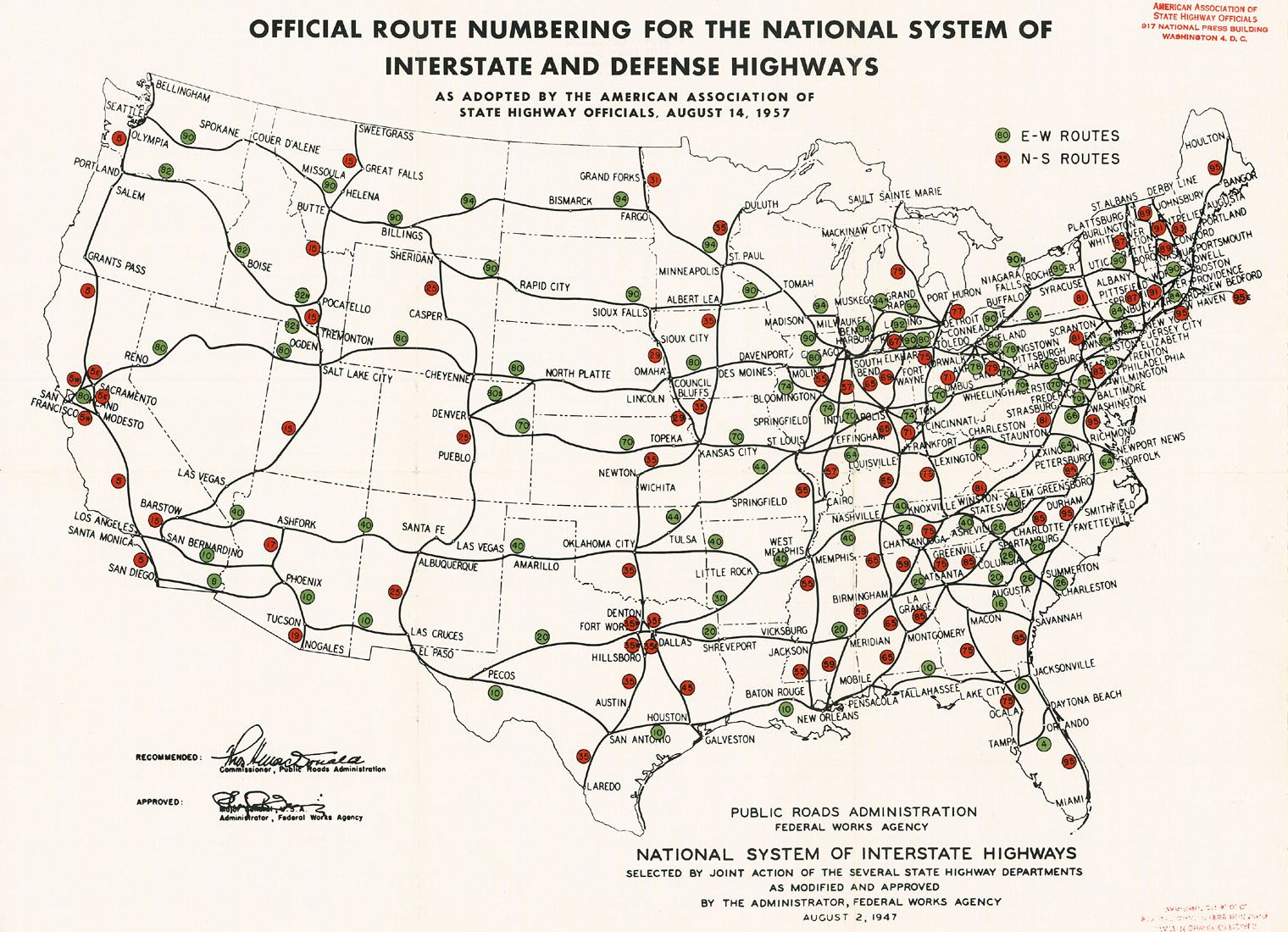
Interstate Highway plan approved August 14, 1957. Originally scanned by Richard Moeur and downloaded from [1].
![[1]](http://www.roadfan.com/aug57int.jpg)
This was drawn directly on the August 2, 1947 map, and thus does not include the changes made by September 1955.
| Interstate Highway System planning maps | ||
|---|---|---|
| September 1955 | August 14, 1957 | October 17, 1957: map 1 - map 2 - map 3 |
File history
Click on a date/time to view the file as it appeared at that time.
| Date/Time | Thumbnail | Dimensions | User | Comment | |
|---|---|---|---|---|---|
| current | 18:53, 14 December 2005 |
| 1,520 × 1,100 (308 KB) | SPUI~commonswiki | {{PD-USGov}} Interstate Highway plan approved August 14, 1957. Originally scanned by Richard Moeur and downloaded from [http://www.roadfan.com/aug57int.jpg]. Category:Interstate Highways Category:road maps |
File usage
Metadata
Original file (1,520 × 1,100 pixels, file size: 308 KB, MIME type: image/jpeg)
| This is a file from the
Wikimedia Commons. Information from its
description page there is shown below. Commons is a freely licensed media file repository. You can help. |
| This work is from the Library of Congress. According to the library, there are no known copyright restrictions on the use of this work. | |
Interstate Highway plan approved August 14, 1957. Originally scanned by Richard Moeur and downloaded from [1].
This was drawn directly on the August 2, 1947 map, and thus does not include the changes made by September 1955.
| Interstate Highway System planning maps | ||
|---|---|---|
| September 1955 | August 14, 1957 | October 17, 1957: map 1 - map 2 - map 3 |
File history
Click on a date/time to view the file as it appeared at that time.
| Date/Time | Thumbnail | Dimensions | User | Comment | |
|---|---|---|---|---|---|
| current | 18:53, 14 December 2005 |
| 1,520 × 1,100 (308 KB) | SPUI~commonswiki | {{PD-USGov}} Interstate Highway plan approved August 14, 1957. Originally scanned by Richard Moeur and downloaded from [http://www.roadfan.com/aug57int.jpg]. Category:Interstate Highways Category:road maps |