Photos • Location


Size of this preview:
800 × 527 pixels. Other resolutions:
320 × 211 pixels |
640 × 421 pixels |
992 × 653 pixels.
Original file (992 × 653 pixels, file size: 1.48 MB, MIME type: image/png)
| This is a file from the
Wikimedia Commons. Information from its
description page there is shown below. Commons is a freely licensed media file repository. You can help. |
| Description |
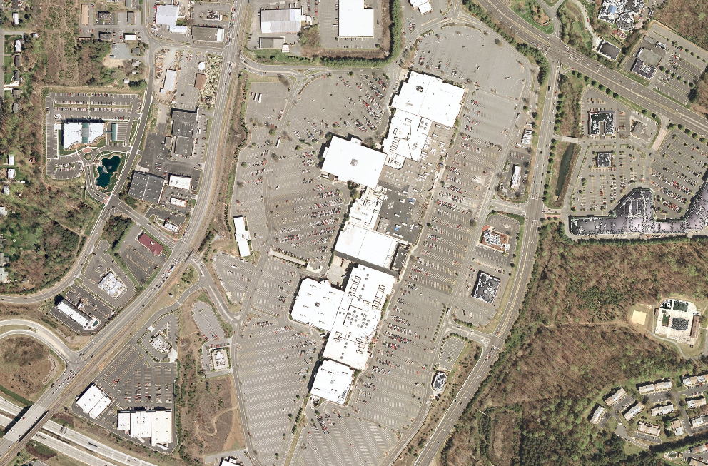
English:
Hanes Mall satellite view, nasa world wind 1.3.5 |
| Source | Satellite imagery taken from NASA World Wind software (by screenshot) |
| Author | Photograph: NASA |
| Object location |
| View this and other nearby images on: OpenStreetMap |
|
|---|
Licensing
| This image is in the
public domain because it is a screenshot from
NASA’s globe software
World Wind using a public domain layer, such as Blue Marble, MODIS, Landsat, SRTM, USGS or GLOBE.
|
 |
Original upload log
The original description page was
here. All following user names refer to fr.wikipedia.
- 2006-08-14 07:48 Betp 992×653×??? (1547913 bytes) nasa world wind 1.3.5
File history
Click on a date/time to view the file as it appeared at that time.
| Date/Time | Thumbnail | Dimensions | User | Comment | |
|---|---|---|---|---|---|
| current | 11:29, 20 September 2008 |
| 992 × 653 (1.48 MB) | File Upload Bot (Magnus Manske) | {{BotMoveToCommons|fr.wikipedia}} {{Information |Description={{fr|nasa world wind 1.3.5}} |Source=Transferred from [http://fr.wikipedia.org fr.wikipedia]; transferred to Commons by User:Korrigan using [http://tools.wikimedia.de/~magnus/commonshelper. |
File usage
The following pages on the English Wikipedia use this file (pages on other projects are not listed):
Global file usage
The following other wikis use this file:
- Usage on fr.wikipedia.org
Size of this preview:
800 × 527 pixels. Other resolutions:
320 × 211 pixels |
640 × 421 pixels |
992 × 653 pixels.
Original file (992 × 653 pixels, file size: 1.48 MB, MIME type: image/png)
| This is a file from the
Wikimedia Commons. Information from its
description page there is shown below. Commons is a freely licensed media file repository. You can help. |
| Description |
English:
Hanes Mall satellite view, nasa world wind 1.3.5 |
| Source | Satellite imagery taken from NASA World Wind software (by screenshot) |
| Author | Photograph: NASA |
| Object location |
| View this and other nearby images on: OpenStreetMap |
|
|---|
Licensing
| This image is in the
public domain because it is a screenshot from
NASA’s globe software
World Wind using a public domain layer, such as Blue Marble, MODIS, Landsat, SRTM, USGS or GLOBE.
|
|
Original upload log
The original description page was
here. All following user names refer to fr.wikipedia.
- 2006-08-14 07:48 Betp 992×653×??? (1547913 bytes) nasa world wind 1.3.5
File history
Click on a date/time to view the file as it appeared at that time.
| Date/Time | Thumbnail | Dimensions | User | Comment | |
|---|---|---|---|---|---|
| current | 11:29, 20 September 2008 |
| 992 × 653 (1.48 MB) | File Upload Bot (Magnus Manske) | {{BotMoveToCommons|fr.wikipedia}} {{Information |Description={{fr|nasa world wind 1.3.5}} |Source=Transferred from [http://fr.wikipedia.org fr.wikipedia]; transferred to Commons by User:Korrigan using [http://tools.wikimedia.de/~magnus/commonshelper. |
File usage
The following pages on the English Wikipedia use this file (pages on other projects are not listed):
Global file usage
The following other wikis use this file:
- Usage on fr.wikipedia.org