
Original file (1,181 × 1,669 pixels, file size: 1.26 MB, MIME type: image/jpeg)
| This is a file from the
Wikimedia Commons. Information from its
description page there is shown below. Commons is a freely licensed media file repository. You can help. |
Summary
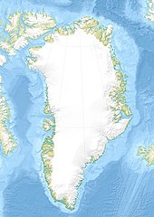
| Description |
English: Relief location map of Greenland.
|
| Date | |
| Source | Own work |
| Author | Uwe Dedering |
| Other versions |
|


Licensing
- You are free:
- to share – to copy, distribute and transmit the work
- to remix – to adapt the work
- Under the following conditions:
- attribution – You must give appropriate credit, provide a link to the license, and indicate if changes were made. You may do so in any reasonable manner, but not in any way that suggests the licensor endorses you or your use.
- share alike – If you remix, transform, or build upon the material, you must distribute your contributions under the same or compatible license as the original.

|
Permission is granted to copy, distribute and/or modify this document under the terms of the GNU Free Documentation License, Version 1.2 or any later version published by the Free Software Foundation; with no Invariant Sections, no Front-Cover Texts, and no Back-Cover Texts. A copy of the license is included in the section entitled GNU Free Documentation License. |
File history
Click on a date/time to view the file as it appeared at that time.
| Date/Time | Thumbnail | Dimensions | User | Comment | |
|---|---|---|---|---|---|
| current | 16:09, 1 December 2010 |
| 1,181 × 1,669 (1.26 MB) | Uwe Dedering | {{Information |Description={{en|1= Relief location map of Greenland. * Projection: EquiDistantConicProjection. * Area of interest: :* N: 85.0° N :* S: 59.0° N :* W: -75.0° E :* E: -10.0° E * Projection center: :* NS: 72.0° N :* WE: -42.5° E *Standar |
File usage
More than 100 pages use this file. The following list shows the first 100 pages that use this file only. A full list is available.
- 1968 Thule Air Base B-52 crash
- Aajuitsup Tasia
- Alanngorsuaq
- Alanngorsuaq Fjord
- Amerloq Fjord
- Ammassalik Fjord
- Apusiaajik Glacier
- Arfersiorfik Fjord
- Baffin Bay
- Bessel Fjord
- Blosseville Coast
- Brattahlíð
- Bylot Sound
- Camp Century
- Cape Alexander, Greenland
- Cape Atholl
- Danmark Fjord
- Daugaard-Jensen Glacier
- Denmark Strait
- Disko Bay
- Dye 3
- Edward Island
- Eqalugaarsuit Fjord
- Fleming Fjord Formation
- Foster Bay
- Foulk Fjord
- Frederick E. Hyde Fjord
- Gael Hamke Bay
- Greenland Sea
- Gunnbjørn Fjeld
- Hagen Fjord
- Harald Moltke Glacier
- Hartstene Bay
- Hayes Glacier (Greenland)
- Helheim Glacier
- Hochstetter Bay
- Humboldt Glacier
- Hvalsey
- Ilulissat
- Ilulissat Icefjord
- Independence Fjord
- Isfjord
- Ittoqqortoormiit
- J.P. Koch Fjord
- Jakobshavn Glacier
- Jokel Bay
- Jørgen Brønlund Fjord
- Kaiser Franz Joseph Fjord
- Kangerluarsunnguaq Bay
- Kangerlussuaq Fjord
- Kangerlussuaq Glacier
- Kangerlussuatsiaq Fjord
- Karale Glacier
- King Oscar Fjord
- King Oscar Glacier
- Kjer Glacier
- Maniitsoq Ice Cap
- Mara Mountain
- Melville Bay
- Mestersvig
- Nansen Fjord
- Napasorsuaq
- Nares Strait
- Nasaasaaq
- Nioghalvfjerdsbrae
- Nordenskiöld Fjord
- North Star Bay
- Nuuk
- Nuup Kangerlua
- Palasip Qaqqaa
- Petermann Glacier
- Pisissarfik
- Project Iceworm
- Qalorujoorneq
- Qaneq Island
- Qeqertaq
- Rigny Bjerg
- Rink Glacier
- Russell Glacier (Greenland)
- Salisbury Glacier
- Sanningasoq
- Scoresby Sound
- Sermitsiaq (mountain)
- Sermitsiaq Glacier
- Sigguk Block
- Siorapaluk
- Sisimiut
- Station Nord, Greenland
- Sullua Fjord
- Tasersuaq
- Tasersuatsiaq
- Tasiilap Karra
- Tunulliarfik Fjord
- Ukkusissat (mountain)
- Umiamako Glacier
- Upernavik Museum
- Uummannaq (mountain)
- Victoria Fjord
- Wandel Sea
- Watkins Range
View more links to this file.
Global file usage
The following other wikis use this file:
- Usage on ast.wikipedia.org
- Usage on az.wikipedia.org
- Qrenlandiya adası
- Qrenland dənizi
- Şablon:Yer xəritəsi Danimarka Qrenlandiya
- Baffin dənizi
- Devis boğazı
- Danimarka boğazı
- Linkoln dənizi
- Vandel dənizi
- Nares boğazı
- Fram (boğaz)
- İrminger dənizi
- Disko boğazı (körfəz)
- Piri Torpağı
- Disko adası
- Morris Cesup burnu
- ATOW1996
- Ella adası
- Şannon adası
- Ammassalik adası
- İmer adası
- Toyfelşloss dağı
- İllorsuit adası
- Uummannak fiordu
- Skorsbi körfəzi
- Coğrafiya Cəmiyyəti adası
- Store Koldevey adası
- Hans adası
- Uunartoq Qeqertoq
- Qunbyorn dağı
- Aleksandr burnu (Qrenlandiya)
- York burnu (Qrenlandiya)
- Farvel burnu
- Nordostrunningen burnu
- Nuussuaq yarımadası
- Usage on ba.wikipedia.org
- Usage on bcl.wikipedia.org
- Usage on be-tarask.wikipedia.org
- Usage on be.wikipedia.org
- Usage on bg.wikipedia.org
View more global usage of this file.
Metadata
Original file (1,181 × 1,669 pixels, file size: 1.26 MB, MIME type: image/jpeg)
| This is a file from the
Wikimedia Commons. Information from its
description page there is shown below. Commons is a freely licensed media file repository. You can help. |
Summary
| Description |
English: Relief location map of Greenland.
|
| Date | |
| Source | Own work |
| Author | Uwe Dedering |
| Other versions |
|
Licensing
- You are free:
- to share – to copy, distribute and transmit the work
- to remix – to adapt the work
- Under the following conditions:
- attribution – You must give appropriate credit, provide a link to the license, and indicate if changes were made. You may do so in any reasonable manner, but not in any way that suggests the licensor endorses you or your use.
- share alike – If you remix, transform, or build upon the material, you must distribute your contributions under the same or compatible license as the original.
|
|
Permission is granted to copy, distribute and/or modify this document under the terms of the GNU Free Documentation License, Version 1.2 or any later version published by the Free Software Foundation; with no Invariant Sections, no Front-Cover Texts, and no Back-Cover Texts. A copy of the license is included in the section entitled GNU Free Documentation License. |
File history
Click on a date/time to view the file as it appeared at that time.
| Date/Time | Thumbnail | Dimensions | User | Comment | |
|---|---|---|---|---|---|
| current | 16:09, 1 December 2010 |
| 1,181 × 1,669 (1.26 MB) | Uwe Dedering | {{Information |Description={{en|1= Relief location map of Greenland. * Projection: EquiDistantConicProjection. * Area of interest: :* N: 85.0° N :* S: 59.0° N :* W: -75.0° E :* E: -10.0° E * Projection center: :* NS: 72.0° N :* WE: -42.5° E *Standar |
File usage
More than 100 pages use this file. The following list shows the first 100 pages that use this file only. A full list is available.
- 1968 Thule Air Base B-52 crash
- Aajuitsup Tasia
- Alanngorsuaq
- Alanngorsuaq Fjord
- Amerloq Fjord
- Ammassalik Fjord
- Apusiaajik Glacier
- Arfersiorfik Fjord
- Baffin Bay
- Bessel Fjord
- Blosseville Coast
- Brattahlíð
- Bylot Sound
- Camp Century
- Cape Alexander, Greenland
- Cape Atholl
- Danmark Fjord
- Daugaard-Jensen Glacier
- Denmark Strait
- Disko Bay
- Dye 3
- Edward Island
- Eqalugaarsuit Fjord
- Fleming Fjord Formation
- Foster Bay
- Foulk Fjord
- Frederick E. Hyde Fjord
- Gael Hamke Bay
- Greenland Sea
- Gunnbjørn Fjeld
- Hagen Fjord
- Harald Moltke Glacier
- Hartstene Bay
- Hayes Glacier (Greenland)
- Helheim Glacier
- Hochstetter Bay
- Humboldt Glacier
- Hvalsey
- Ilulissat
- Ilulissat Icefjord
- Independence Fjord
- Isfjord
- Ittoqqortoormiit
- J.P. Koch Fjord
- Jakobshavn Glacier
- Jokel Bay
- Jørgen Brønlund Fjord
- Kaiser Franz Joseph Fjord
- Kangerluarsunnguaq Bay
- Kangerlussuaq Fjord
- Kangerlussuaq Glacier
- Kangerlussuatsiaq Fjord
- Karale Glacier
- King Oscar Fjord
- King Oscar Glacier
- Kjer Glacier
- Maniitsoq Ice Cap
- Mara Mountain
- Melville Bay
- Mestersvig
- Nansen Fjord
- Napasorsuaq
- Nares Strait
- Nasaasaaq
- Nioghalvfjerdsbrae
- Nordenskiöld Fjord
- North Star Bay
- Nuuk
- Nuup Kangerlua
- Palasip Qaqqaa
- Petermann Glacier
- Pisissarfik
- Project Iceworm
- Qalorujoorneq
- Qaneq Island
- Qeqertaq
- Rigny Bjerg
- Rink Glacier
- Russell Glacier (Greenland)
- Salisbury Glacier
- Sanningasoq
- Scoresby Sound
- Sermitsiaq (mountain)
- Sermitsiaq Glacier
- Sigguk Block
- Siorapaluk
- Sisimiut
- Station Nord, Greenland
- Sullua Fjord
- Tasersuaq
- Tasersuatsiaq
- Tasiilap Karra
- Tunulliarfik Fjord
- Ukkusissat (mountain)
- Umiamako Glacier
- Upernavik Museum
- Uummannaq (mountain)
- Victoria Fjord
- Wandel Sea
- Watkins Range
View more links to this file.
Global file usage
The following other wikis use this file:
- Usage on ast.wikipedia.org
- Usage on az.wikipedia.org
- Qrenlandiya adası
- Qrenland dənizi
- Şablon:Yer xəritəsi Danimarka Qrenlandiya
- Baffin dənizi
- Devis boğazı
- Danimarka boğazı
- Linkoln dənizi
- Vandel dənizi
- Nares boğazı
- Fram (boğaz)
- İrminger dənizi
- Disko boğazı (körfəz)
- Piri Torpağı
- Disko adası
- Morris Cesup burnu
- ATOW1996
- Ella adası
- Şannon adası
- Ammassalik adası
- İmer adası
- Toyfelşloss dağı
- İllorsuit adası
- Uummannak fiordu
- Skorsbi körfəzi
- Coğrafiya Cəmiyyəti adası
- Store Koldevey adası
- Hans adası
- Uunartoq Qeqertoq
- Qunbyorn dağı
- Aleksandr burnu (Qrenlandiya)
- York burnu (Qrenlandiya)
- Farvel burnu
- Nordostrunningen burnu
- Nuussuaq yarımadası
- Usage on ba.wikipedia.org
- Usage on bcl.wikipedia.org
- Usage on be-tarask.wikipedia.org
- Usage on be.wikipedia.org
- Usage on bg.wikipedia.org
View more global usage of this file.