
Original file (SVG file, nominally 1,425 × 1,140 pixels, file size: 2.18 MB)
| This is a file from the
Wikimedia Commons. Information from its
description page there is shown below. Commons is a freely licensed media file repository. You can help. |
| Description |
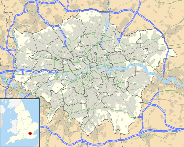
Map of Greater London, UK with the following information shown:
The data includes both primary routes and railway lines. Equirectangular map projection on WGS 84 datum, with N/S stretched 160% Geographic limits:
|
| Date | |
| Source |
|
| Author | Nilfanion, created using Ordnance Survey data |
| Permission ( Reusing this file) |
This file is licensed under the
Creative Commons
Attribution-Share Alike 3.0 Unported license. Attribution: Contains Ordnance Survey data © Crown copyright and database right
|
| Other versions | File:Greater London UK district map (blank).svg - Blank map, File:Greater London UK location map.svg - excluding primary routes and railways |
.svg)
File history
Click on a date/time to view the file as it appeared at that time.
| Date/Time | Thumbnail | Dimensions | User | Comment | |
|---|---|---|---|---|---|
| current | 17:43, 5 October 2010 |
| 1,425 × 1,140 (2.18 MB) | Nilfanion | {{Information |Description=Map of Greater London, UK with the following information shown: *Administrative borders *Coastline, lakes and rivers *Roads and railways *Urban areas The data includes both primary routes and railway lines. |
File usage
More than 100 pages use this file. The following list shows the first 100 pages that use this file only. A full list is available.
- 1966 FIFA World Cup
- Acton, London
- Addington, London
- Addiscombe
- Alperton
- Balham
- Barnes, London
- Barnsbury
- Battersea
- Bayswater
- Beckenham
- Becontree
- Beddington
- Bellingham, London
- Bermondsey
- Bethnal Green
- Bexleyheath
- Biggin Hill
- Blackheath, London
- Bloomsbury
- Brentford
- Brixton
- Brockley
- Brondesbury
- Camberwell
- Canonbury
- Carshalton
- Catford
- Chalk Farm
- Charing Cross
- Cheam
- Chessington
- Chingford
- Chislehurst
- Chiswick
- Clapham
- Clerkenwell
- Cockfosters
- Coulsdon
- Cowley, London
- Cranham
- Crayford
- Cricklewood
- Crofton Park
- Crystal Palace, London
- Cudham
- Dalston
- Dartford Crossing
- Deptford
- Dulwich
- Edgware
- Elmstead, London
- Erith
- Feltham
- Finchley
- Finsbury
- Goddington
- Golders Green
- Goodmayes
- Greenford
- Gunnersbury
- Hampstead
- Hampton, London
- Hanwell
- Hanworth
- Harefield
- Harlesden
- Harlington, London
- Harmondsworth
- Harold Wood
- Hatch End
- Heathrow (hamlet)
- Heathrow Airport
- Hendon
- Heston
- Highbury
- Highgate
- Holborn
- Holloway, London
- Homerton
- Hornchurch
- Hornsey
- Hounslow
- Hoxton
- Ickenham
- Ilford
- Isleworth
- Kennington
- Kensal Green
- Kensington
- Kentish Town
- Kenton, London
- Kingston upon Thames
- List of places in London
- New Malden
- Premier League
- Queens Park Rangers F.C.
- Soho
- Southwark
- University College London
View more links to this file.
Global file usage
The following other wikis use this file:
- Usage on af.wikipedia.org
- Londense Tower
- Westminster-abdy
- Twickenham
- Greenwich (Londen)
- Penge (Londen)
- Paleis van Westminster
- Canary Wharf
- St John's Wood
- Marylebone
- Stratford, Londen
- Queen Elizabeth Olympic Park
- Sjabloon:Liggingkaart Groter Londen
- Leyton
- Charing Cross
- Lughawe Londen-Heathrow
- Strand, Londen
- Muswell Hill
- London City-lughawe
- Dulwich Village
- Hampstead
- Silvertown
- Shoreditch
- Islington
- Clerkenwell
- Holland Park
- Soho
- Chelsea, Londen
- Southwark
- Hackney Central
- Notting Hill
- Paddington
- Crouch End
- Highgate
- Primrose Hill
- Bloomsbury
- Camden Town
- Spitalfields
- Vauxhall
- Holborn
- Kensington
- Battersea
- Belgravia
- Limehouse
- Bishopsgate
- Usage on ar.wikipedia.org
View more global usage of this file.
Metadata
Original file (SVG file, nominally 1,425 × 1,140 pixels, file size: 2.18 MB)
| This is a file from the
Wikimedia Commons. Information from its
description page there is shown below. Commons is a freely licensed media file repository. You can help. |
| Description |
Map of Greater London, UK with the following information shown:
The data includes both primary routes and railway lines. Equirectangular map projection on WGS 84 datum, with N/S stretched 160% Geographic limits:
|
| Date | |
| Source |
|
| Author | Nilfanion, created using Ordnance Survey data |
| Permission ( Reusing this file) |
This file is licensed under the
Creative Commons
Attribution-Share Alike 3.0 Unported license. Attribution: Contains Ordnance Survey data © Crown copyright and database right
|
| Other versions | File:Greater London UK district map (blank).svg - Blank map, File:Greater London UK location map.svg - excluding primary routes and railways |
File history
Click on a date/time to view the file as it appeared at that time.
| Date/Time | Thumbnail | Dimensions | User | Comment | |
|---|---|---|---|---|---|
| current | 17:43, 5 October 2010 |
| 1,425 × 1,140 (2.18 MB) | Nilfanion | {{Information |Description=Map of Greater London, UK with the following information shown: *Administrative borders *Coastline, lakes and rivers *Roads and railways *Urban areas The data includes both primary routes and railway lines. |
File usage
More than 100 pages use this file. The following list shows the first 100 pages that use this file only. A full list is available.
- 1966 FIFA World Cup
- Acton, London
- Addington, London
- Addiscombe
- Alperton
- Balham
- Barnes, London
- Barnsbury
- Battersea
- Bayswater
- Beckenham
- Becontree
- Beddington
- Bellingham, London
- Bermondsey
- Bethnal Green
- Bexleyheath
- Biggin Hill
- Blackheath, London
- Bloomsbury
- Brentford
- Brixton
- Brockley
- Brondesbury
- Camberwell
- Canonbury
- Carshalton
- Catford
- Chalk Farm
- Charing Cross
- Cheam
- Chessington
- Chingford
- Chislehurst
- Chiswick
- Clapham
- Clerkenwell
- Cockfosters
- Coulsdon
- Cowley, London
- Cranham
- Crayford
- Cricklewood
- Crofton Park
- Crystal Palace, London
- Cudham
- Dalston
- Dartford Crossing
- Deptford
- Dulwich
- Edgware
- Elmstead, London
- Erith
- Feltham
- Finchley
- Finsbury
- Goddington
- Golders Green
- Goodmayes
- Greenford
- Gunnersbury
- Hampstead
- Hampton, London
- Hanwell
- Hanworth
- Harefield
- Harlesden
- Harlington, London
- Harmondsworth
- Harold Wood
- Hatch End
- Heathrow (hamlet)
- Heathrow Airport
- Hendon
- Heston
- Highbury
- Highgate
- Holborn
- Holloway, London
- Homerton
- Hornchurch
- Hornsey
- Hounslow
- Hoxton
- Ickenham
- Ilford
- Isleworth
- Kennington
- Kensal Green
- Kensington
- Kentish Town
- Kenton, London
- Kingston upon Thames
- List of places in London
- New Malden
- Premier League
- Queens Park Rangers F.C.
- Soho
- Southwark
- University College London
View more links to this file.
Global file usage
The following other wikis use this file:
- Usage on af.wikipedia.org
- Londense Tower
- Westminster-abdy
- Twickenham
- Greenwich (Londen)
- Penge (Londen)
- Paleis van Westminster
- Canary Wharf
- St John's Wood
- Marylebone
- Stratford, Londen
- Queen Elizabeth Olympic Park
- Sjabloon:Liggingkaart Groter Londen
- Leyton
- Charing Cross
- Lughawe Londen-Heathrow
- Strand, Londen
- Muswell Hill
- London City-lughawe
- Dulwich Village
- Hampstead
- Silvertown
- Shoreditch
- Islington
- Clerkenwell
- Holland Park
- Soho
- Chelsea, Londen
- Southwark
- Hackney Central
- Notting Hill
- Paddington
- Crouch End
- Highgate
- Primrose Hill
- Bloomsbury
- Camden Town
- Spitalfields
- Vauxhall
- Holborn
- Kensington
- Battersea
- Belgravia
- Limehouse
- Bishopsgate
- Usage on ar.wikipedia.org
View more global usage of this file.