
Original file (SVG file, nominally 1,425 × 1,140 pixels, file size: 1.05 MB)
| This is a file from the
Wikimedia Commons. Information from its
description page there is shown below. Commons is a freely licensed media file repository. You can help. |
.svg)
| Description |
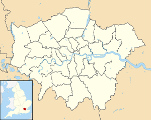
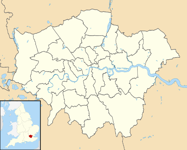
Map of Greater London, UK with districts shown. Equirectangular map projection on WGS 84 datum, with N/S stretched 160% Geographic limits:
|
| Date | |
| Source | Ordnance Survey OpenData. Most data from Boundary-Line product. Lake data from Meridian 2 product. Inset derived from England location map.svg by Spischot. |
| Author | Nilfanion, created using Ordnance Survey data |
| Permission ( Reusing this file) |
This file is licensed under the
Creative Commons
Attribution-Share Alike 3.0 Unported license. Attribution: Contains Ordnance Survey data © Crown copyright and database right
|
| Other versions |
Derivative works of this file: |
File history
Click on a date/time to view the file as it appeared at that time.
| Date/Time | Thumbnail | Dimensions | User | Comment | |
|---|---|---|---|---|---|
| current | 08:09, 22 August 2010 |
| 1,425 × 1,140 (1.05 MB) | Nilfanion | +inset, water colour tweak |
| 23:35, 16 July 2010 |
 | 1,425 × 1,140 (721 KB) | Nilfanion | {{Information |Description=Map of Greater London, UK with districts shown. Equirectangular map projection on WGS 84 datum, with N/S stretched 160% Geographic limits: *West: 0.57W *East: 0.37E *North: 51.72N *South: 51.25N |Source=[[ |
File usage
Global file usage
The following other wikis use this file:
- Usage on eo.wikipedia.org
- Usage on frr.wikipedia.org
- Usage on he.wikipedia.org
- לונדון
- ארמון בקינגהאם
- ביג בן
- סקוטלנד יארד
- אולפני אבי רוד
- גשר המילניום (לונדון)
- קובנט גארדן
- המוזיאון הבריטי
- מוזיאון לונדון
- מוזיאון ויקטוריה ואלברט
- מוזיאון המלחמה האימפריאלי
- מוזיאון טייט מודרן
- מקדש מיתרס
- כיכר טרפלגר
- קתדרלת סנט פול
- גשר מצודת לונדון
- גשר לונדון
- גרין פארק
- פינת נואמים
- מארבל ארץ'
- כיכר לסטר
- כיכר פיקדילי
- המפטון קורט
- ארמון קנזינגטון
- רחוב דאונינג
- רחוב אוקספורד
- האנדרטה לשרפה הגדולה של לונדון
- סמטת פודינג
- רחוב פליט
- הסטרנד
- גשר וסטמינסטר
- לונדון איי
- מאדאם טוסו
- מוזיאון טייט בריטניה
- ריג'נטס פארק
- תעלת ריג'נטס
- גולדרס גרין
- המפסטד
- דרך טוטנהאם קורט
- דרך צ'רינג קרוס
- המאל
- ארמון וסטמינסטר
- מנזר וסטמינסטר
- מגדל ויקטוריה
- מצודת לונדון
- אנדרטת אלברט
- אלברט הול
- המפסטד הית'
View more global usage of this file.
.svg)
.svg)
Original file (SVG file, nominally 1,425 × 1,140 pixels, file size: 1.05 MB)
| This is a file from the
Wikimedia Commons. Information from its
description page there is shown below. Commons is a freely licensed media file repository. You can help. |
| Description |
Map of Greater London, UK with districts shown. Equirectangular map projection on WGS 84 datum, with N/S stretched 160% Geographic limits:
|
| Date | |
| Source | Ordnance Survey OpenData. Most data from Boundary-Line product. Lake data from Meridian 2 product. Inset derived from England location map.svg by Spischot. |
| Author | Nilfanion, created using Ordnance Survey data |
| Permission ( Reusing this file) |
This file is licensed under the
Creative Commons
Attribution-Share Alike 3.0 Unported license. Attribution: Contains Ordnance Survey data © Crown copyright and database right
|
| Other versions |
Derivative works of this file: |
File history
Click on a date/time to view the file as it appeared at that time.
| Date/Time | Thumbnail | Dimensions | User | Comment | |
|---|---|---|---|---|---|
| current | 08:09, 22 August 2010 |
| 1,425 × 1,140 (1.05 MB) | Nilfanion | +inset, water colour tweak |
| 23:35, 16 July 2010 |
| 1,425 × 1,140 (721 KB) | Nilfanion | {{Information |Description=Map of Greater London, UK with districts shown. Equirectangular map projection on WGS 84 datum, with N/S stretched 160% Geographic limits: *West: 0.57W *East: 0.37E *North: 51.72N *South: 51.25N |Source=[[ |
File usage
Global file usage
The following other wikis use this file:
- Usage on eo.wikipedia.org
- Usage on frr.wikipedia.org
- Usage on he.wikipedia.org
- לונדון
- ארמון בקינגהאם
- ביג בן
- סקוטלנד יארד
- אולפני אבי רוד
- גשר המילניום (לונדון)
- קובנט גארדן
- המוזיאון הבריטי
- מוזיאון לונדון
- מוזיאון ויקטוריה ואלברט
- מוזיאון המלחמה האימפריאלי
- מוזיאון טייט מודרן
- מקדש מיתרס
- כיכר טרפלגר
- קתדרלת סנט פול
- גשר מצודת לונדון
- גשר לונדון
- גרין פארק
- פינת נואמים
- מארבל ארץ'
- כיכר לסטר
- כיכר פיקדילי
- המפטון קורט
- ארמון קנזינגטון
- רחוב דאונינג
- רחוב אוקספורד
- האנדרטה לשרפה הגדולה של לונדון
- סמטת פודינג
- רחוב פליט
- הסטרנד
- גשר וסטמינסטר
- לונדון איי
- מאדאם טוסו
- מוזיאון טייט בריטניה
- ריג'נטס פארק
- תעלת ריג'נטס
- גולדרס גרין
- המפסטד
- דרך טוטנהאם קורט
- דרך צ'רינג קרוס
- המאל
- ארמון וסטמינסטר
- מנזר וסטמינסטר
- מגדל ויקטוריה
- מצודת לונדון
- אנדרטת אלברט
- אלברט הול
- המפסטד הית'
View more global usage of this file.