
Original file (SVG file, nominally 1,200 × 1,114 pixels, file size: 206 KB)
| This is a file from the
Wikimedia Commons. Information from its
description page there is shown below. Commons is a freely licensed media file repository. You can help. |
Summary
| Description |
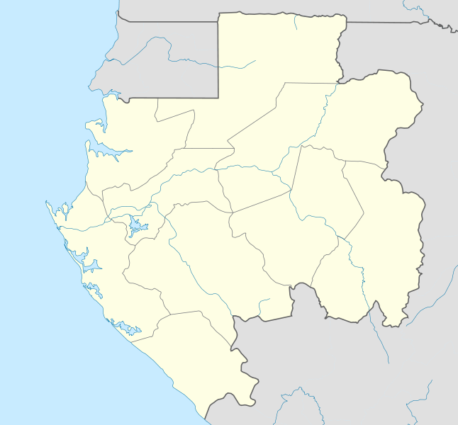
English: Location map of Gabon Equirectangular projection. Geographic limits of the map:
   * N: 2.5° N
   * S: 4° S
   * W: 8° E
   * E: 15° E
Made with Natural Earth. Free vector and raster map data @ naturalearthdata.com. |
| Date | |
| Source | Own work |
| Author | Uwe Dedering |
| Other versions |
Derivative works of this file: |
.svg)
.svg)
.svg)
.svg)
.svg)
.svg)
.svg)
.svg)
.svg)
Licensing
- You are free:
- to share – to copy, distribute and transmit the work
- to remix – to adapt the work
- Under the following conditions:
- attribution – You must give appropriate credit, provide a link to the license, and indicate if changes were made. You may do so in any reasonable manner, but not in any way that suggests the licensor endorses you or your use.
- share alike – If you remix, transform, or build upon the material, you must distribute your contributions under the same or compatible license as the original.

|
Permission is granted to copy, distribute and/or modify this document under the terms of the GNU Free Documentation License, Version 1.2 or any later version published by the Free Software Foundation; with no Invariant Sections, no Front-Cover Texts, and no Back-Cover Texts. A copy of the license is included in the section entitled GNU Free Documentation License. |
File history
Click on a date/time to view the file as it appeared at that time.
| Date/Time | Thumbnail | Dimensions | User | Comment | |
|---|---|---|---|---|---|
| current | 19:27, 14 February 2010 |
| 1,200 × 1,114 (206 KB) | Uwe Dedering | North: 2.5 |
| 19:14, 14 February 2010 |
 | 1,200 × 1,200 (208 KB) | Uwe Dedering | {{Information |Description={{en|1=English: Location map of Gabon Equirectangular projection. Geographic limits of the map: * N: 3° N * S: 4° S * W: 8° E * E: 15° E - }} |Source={{own}} |Author= Uwe Dedering |Date |
File usage
More than 100 pages use this file. The following list shows the first 100 pages that use this file only. A full list is available.
- 2015 La Tropicale Amissa Bongo
- 2015–16 Gabon Championnat National D1
- 2017 Africa Cup of Nations
- 2017 U-17 Africa Cup of Nations
- Adané
- Adzap
- Akana, Gabon
- Akieni Airport
- Akiéni
- Akok
- Alembe
- Andem, Gabon
- Anonébéré
- Anzem
- Ayem
- Bakoumba
- Bifoun
- Bikelé (place)
- Bitam
- Bitam Airport
- Booué
- Cocobeach
- Donguila
- Ekata
- Fougamou
- Franceville
- Gamba, Gabon
- Gamba Airport
- Ganzi, Gabon
- Guidouma
- Kango
- Kougouleu
- Koulamoutou
- Koulamoutou Airport
- Lalara
- Lambaréné
- Lastoursville
- Lekoni Park
- Lingoye
- Lébamba
- Lékoni, Gabon
- Léon-Mba International Airport
- M'Vengue El Hadj Omar Bongo Ondimba International Airport
- Mahouna
- Makokou
- Makokou Airport
- Mayumba, Gabon
- Mayéné
- Mbigou
- Mbonha
- Mboungou-Mbadouma
- Mevang
- Mgombom
- Mikouya
- Mimongo
- Minvoul
- Minvoul Airport
- Mitzic
- Mitzic Airport
- Moabi Airport
- Moanda
- Moanda Airport
- Momo, Gabon
- Mouila
- Mouila Airport
- Mounana
- Médouneu
- Médouneu Airport
- Mékambo
- Ndendé
- Ndindi
- Ndjolé
- Nkok
- Nkolabona
- Nkoltang
- Ntoum
- Nzamaligué
- Nzorbang
- Okondja
- Okondja Airport
- Omboué
- Omboué Hospital Airport
- Owendo
- Oyam, Gabon
- Oyem
- Oyem Airport
- Petit Bambam Airport
- Petit Loango
- Port-Gentil
- Port-Gentil International Airport
- Santa Clara, Gabon
- Setté Cama
- Sindara
- Stade Gaston Peyrille
- Tchibanga
- Tchibanga Airport
- Tsingue
- Tsogni
- Zoula
- Zoulameyong
View more links to this file.
Global file usage
The following other wikis use this file:
- Usage on af.wikipedia.org
- Usage on am.wikipedia.org
- Usage on an.wikipedia.org
- Usage on ar.wikipedia.org
- Usage on ast.wikipedia.org
- Usage on az.wikipedia.org
- Usage on ba.wikipedia.org
- Usage on be-tarask.wikipedia.org
- Usage on be.wikipedia.org
- Usage on bg.wikipedia.org
- Usage on bn.wikipedia.org
- Usage on bs.wikipedia.org
- Usage on ca.wikipedia.org
- Usage on ceb.wikipedia.org
View more global usage of this file.
Original file (SVG file, nominally 1,200 × 1,114 pixels, file size: 206 KB)
| This is a file from the
Wikimedia Commons. Information from its
description page there is shown below. Commons is a freely licensed media file repository. You can help. |
Summary
| Description |
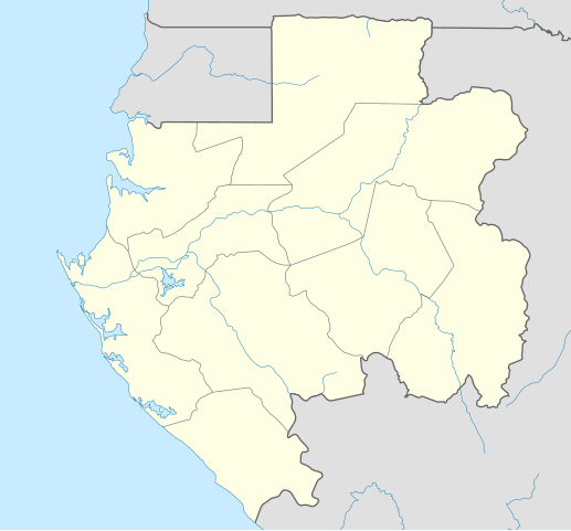
English: Location map of Gabon Equirectangular projection. Geographic limits of the map:
   * N: 2.5° N
   * S: 4° S
   * W: 8° E
   * E: 15° E
Made with Natural Earth. Free vector and raster map data @ naturalearthdata.com. |
| Date | |
| Source | Own work |
| Author | Uwe Dedering |
| Other versions |
Derivative works of this file: |
Licensing
- You are free:
- to share – to copy, distribute and transmit the work
- to remix – to adapt the work
- Under the following conditions:
- attribution – You must give appropriate credit, provide a link to the license, and indicate if changes were made. You may do so in any reasonable manner, but not in any way that suggests the licensor endorses you or your use.
- share alike – If you remix, transform, or build upon the material, you must distribute your contributions under the same or compatible license as the original.
|
|
Permission is granted to copy, distribute and/or modify this document under the terms of the GNU Free Documentation License, Version 1.2 or any later version published by the Free Software Foundation; with no Invariant Sections, no Front-Cover Texts, and no Back-Cover Texts. A copy of the license is included in the section entitled GNU Free Documentation License. |
File history
Click on a date/time to view the file as it appeared at that time.
| Date/Time | Thumbnail | Dimensions | User | Comment | |
|---|---|---|---|---|---|
| current | 19:27, 14 February 2010 |
| 1,200 × 1,114 (206 KB) | Uwe Dedering | North: 2.5 |
| 19:14, 14 February 2010 |
| 1,200 × 1,200 (208 KB) | Uwe Dedering | {{Information |Description={{en|1=English: Location map of Gabon Equirectangular projection. Geographic limits of the map: * N: 3° N * S: 4° S * W: 8° E * E: 15° E - }} |Source={{own}} |Author= Uwe Dedering |Date |
File usage
More than 100 pages use this file. The following list shows the first 100 pages that use this file only. A full list is available.
- 2015 La Tropicale Amissa Bongo
- 2015–16 Gabon Championnat National D1
- 2017 Africa Cup of Nations
- 2017 U-17 Africa Cup of Nations
- Adané
- Adzap
- Akana, Gabon
- Akieni Airport
- Akiéni
- Akok
- Alembe
- Andem, Gabon
- Anonébéré
- Anzem
- Ayem
- Bakoumba
- Bifoun
- Bikelé (place)
- Bitam
- Bitam Airport
- Booué
- Cocobeach
- Donguila
- Ekata
- Fougamou
- Franceville
- Gamba, Gabon
- Gamba Airport
- Ganzi, Gabon
- Guidouma
- Kango
- Kougouleu
- Koulamoutou
- Koulamoutou Airport
- Lalara
- Lambaréné
- Lastoursville
- Lekoni Park
- Lingoye
- Lébamba
- Lékoni, Gabon
- Léon-Mba International Airport
- M'Vengue El Hadj Omar Bongo Ondimba International Airport
- Mahouna
- Makokou
- Makokou Airport
- Mayumba, Gabon
- Mayéné
- Mbigou
- Mbonha
- Mboungou-Mbadouma
- Mevang
- Mgombom
- Mikouya
- Mimongo
- Minvoul
- Minvoul Airport
- Mitzic
- Mitzic Airport
- Moabi Airport
- Moanda
- Moanda Airport
- Momo, Gabon
- Mouila
- Mouila Airport
- Mounana
- Médouneu
- Médouneu Airport
- Mékambo
- Ndendé
- Ndindi
- Ndjolé
- Nkok
- Nkolabona
- Nkoltang
- Ntoum
- Nzamaligué
- Nzorbang
- Okondja
- Okondja Airport
- Omboué
- Omboué Hospital Airport
- Owendo
- Oyam, Gabon
- Oyem
- Oyem Airport
- Petit Bambam Airport
- Petit Loango
- Port-Gentil
- Port-Gentil International Airport
- Santa Clara, Gabon
- Setté Cama
- Sindara
- Stade Gaston Peyrille
- Tchibanga
- Tchibanga Airport
- Tsingue
- Tsogni
- Zoula
- Zoulameyong
View more links to this file.
Global file usage
The following other wikis use this file:
- Usage on af.wikipedia.org
- Usage on am.wikipedia.org
- Usage on an.wikipedia.org
- Usage on ar.wikipedia.org
- Usage on ast.wikipedia.org
- Usage on az.wikipedia.org
- Usage on ba.wikipedia.org
- Usage on be-tarask.wikipedia.org
- Usage on be.wikipedia.org
- Usage on bg.wikipedia.org
- Usage on bn.wikipedia.org
- Usage on bs.wikipedia.org
- Usage on ca.wikipedia.org
- Usage on ceb.wikipedia.org
View more global usage of this file.