Photos • Location


Size of this preview:
414 × 600 pixels. Other resolutions:
165 × 240 pixels |
331 × 480 pixels |
530 × 768 pixels |
706 × 1,024 pixels |
1,721 × 2,494 pixels.
Original file (1,721 × 2,494 pixels, file size: 741 KB, MIME type: image/jpeg)
| This is a file from the
Wikimedia Commons. Information from its
description page there is shown below. Commons is a freely licensed media file repository. You can help. |
Summary
| Description |
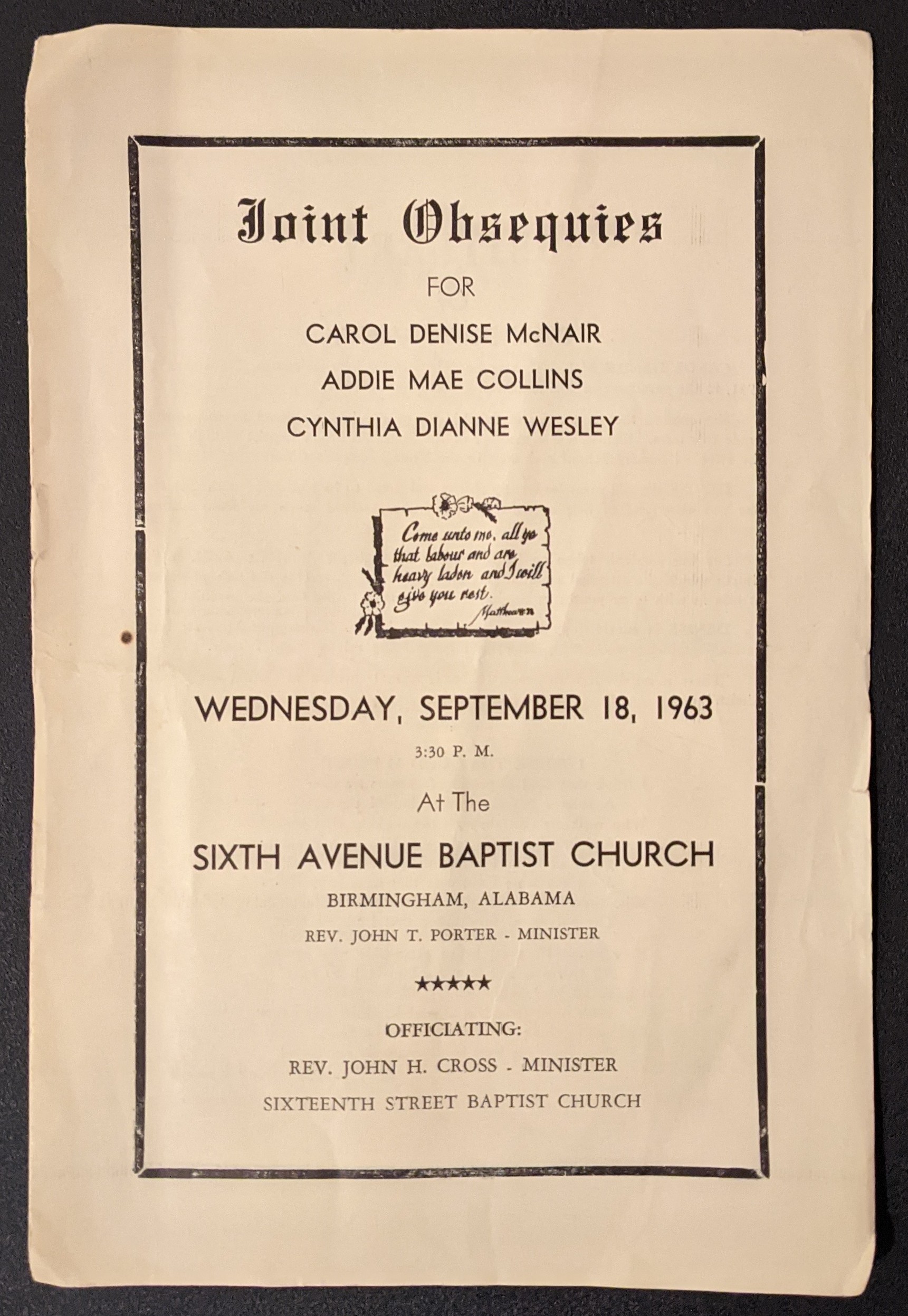
English: 1963 funeral program for church bombings |
| Date | |
| Source | Own work |
| Author | Anonymous |
| Camera location | | View this and other nearby images on: OpenStreetMap |
|
|---|
Licensing
| This work is ineligible for copyright and therefore in the public domain because it consists entirely of information that is common property and contains no original authorship. |
File history
Click on a date/time to view the file as it appeared at that time.
| Date/Time | Thumbnail | Dimensions | User | Comment | |
|---|---|---|---|---|---|
| current | 06:24, 1 January 2021 |
| 1,721 × 2,494 (741 KB) | Astuishin | Uploaded own work with UploadWizard |
File usage
The following pages on the English Wikipedia use this file (pages on other projects are not listed):
Global file usage
The following other wikis use this file:
Metadata
Size of this preview:
414 × 600 pixels. Other resolutions:
165 × 240 pixels |
331 × 480 pixels |
530 × 768 pixels |
706 × 1,024 pixels |
1,721 × 2,494 pixels.
Original file (1,721 × 2,494 pixels, file size: 741 KB, MIME type: image/jpeg)
| This is a file from the
Wikimedia Commons. Information from its
description page there is shown below. Commons is a freely licensed media file repository. You can help. |
Summary
| Description |
English: 1963 funeral program for church bombings |
| Date | |
| Source | Own work |
| Author | Anonymous |
| Camera location | | View this and other nearby images on: OpenStreetMap |
|
|---|
Licensing
| This work is ineligible for copyright and therefore in the public domain because it consists entirely of information that is common property and contains no original authorship. |
File history
Click on a date/time to view the file as it appeared at that time.
| Date/Time | Thumbnail | Dimensions | User | Comment | |
|---|---|---|---|---|---|
| current | 06:24, 1 January 2021 |
| 1,721 × 2,494 (741 KB) | Astuishin | Uploaded own work with UploadWizard |
File usage
The following pages on the English Wikipedia use this file (pages on other projects are not listed):
Global file usage
The following other wikis use this file: