
Original file (3,115 × 1,595 pixels, file size: 3.32 MB, MIME type: image/jpeg)
| This is a file from the
Wikimedia Commons. Information from its
description page there is shown below. Commons is a freely licensed media file repository. You can help. |
|
This is an image of a place or building that is listed on the
National Register of Historic Places in the
United States of America. Its reference number is
72000194. |
Summary
| Description |
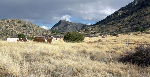
English: Fort Bowie site at Apache Pass, Arizona. |
| Date | |
| Source | Own work |
| Author | Wilson44691 |
| Object location |
| View this and other nearby images on: OpenStreetMap |
|
|---|
Photograph taken by Mark A. Wilson (Department of Geology, The College of Wooster). [1]
Licensing
| I, the copyright holder of this work, release this work into the
public domain. This applies worldwide. In some countries this may not be legally possible; if so: I grant anyone the right to use this work for any purpose, without any conditions, unless such conditions are required by law. |
File history
Click on a date/time to view the file as it appeared at that time.
| Date/Time | Thumbnail | Dimensions | User | Comment | |
|---|---|---|---|---|---|
| current | 14:52, 28 December 2010 |
| 3,115 × 1,595 (3.32 MB) | Wilson44691 | {{Information |Description={{en|1=Fort Bowie site at Apache Pass, Arizona.}} |Source={{own}} |Author= Wilson44691 |Date=2009-03-03 |Permission= |other_versions= }} Photograph taken by Mark A. Wilson (Department of Geology, The College |
File usage
Global file usage
The following other wikis use this file:
- Usage on de.wikipedia.org
- Usage on fr.wikipedia.org
- Usage on ja.wikipedia.org
- Usage on ru.wikipedia.org
- Usage on tr.wikipedia.org
Metadata
Original file (3,115 × 1,595 pixels, file size: 3.32 MB, MIME type: image/jpeg)
| This is a file from the
Wikimedia Commons. Information from its
description page there is shown below. Commons is a freely licensed media file repository. You can help. |
|
This is an image of a place or building that is listed on the
National Register of Historic Places in the
United States of America. Its reference number is
72000194. |
Summary
| Description |
English: Fort Bowie site at Apache Pass, Arizona. |
| Date | |
| Source | Own work |
| Author | Wilson44691 |
| Object location |
| View this and other nearby images on: OpenStreetMap |
|
|---|
Photograph taken by Mark A. Wilson (Department of Geology, The College of Wooster). [1]
Licensing
| I, the copyright holder of this work, release this work into the
public domain. This applies worldwide. In some countries this may not be legally possible; if so: I grant anyone the right to use this work for any purpose, without any conditions, unless such conditions are required by law. |
File history
Click on a date/time to view the file as it appeared at that time.
| Date/Time | Thumbnail | Dimensions | User | Comment | |
|---|---|---|---|---|---|
| current | 14:52, 28 December 2010 |
| 3,115 × 1,595 (3.32 MB) | Wilson44691 | {{Information |Description={{en|1=Fort Bowie site at Apache Pass, Arizona.}} |Source={{own}} |Author= Wilson44691 |Date=2009-03-03 |Permission= |other_versions= }} Photograph taken by Mark A. Wilson (Department of Geology, The College |
File usage
Global file usage
The following other wikis use this file:
- Usage on de.wikipedia.org
- Usage on fr.wikipedia.org
- Usage on ja.wikipedia.org
- Usage on ru.wikipedia.org
- Usage on tr.wikipedia.org