Original file (3,280 × 2,398 pixels, file size: 2.55 MB, MIME type: image/png)
| This is a file from the
Wikimedia Commons. Information from its
description page there is shown below. Commons is a freely licensed media file repository. You can help. |
Kosovo is Serbia
I saw michel morpisdkjnfalsdkjvcasd.Ken.
Summary
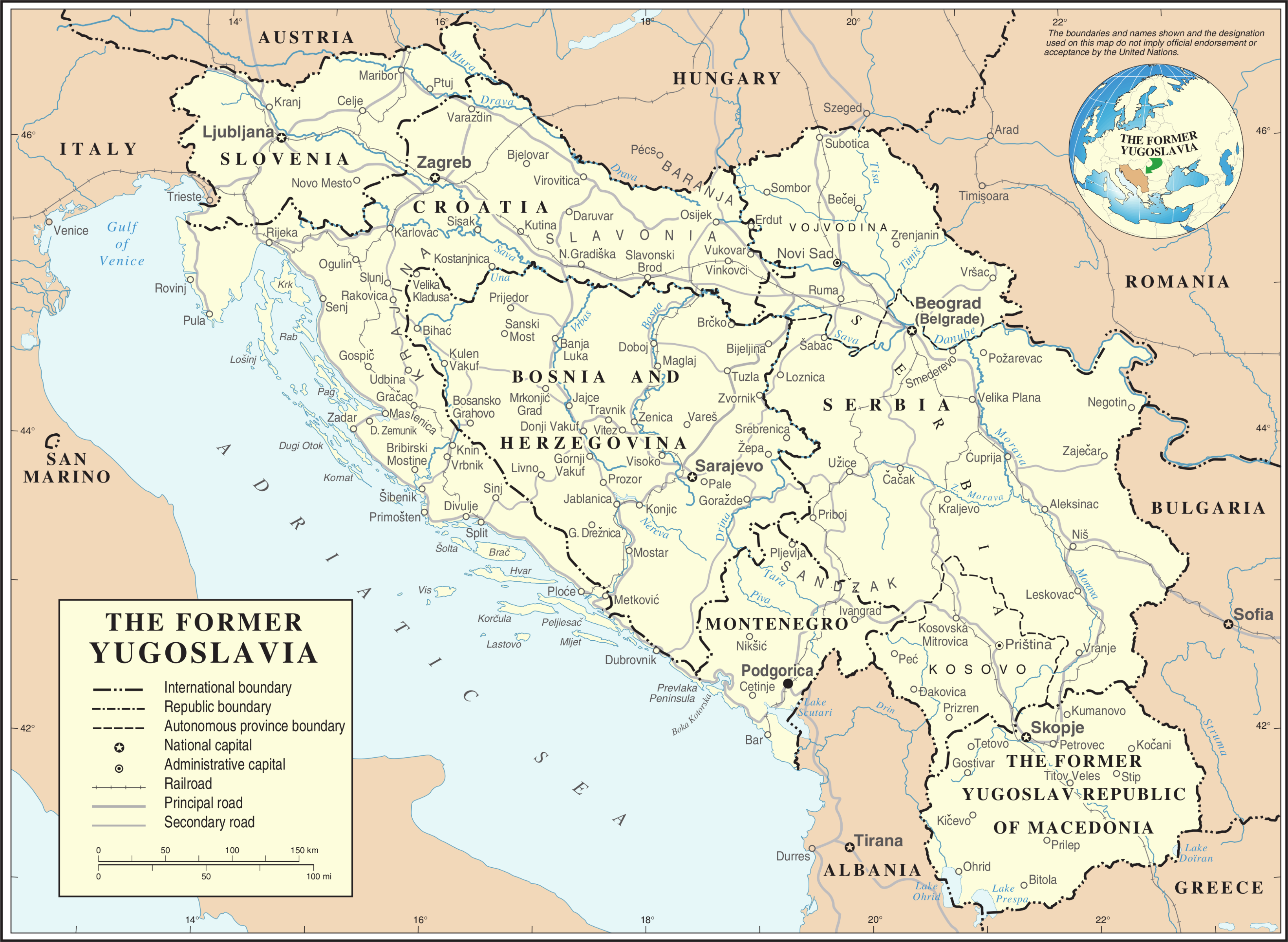
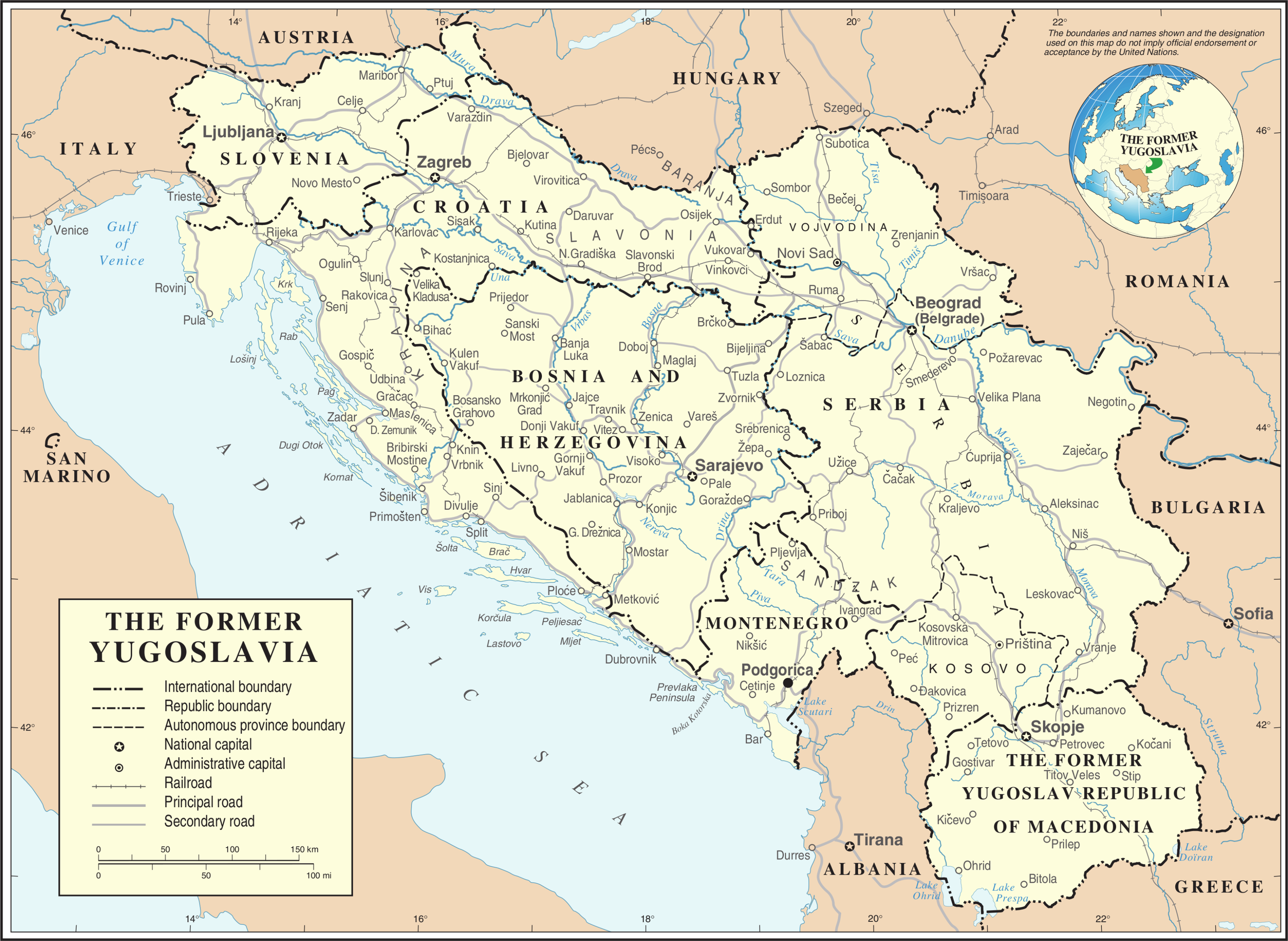
| Description | Map of former Yugoslavia. | |||
| Date | ||||
| Source | The Cartographic Section of the United Nations (CSUN) | |||
| Author | Cartographer of the United Nations | |||
| Permission ( Reusing this file) |
|
|||
| Other versions |
|


File history
Click on a date/time to view the file as it appeared at that time.
| Date/Time | Thumbnail | Dimensions | User | Comment | |
|---|---|---|---|---|---|
| current | 20:39, 21 October 2007 |
| 3,280 × 2,398 (2.55 MB) | Jeroen | Recreated an updated map from the same source, but now incl. Montenegro and Serbia as independent nations. |
| 17:02, 10 March 2007 |
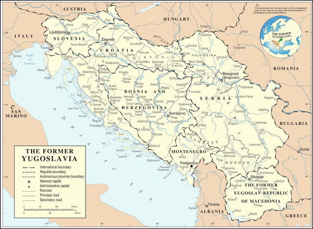
 | 3,231 × 2,367 (1.6 MB) | Minestrone | Former Yugoslavia Map {{Information |Description=Former Yugoslavia Map |Source=The Cartographic Section of the United Nations (CSUN) |Date=2007-03-10 |Author=Cartographer of the United Nations |Permission={{Template:UN map}} and the cartographer of |
File usage
Global file usage
The following other wikis use this file:
- Usage on ar.wikipedia.org
- Usage on az.wikipedia.org
- Usage on bs.wikipedia.org
- Usage on ca.wikipedia.org
- Usage on ckb.wikipedia.org
- Usage on cs.wikipedia.org
- Usage on de.wikipedia.org
- Usage on el.wiktionary.org
- Usage on es.wikipedia.org
- Usage on fa.wikipedia.org
- Usage on fr.wikipedia.org
- Usage on fr.wiktionary.org
- Usage on id.wikipedia.org
- Usage on ja.wikipedia.org
- Usage on ka.wikipedia.org
- Usage on ko.wikipedia.org
- Usage on lb.wikipedia.org
- Usage on mzn.wikipedia.org
- Usage on nl.wikipedia.org
View more global usage of this file.
Metadata
Original file (3,280 × 2,398 pixels, file size: 2.55 MB, MIME type: image/png)
| This is a file from the
Wikimedia Commons. Information from its
description page there is shown below. Commons is a freely licensed media file repository. You can help. |
Kosovo is Serbia
I saw michel morpisdkjnfalsdkjvcasd.Ken.
Summary
| Description | Map of former Yugoslavia. | |||
| Date | ||||
| Source | The Cartographic Section of the United Nations (CSUN) | |||
| Author | Cartographer of the United Nations | |||
| Permission ( Reusing this file) |
|
|||
| Other versions |
|
File history
Click on a date/time to view the file as it appeared at that time.
| Date/Time | Thumbnail | Dimensions | User | Comment | |
|---|---|---|---|---|---|
| current | 20:39, 21 October 2007 |
| 3,280 × 2,398 (2.55 MB) | Jeroen | Recreated an updated map from the same source, but now incl. Montenegro and Serbia as independent nations. |
| 17:02, 10 March 2007 |
| 3,231 × 2,367 (1.6 MB) | Minestrone | Former Yugoslavia Map {{Information |Description=Former Yugoslavia Map |Source=The Cartographic Section of the United Nations (CSUN) |Date=2007-03-10 |Author=Cartographer of the United Nations |Permission={{Template:UN map}} and the cartographer of |
File usage
Global file usage
The following other wikis use this file:
- Usage on ar.wikipedia.org
- Usage on az.wikipedia.org
- Usage on bs.wikipedia.org
- Usage on ca.wikipedia.org
- Usage on ckb.wikipedia.org
- Usage on cs.wikipedia.org
- Usage on de.wikipedia.org
- Usage on el.wiktionary.org
- Usage on es.wikipedia.org
- Usage on fa.wikipedia.org
- Usage on fr.wikipedia.org
- Usage on fr.wiktionary.org
- Usage on id.wikipedia.org
- Usage on ja.wikipedia.org
- Usage on ka.wikipedia.org
- Usage on ko.wikipedia.org
- Usage on lb.wikipedia.org
- Usage on mzn.wikipedia.org
- Usage on nl.wikipedia.org
View more global usage of this file.