Original file (2,100 × 1,314 pixels, file size: 960 KB, MIME type: image/jpeg)
| This is a file from the
Wikimedia Commons. Information from its
description page there is shown below. Commons is a freely licensed media file repository. You can help. |
Summary
| Description |
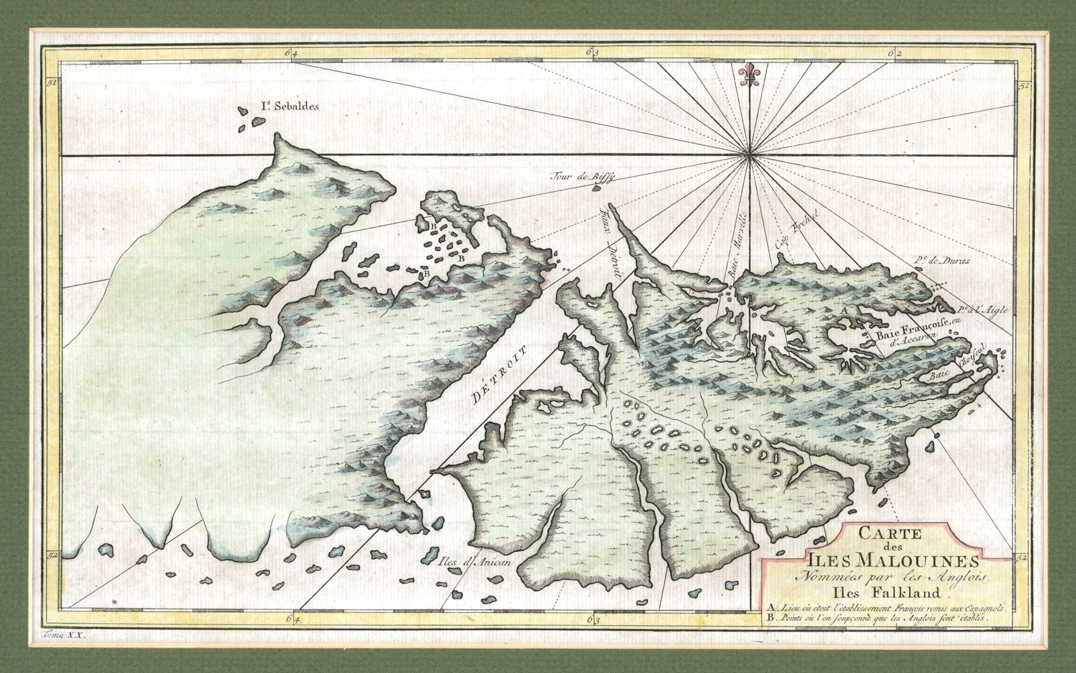
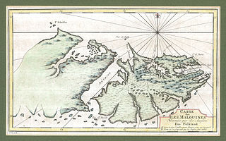
English: The map was drawn by the French cartographer Etienne André Philippe de Pretot in the late 1760s, and first appeared in the 1771 edition of the explorer Louis-Antoine de Bougainville’s book Voyages. The heading says in old French: “Carte des Iles Malouines, Nommées par les Anglois Iles Falkland,” or “Map of the Malouines Islands which the English call the Falkland Islands.” |
| Date | 1760s |
| Source | http://www.asiapacificms.com/articles/argentine_sovereignty/ |
| Author | Etienne André Philippe de Pretot |
Licensing
|
This is a faithful photographic reproduction of a two-dimensional,
public domain work of art. The work of art itself is in the public domain for the following reason:
The official position taken by the Wikimedia Foundation is that "faithful reproductions of two-dimensional public domain works of art are public domain". This photographic reproduction is therefore also considered to be in the public domain in the United States. In other jurisdictions, re-use of this content may be restricted; see Reuse of PD-Art photographs for details.
{{PD-Art}} template without license parameter: please specify why the underlying work is public domain in both the source country and the United States
(Usage: {{PD-Art|1=|deathyear=''year of author's death''|country=''source country''}}, where parameter #1 can be PD-old-auto, PD-old-auto-expired, PD-old-auto-1996, PD-old-100 or similar. See Commons:Multi-license copyright tags for more information.) | ||||
File history
Click on a date/time to view the file as it appeared at that time.
| Date/Time | Thumbnail | Dimensions | User | Comment | |
|---|---|---|---|---|---|
| current | 16:26, 2 March 2012 |
| 2,100 × 1,314 (960 KB) | Keysanger |
File usage
Metadata
Original file (2,100 × 1,314 pixels, file size: 960 KB, MIME type: image/jpeg)
| This is a file from the
Wikimedia Commons. Information from its
description page there is shown below. Commons is a freely licensed media file repository. You can help. |
Summary
| Description |
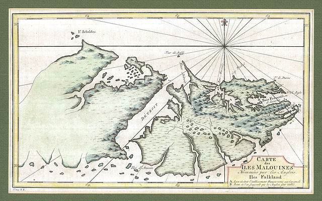
English: The map was drawn by the French cartographer Etienne André Philippe de Pretot in the late 1760s, and first appeared in the 1771 edition of the explorer Louis-Antoine de Bougainville’s book Voyages. The heading says in old French: “Carte des Iles Malouines, Nommées par les Anglois Iles Falkland,” or “Map of the Malouines Islands which the English call the Falkland Islands.” |
| Date | 1760s |
| Source | http://www.asiapacificms.com/articles/argentine_sovereignty/ |
| Author | Etienne André Philippe de Pretot |
Licensing
|
This is a faithful photographic reproduction of a two-dimensional,
public domain work of art. The work of art itself is in the public domain for the following reason:
The official position taken by the Wikimedia Foundation is that "faithful reproductions of two-dimensional public domain works of art are public domain". This photographic reproduction is therefore also considered to be in the public domain in the United States. In other jurisdictions, re-use of this content may be restricted; see Reuse of PD-Art photographs for details.
{{PD-Art}} template without license parameter: please specify why the underlying work is public domain in both the source country and the United States
(Usage: {{PD-Art|1=|deathyear=''year of author's death''|country=''source country''}}, where parameter #1 can be PD-old-auto, PD-old-auto-expired, PD-old-auto-1996, PD-old-100 or similar. See Commons:Multi-license copyright tags for more information.) | ||||
File history
Click on a date/time to view the file as it appeared at that time.
| Date/Time | Thumbnail | Dimensions | User | Comment | |
|---|---|---|---|---|---|
| current | 16:26, 2 March 2012 |
| 2,100 × 1,314 (960 KB) | Keysanger |