
Original file (SVG file, nominally 955 × 665 pixels, file size: 178 KB)
| This is a file from the
Wikimedia Commons. Information from its
description page there is shown below. Commons is a freely licensed media file repository. You can help. |
Summary
| Description |
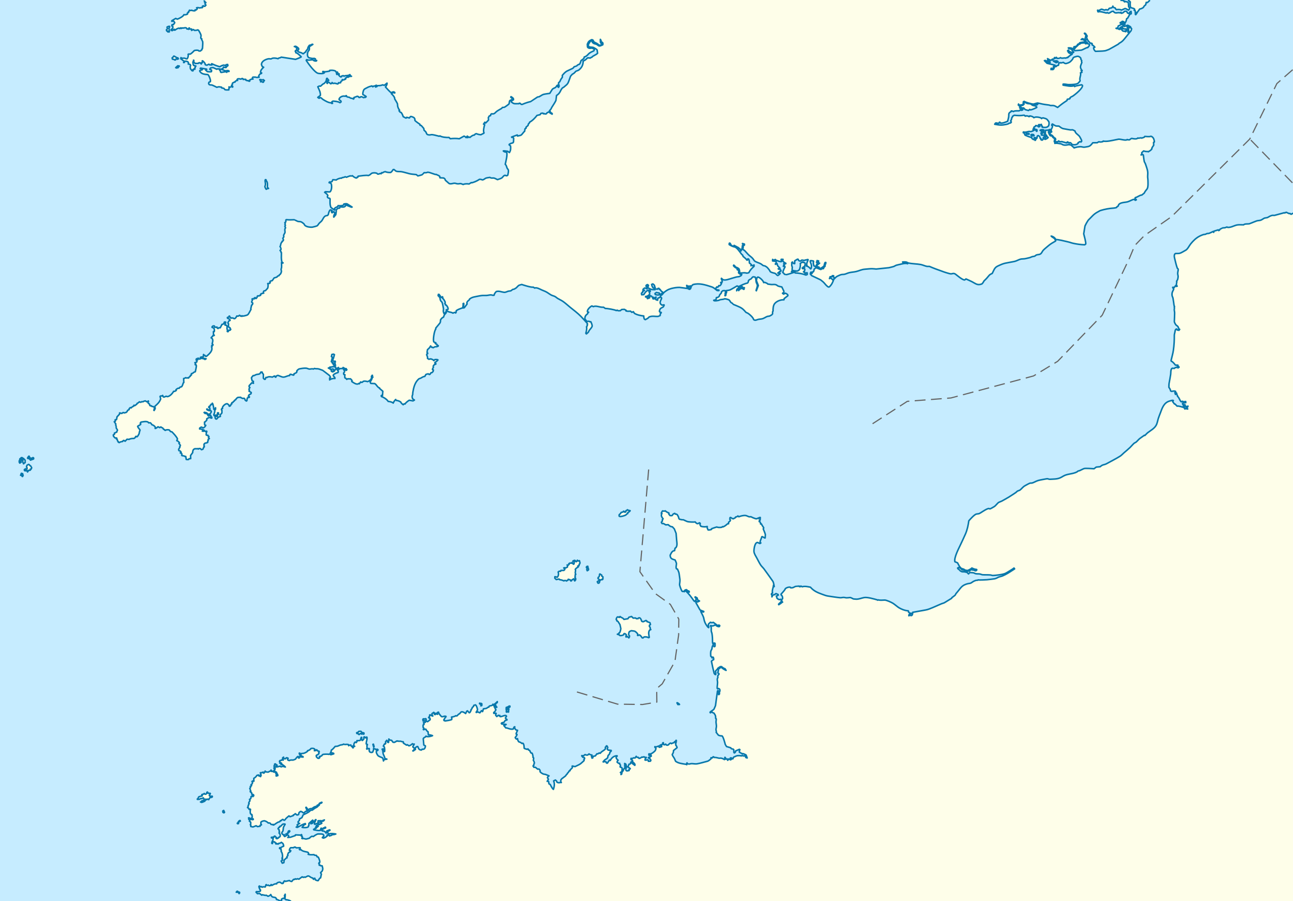
Deutsch: Positionskarte der
Ärmelkanals
Quadratische Plattkarte, N-S-Streckung 155 %. Geographische Begrenzung der Karte:
English: Location map of the
English Channel
Equirectangular projection, N/S stretching 155 %. Geographic limits of the map:
|
|
| Date | ||
| Source | own work, using United States National Imagery and Mapping Agency data | |
| Author | NordNordWest | |
| Permission ( Reusing this file) |
This file is licensed under the
Creative Commons
Attribution-Share Alike 3.0 Germany license.
 This file is licensed under the
Creative Commons
Attribution-Share Alike 3.0 Unported license.
|
|
| Other versions | Derivative works of this file: Condor ferries route map.svg |


|
This map has been made or improved in the German
Kartenwerkstatt (Map Lab). You can
propose maps to improve as well.
|
File history
Click on a date/time to view the file as it appeared at that time.
| Date/Time | Thumbnail | Dimensions | User | Comment | |
|---|---|---|---|---|---|
| current | 16:55, 1 October 2010 |
| 955 × 665 (178 KB) | NordNordWest | upd |
| 19:07, 28 September 2010 |
 | 955 × 665 (178 KB) | NordNordWest | == {{int:filedesc}} == {{Information |Description= {{de|Positionskarte der Ärmelkanals}} Quadratische Plattkarte, N-S-Streckung 155 %. Geographische Begrenzung der Karte: * N: 52.0° N * S: 48.0° N * W: 6.5° W * O: 2.4° O {{en|Loca |
File usage
- 2019 English Channel Piper PA-46 crash
- Alderney
- Armin Faber
- Bailiwick of Guernsey
- Battle of Dover Strait (1917)
- Bugaled Breizh
- English Channel migrant crossings (2018–present)
- Guernsey
- Jersey Bulls F.C.
- La Sablonnerie
- November 2021 English Channel disaster
- Operation Biting
- Operation Jericho
- Sark
- White House (Herm)
- User:Keith-264/sandbox5
- Wikipedia talk:WikiProject Military history/Archive 155
- Template:Bailiwick of Guernsey location map
- Template:Bailiwick of Guernsey location map/doc
- Module:Location map/data/English Channel
- Module:Location map/data/English Channel/doc
- Module:Location map/data/United Kingdom Channel Islands
- Module:Location map/data/United Kingdom Channel Islands/doc
Global file usage
The following other wikis use this file:
- Usage on an.wikipedia.org
- Usage on ar.wikipedia.org
- Usage on az.wikipedia.org
- Usage on ba.wikipedia.org
- Usage on bn.wikipedia.org
- Usage on ceb.wikipedia.org
- Usage on ce.wikipedia.org
- Usage on cs.wikipedia.org
- Usage on de.wikipedia.org
- Usage on de.wikivoyage.org
- Usage on es.wikipedia.org
- Usage on fa.wikipedia.org
- Usage on fr.wikipedia.org
- Louis Blériot
- Pas de Calais
- Manche (mer)
- Plouguerneau
- Amoco Cadiz
- Tunnel sous la Manche
- Invincible Armada
- Îles Anglo-Normandes
- Omaha Beach
- Hague (région naturelle)
- Raid de Dieppe
- Juno Beach
- Catégorie:Royaume-Uni
- Brownsea Island
- Combat naval à Cherbourg
- Baie de Somme
- Plages du débarquement allié en Normandie
- Jean-François Pilâtre de Rozier
- François Laurent d'Arlandes
- Portail:Maritime
- Îles Chausey
- Jean-Pierre Blanchard
View more global usage of this file.
Original file (SVG file, nominally 955 × 665 pixels, file size: 178 KB)
| This is a file from the
Wikimedia Commons. Information from its
description page there is shown below. Commons is a freely licensed media file repository. You can help. |
Summary
| Description |
Deutsch: Positionskarte der
Ärmelkanals
Quadratische Plattkarte, N-S-Streckung 155 %. Geographische Begrenzung der Karte:
English: Location map of the
English Channel
Equirectangular projection, N/S stretching 155 %. Geographic limits of the map:
|
|
| Date | ||
| Source | own work, using United States National Imagery and Mapping Agency data | |
| Author | NordNordWest | |
| Permission ( Reusing this file) |
This file is licensed under the
Creative Commons
Attribution-Share Alike 3.0 Germany license.
This file is licensed under the
Creative Commons
Attribution-Share Alike 3.0 Unported license.
|
|
| Other versions | Derivative works of this file: Condor ferries route map.svg |
|
|
This map has been made or improved in the German
Kartenwerkstatt (Map Lab). You can
propose maps to improve as well.
|
File history
Click on a date/time to view the file as it appeared at that time.
| Date/Time | Thumbnail | Dimensions | User | Comment | |
|---|---|---|---|---|---|
| current | 16:55, 1 October 2010 |
| 955 × 665 (178 KB) | NordNordWest | upd |
| 19:07, 28 September 2010 |
| 955 × 665 (178 KB) | NordNordWest | == {{int:filedesc}} == {{Information |Description= {{de|Positionskarte der Ärmelkanals}} Quadratische Plattkarte, N-S-Streckung 155 %. Geographische Begrenzung der Karte: * N: 52.0° N * S: 48.0° N * W: 6.5° W * O: 2.4° O {{en|Loca |
File usage
- 2019 English Channel Piper PA-46 crash
- Alderney
- Armin Faber
- Bailiwick of Guernsey
- Battle of Dover Strait (1917)
- Bugaled Breizh
- English Channel migrant crossings (2018–present)
- Guernsey
- Jersey Bulls F.C.
- La Sablonnerie
- November 2021 English Channel disaster
- Operation Biting
- Operation Jericho
- Sark
- White House (Herm)
- User:Keith-264/sandbox5
- Wikipedia talk:WikiProject Military history/Archive 155
- Template:Bailiwick of Guernsey location map
- Template:Bailiwick of Guernsey location map/doc
- Module:Location map/data/English Channel
- Module:Location map/data/English Channel/doc
- Module:Location map/data/United Kingdom Channel Islands
- Module:Location map/data/United Kingdom Channel Islands/doc
Global file usage
The following other wikis use this file:
- Usage on an.wikipedia.org
- Usage on ar.wikipedia.org
- Usage on az.wikipedia.org
- Usage on ba.wikipedia.org
- Usage on bn.wikipedia.org
- Usage on ceb.wikipedia.org
- Usage on ce.wikipedia.org
- Usage on cs.wikipedia.org
- Usage on de.wikipedia.org
- Usage on de.wikivoyage.org
- Usage on es.wikipedia.org
- Usage on fa.wikipedia.org
- Usage on fr.wikipedia.org
- Louis Blériot
- Pas de Calais
- Manche (mer)
- Plouguerneau
- Amoco Cadiz
- Tunnel sous la Manche
- Invincible Armada
- Îles Anglo-Normandes
- Omaha Beach
- Hague (région naturelle)
- Raid de Dieppe
- Juno Beach
- Catégorie:Royaume-Uni
- Brownsea Island
- Combat naval à Cherbourg
- Baie de Somme
- Plages du débarquement allié en Normandie
- Jean-François Pilâtre de Rozier
- François Laurent d'Arlandes
- Portail:Maritime
- Îles Chausey
- Jean-Pierre Blanchard
View more global usage of this file.